We are in the process of migrating all NASA Earth science data sites into Earthdata from now until end of 2026. Not all NASA Earth science data and resources will appear here until then. Thank you for your patience as we make this transition.
Read about the Web Unification Project
Suomi NPP Resources
Suomi NPP Learning Resources

This training builds capacity to apply Python codes and other online tools to work with datasets from NASA's Goddard Earth Observing System (GEOS).
Training
Feb. 22 - March 1, 2022

Esta capacitación de ARSET cubre el Kit de herramientas de observación de la Tierra para ciudades y asentamientos humanos sostenibles.
Training
Jan. 27 - Feb. 10, 2022
This ARSET training provides an overview of the Earth Observations Toolkit for Sustainable Cities and Human Settlements.
Training
Jan. 27 - Feb. 10, 2022

This ARSET training reviews pre-fire risk assessment and post-fire mapping using open-source tools like Google Earth Engine.
Training
Jan. 18-20, 2022

Learn about the NASA DEVELOP internship projects that used data distributed by the Land Processes Distributed Active Archive Center (LP DAAC) in spring 2021.
StoryMap
Dec. 3, 2021

This ARSET training provides participants with the skills to combine in situ measurements and optical remote sensing data to assess water quality.
Training
Nov. 30 - Dec. 7, 2021

Join us for an overview of NASA's LAADS DAAC, its Level-1 and atmospheric data products, and to explore different options to search, discover, and acquire the data.
Webinar
Oct. 25, 2021

This ARSET training provides an overview of NASA resources for monitoring climate change and its impacts.
Training
Sept. 29 - Oct. 6, 2021
SHOWING 8 OF 67
Suomi NPP News
View All News
Filters
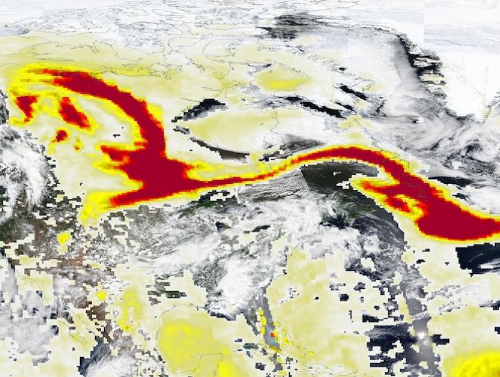
Image captured May 29, 2025, by the VIIRS and OMPS instruments aboard the joint NASA/NOAA Suomi NPP platform.
Worldview Image of the Week
May 30, 2025
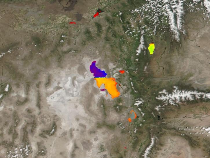
Image captured May 21, 2025, by the VIIRS instrument aboard the joint NASA/NOAA Suomi NPP platform.
Worldview Image of the Week
May 22, 2025
A summary of datasets, products, and resources released by NASA’s Distributed Active Archive Centers (DAACs) in April 2025.
News
May 13, 2025
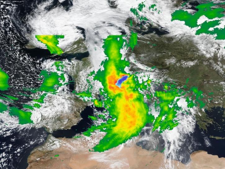
Image captured on Apr 16, 2025, by the VIIRS instrument aboard the Suomi NPP platform, with IMERG Precipitation Rate.
Worldview Image of the Week
April 17, 2025
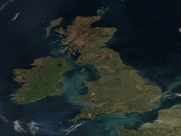
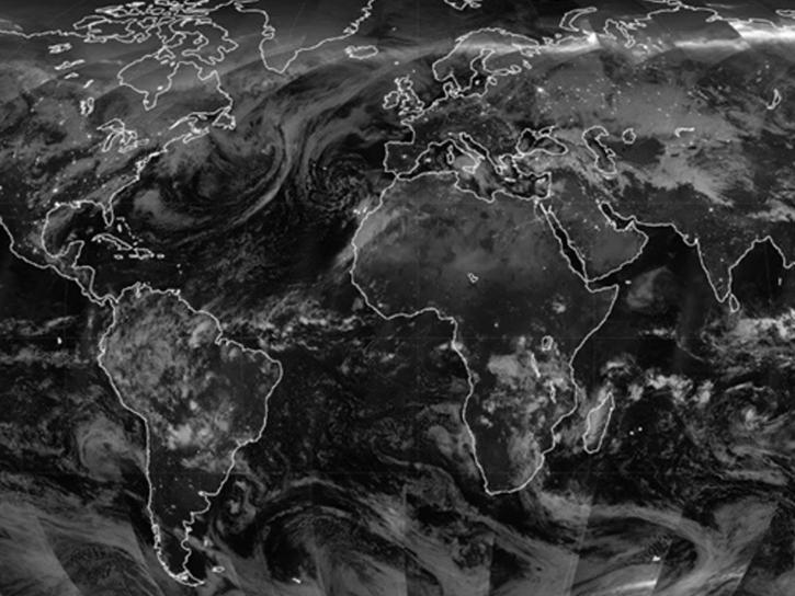
Image captured on Apr 2, 2025, by the VIIRS instrument aboard the joint NASA/NOAA Suomi NPP platform.
Worldview Image of the Week
April 4, 2025

Users of NASA’s Fire Information for Resource Management System (FIRMS) can now differentiate between fires caused by burning vegetation and fires from natural heat sources or industrial heat sources.
Blog
March 7, 2025

Satellite-based maps offer quick first alerts and approximate locations of potential wildfires that are then precisely tracked and fought by teams on the ground.
Feature Article
Jan. 13, 2025

The atlas now features NASA Earth science data formatted specifically for geographic information systems (GIS) users.
Feature Article
Jan. 7, 2025
SHOWING 8 OF 333
Frequently Asked Questions
Earthdata Forum
Our online forum provides a space for users to browse thousands of FAQs about research needs, data, and data applications. You can also submit new questions for our experts to answer.
Submit Questions to Earthdata Forumand View Expert Responses