We are in the process of migrating all NASA Earth science data sites into Earthdata from now until end of 2026. Not all NASA Earth science data and resources will appear here until then. Thank you for your patience as we make this transition.
Read about the Web Unification Project
Terra Resources
Terra Learning Resources

This ArcGIS Python Toolbox simplifies access to quality data by decoding complex quality information into usable thematic raster files.
Tutorial
Aug. 18, 2020

NASA's Land Processes Distributed Active Archive Center (LP DAAC) provides an introduction to learning resources for the ecology community.
Webinar
Aug. 6, 2020
In response to the Deepwater Horizon oil spill, researchers used a machine learning algorithm to classify oil thickness with Terra ASTER data.
Data in Action
July 23, 2020

This ARSET training teaches how to use earth observations to estimate water budgets for a given river basin.
Training
July 21 - Aug. 4, 2020

See how the Tennessee Valley Energy DEVELOP team used Earth observations to predict river water temperatures for managing and protecting aquatic ecosystems.
Data in Action
July 1, 2020

This ARSET training focuses on the use of remote sensing to understand global phenology.
Training
June 30 - July 14, 2020

Researchers used MODIS land cover products and ASTER models to identify suitable areas where an endangered species of monkey may reside.
Data in Action
June 29, 2020

Learn how a NASA DEVELOP team helped create models to determine an ideal location for a jaguar corridor using NASA Earth observation data.
Data in Action
May 21, 2020
SHOWING 8 OF 235
Terra News
View All News
Filters

NASA Earth observation data contributed to the discovery of a previously unknown subpopulation of polar bears in Southeast Greenland.
Feature Article
June 23, 2022

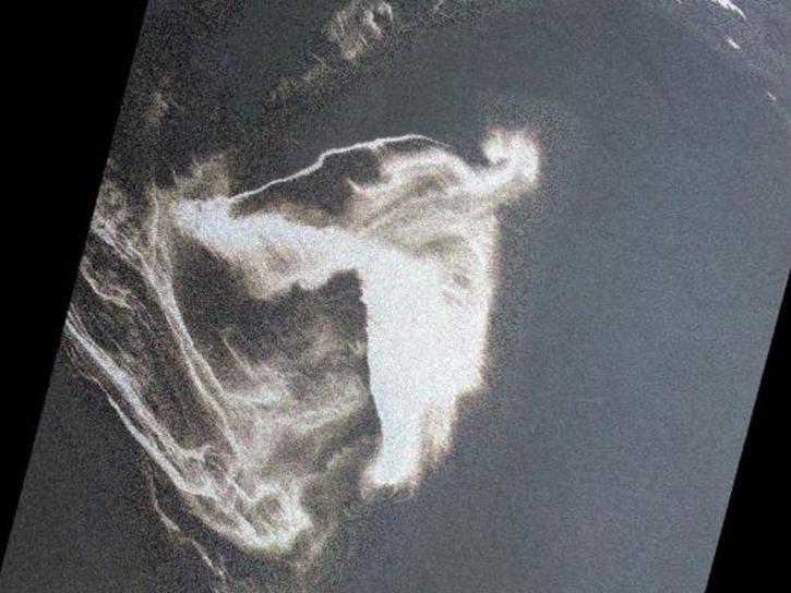
Image captured on Jun 13, 2022, by the MODIS instrument aboard the Terra satellite.
Worldview Image of the Week
June 14, 2022

Data from NASA’s LP DAAC help Dr. David Thoma determine how climate change will impact natural resources on National Park System lands.
Data User Story
May 23, 2022

Update Your Bookmarks: We are no longer processing the "Chlorophyll a Terra/MODIS" (MODIS_Terra_Chlorophyll_A) and "Chlorophyll a Aqua/MODIS" (MODIS_Aqua_Chlorophyll_A). Comparable layers are available for Terra/MODIS, Aqua/MODIS and now, Suomi NPP/VIIRS.
Blog
May 19, 2022

With the eventual retirement of the Terra and Aqua platforms, the Visible Infrared Imaging Radiometer Suite (VIIRS) instruments will take the lead in daily Earth observations.
Feature Article
May 18, 2022

NASA’s Terra mission soon will shift to Phase F: decommissioning. Here's what this means for the future of this groundbreaking satellite.
Feature Article
May 3, 2022

Data from NASA’s NSIDC DAAC helps scientists like Dr. Kristin Poinar develop the next generation of models for forecasting sea-level rise from melting glaciers and ice sheets.
Data User Story
May 3, 2022

Data from NASA’s Atmospheric Science Data Center helps system engineers like Abigail Nastan develop engaging new ways of partnering with data users to maximize the benefits of NASA Earth science missions.
Data User Story
May 2, 2022
SHOWING 8 OF 450
Frequently Asked Questions
Earthdata Forum
Our online forum provides a space for users to browse thousands of FAQs about research needs, data, and data applications. You can also submit new questions for our experts to answer.
Submit Questions to Earthdata Forumand View Expert Responses