We are in the process of migrating all NASA Earth science data sites into Earthdata from now until end of 2026. Not all NASA Earth science data and resources will appear here until then. Thank you for your patience as we make this transition.
Read about the Web Unification Project
Terra Resources
Terra Learning Resources

See how NASA's Land Processes Distributed Active Archive Center (LP DAAC) uses land cover and vegetation continuous fields data to highlight land cover changes.
StoryMap
Jan. 16, 2020

During this webinar we will provide answers to commonly asked questions about NASA land processes data, services and tools, and show you how to navigate the new LP DAAC website to discover data resources.
Webinar
Jan. 15, 2020

Explore how NASA remote sensing data and satellite imagery are used to monitor the evolution of fires.
Data in Action
Dec. 2, 2019

This ARSET training focuses on describing NASA digital elevation data and its application in deriving river basin information using HydroSHEDS.
Training
Nov. 26, 2019

Explore how satellite data supported soybean crop modeling in Brazil and the U.S., hurricane and drought damage assessment in the Caribbean, and dam site evaluation in northern Iraq.
Data in Action
Oct. 28, 2019

Learn to use the Application for Extracting and Exploring Analysis Ready Samples (AppEEARS) tool with various fire, temperature, precipitation, and vegetation data.
Webinar
Oct. 25, 2019

Researchers use NASA data to better understand key mechanisms responsible for near-surface salinity variations in the ocean.
Data in Action
Oct. 3, 2019

This ARSET training guides participants through using Earth observations for habitat monitoring, specifically for freshwater fish and other species.
Training
Sept. 17 - Oct. 1, 2019
SHOWING 8 OF 235
Terra News
View All News
Filters

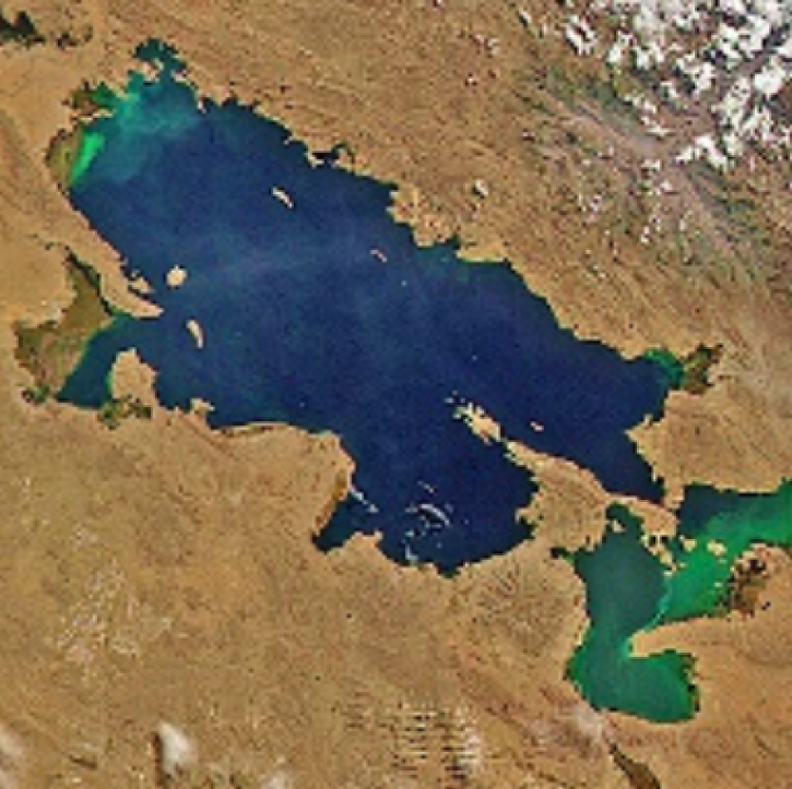
Images captured on Oct 11 and 12, 2021, by the MODIS instrument aboard the Aqua and Terra satellites.
Worldview Image of the Week
Dec. 21, 2021
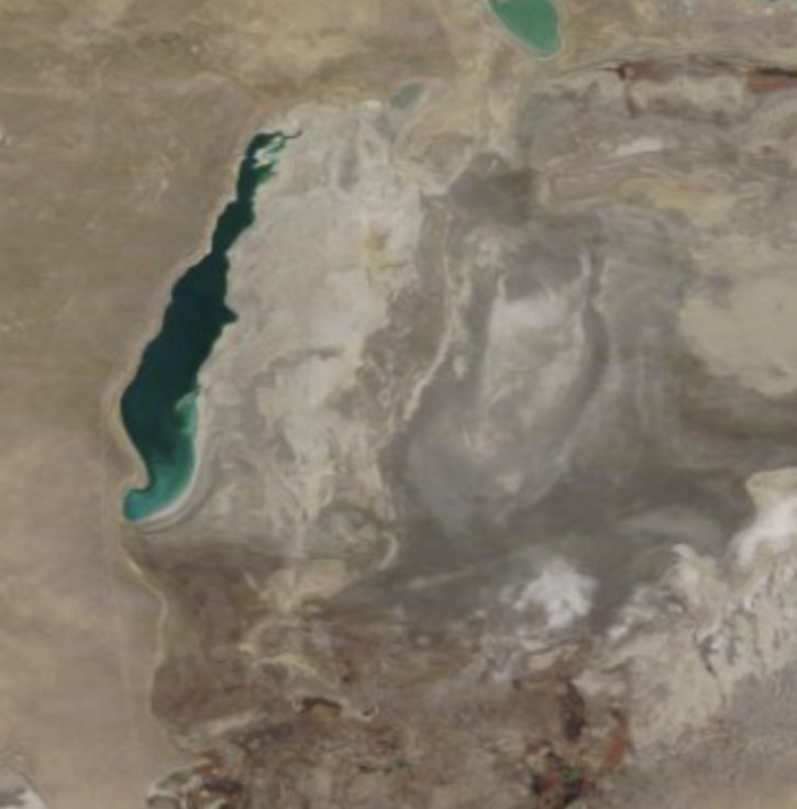
Worldview Image of the Week: Comparison image of Aral Sea
Worldview Image of the Week
Dec. 7, 2021
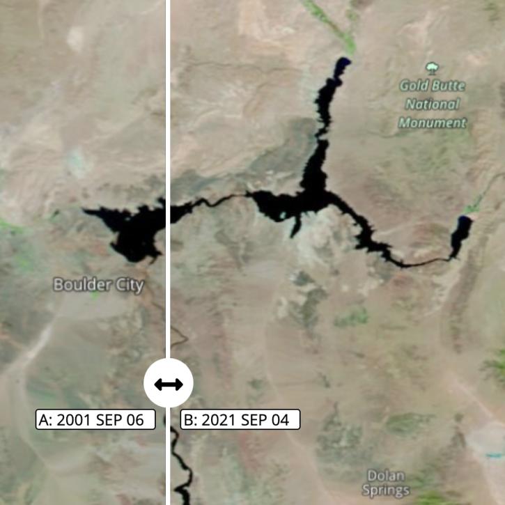
Images captured on Sep 6 and Sep 4, 2021, by the MODIS instrument aboard the Terra satellite.
Worldview Image of the Week
Nov. 1, 2021

Image captured on Aug 16, 2021, by the MODIS instrument aboard NASA's Terra satellite.
Worldview Image of the Week
Nov. 1, 2021

Satellites provide crucial information for researchers to monitor and help improve agricultural productivity in India.
Feature Article
Oct. 22, 2021
With its high-resolution HawkEye instrument, SeaHawk has shown CubeSats are an inexpensive and timely way to obtain high-quality ocean color data.
Feature Article
Oct. 20, 2021

Data available from NASA’s LP DAAC helps scientists like Dr. Robert Wright develop systems for autonomously detecting volcanic eruptions from space.
Data User Story
Oct. 20, 2021

POWER is releasing new user-defined analytic capabilities in version 2.
News
Aug. 16, 2021
SHOWING 8 OF 450
Frequently Asked Questions
Earthdata Forum
Our online forum provides a space for users to browse thousands of FAQs about research needs, data, and data applications. You can also submit new questions for our experts to answer.
Submit Questions to Earthdata Forumand View Expert Responses