We are in the process of migrating all NASA Earth science data sites into Earthdata from now until end of 2026. Not all NASA Earth science data and resources will appear here until then. Thank you for your patience as we make this transition.
Read about the Web Unification Project
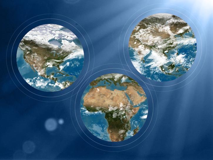
Terra Resources
Terra Learning Resources

View a demonstration of the Point Sampler using the Application for Extracting and Exploring Analysis Ready Samples (AppEEARS).
Tutorial
Dec. 21, 2018
Read stories from the 2017 issue of Sensing our Planet to learn about the many uses of MODIS data distributed by LP DAAC.
Data in Action
Dec. 19, 2018
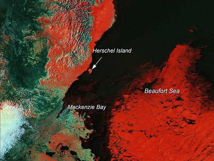
Learn how scientists use remote sensing data to study sea ice patterns to see how changes can influence weather, climate, and animal populations in these regions.
Data in Action
Dec. 6, 2018

Read stories from the 2016 issue of Sensing our Planet to learn about the many uses of MODIS data distributed by LP DAAC.
Data in Action
Nov. 28, 2018

NASA scientists examined the sea surface temperature response associated with this 2018 hurricane.
Data in Action
Nov. 26, 2018

The Application for Extracting and Exploring Analysis Ready Samples (AppEEARS) tool simplifies data access, extraction, transformation, and visualization for defined areas.
Tutorial
Nov. 9, 2018

Learn how remote sensing is used to determine the unique spectral characteristics of plants.
Tutorial
Oct. 29, 2018

Learn how satellite data supported research on forest growing seasons in Thailand, land degradation risk in Cyprus, and agricultural yield forecasting in Eastern Europe.
Data in Action
Oct. 25, 2018
SHOWING 8 OF 235
Terra News
View All News
Filters

Studying modern earthquakes that produce liquefaction can help better interpret the geologic record of liquefaction during past events.
Feature Article
July 28, 2020

In the Alps, glaciers are retreating and disappearing every year, much to the dismay of mountain climbers, tourist agencies, and environmental researchers.
Feature Article
July 28, 2020

In October 2001, a volcano in the remote South Sandwich Islands began spewing ash and lava. Less than 24 hours after the eruption began, a research team nearly 9,000 miles away was estimating how much energy the volcano was producing.
Feature Article
July 28, 2020

Researchers map vegetation and analyze the heat island effect in the urban landscape.
Feature Article
July 28, 2020

As wildlands shrink, scientists study the ecologies that people have tamed.
Feature Article
July 28, 2020

Remote sensing and meteorological data help forecast the health of a landscape.
Feature Article
July 23, 2020
Landowners and land managers monitor their land's health through a variety of methods. But what about people who own or manage millions of acres?
Feature Article
July 23, 2020

A simple tool helps a scientist open the remotely sense world to her students.
Feature Article
July 22, 2020
SHOWING 8 OF 450
Frequently Asked Questions
Earthdata Forum
Our online forum provides a space for users to browse thousands of FAQs about research needs, data, and data applications. You can also submit new questions for our experts to answer.
Submit Questions to Earthdata Forumand View Expert Responses