We are in the process of migrating all NASA Earth science data sites into Earthdata from now until end of 2026. Not all NASA Earth science data and resources will appear here until then. Thank you for your patience as we make this transition.
Read about the Web Unification Project
Terra Resources
Terra Learning Resources

Learn how to access and use Moderate Resolution Imaging Spectroradiometer (MODIS) Vegetation Indices data.
Tutorial
April 10, 2017

Learn how to access and use Moderate Resolution Imaging Spectroradiometer (MODIS) Vegetation Indices data.
Tutorial
April 10, 2017

Learn how to interpret Moderate Resolution Imaging Spectroradiometer (MODIS) Vegetation Indices quality data by understanding layers, decoding bits, and using tools for quality assessment.
Tutorial
April 10, 2017

Learn how to access improved Moderate Resolution Imaging Spectroradiometer (MODIS) Land Surface Temperature data via Earthdata Search, covering product details and download steps.
Tutorial
April 10, 2017

Learn how to use Moderate Resolution Imaging Spectroradiometer (MODIS) Version 6 Land Surface Temperature data, and access details about its scale factors, visualization, and related resources.
Tutorial
April 10, 2017

Learn how to interpret and utilize quality information within Moderate Resolution Imaging Spectroradiometer (MODIS) Thermal Anomalies and Fire data.
Tutorial
April 5, 2017

Learn how to use Moderate Resolution Imaging Spectroradiometer (MODIS) Thermal Anomalies and Fire data, interpret fire masks, and visualize data.
Tutorial
April 5, 2017

Learn how to access Moderate Resolution Imaging Spectroradiometer (MODIS) Thermal Anomalies and Fire data via Earthdata Search, covering product details and download steps.
Tutorial
April 5, 2017
SHOWING 8 OF 235
Terra News
View All News
Filters
NASA's Level-1 and Atmosphere Archive and Distribution System Distributed Active Archive Center has joined the Earthdata Forum, NASA's interactive platform that gives data users the chance to communicate with and learn from experts.
News
March 1, 2021

Is the delicate relationship between fire and plants changing?
Feature Article
March 1, 2021

Invasive species cost the U.S. economy approximately $120 billion a year and disrupt the dynamics of ecosystems. Researchers are increasingly using remote sensing to map where invasive species are and where they could spread in order to minimize their damage.
Feature Article
Feb. 25, 2021

Deforestation is taking a toll on the Amazon and other areas of high variability of life. Dr. Eric Bullock uses NASA Earth observation data to explore the consequences of land use and land cover change in these areas.
Data User Story
Feb. 25, 2021

Global climate change is leading to shifts in vital ecosystems. Dr. Malone uses Earth observation data to explore how a changing climate impacts ecosystem structure and function.
Data User Story
Feb. 25, 2021

Coastal ecosystems are some of Earth’s most biologically varied environments, especially coastal mangrove forests. Dr. Lagomasino uses Earth observing data to study these vital biomes.
Data User Story
Feb. 25, 2021
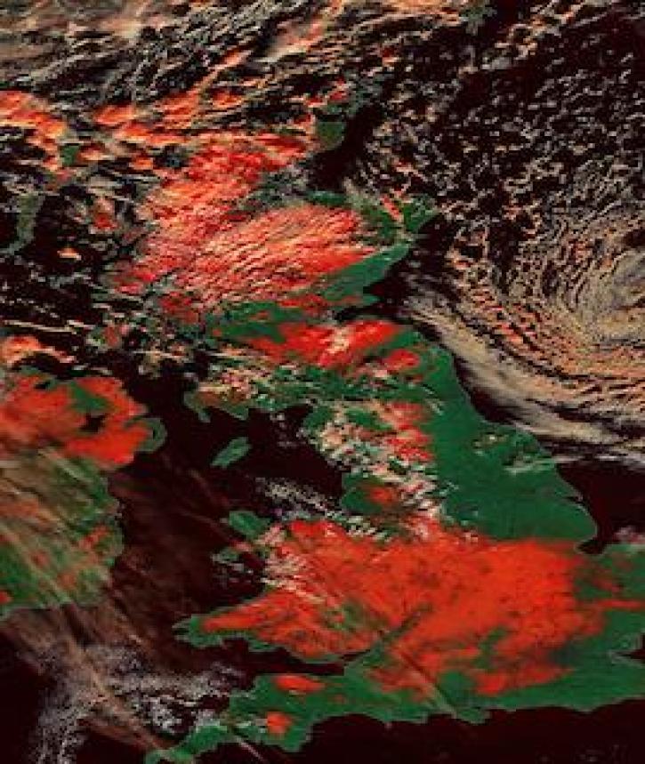
Image captured on 25 January 2021, by the MODIS instrument, aboard the Terra satellite.
Worldview Image of the Week
Feb. 1, 2021

The webinar introduces satellite remote sensing, radiance conversion, image classification, and geophysical product creation, and more.
Webinar
Jan. 29, 2021
SHOWING 8 OF 450
Frequently Asked Questions
Earthdata Forum
Our online forum provides a space for users to browse thousands of FAQs about research needs, data, and data applications. You can also submit new questions for our experts to answer.
Submit Questions to Earthdata Forumand View Expert Responses