We are in the process of migrating all NASA Earth science data sites into Earthdata from now until end of 2026. Not all NASA Earth science data and resources will appear here until then. Thank you for your patience as we make this transition.
Read about the Web Unification Project
Terra Resources
Terra Learning Resources

Learn how to access and use Moderate Resolution Imaging Spectroradiometer (MODIS) Version 6 land data.
Webinar
Nov. 22, 2016

This visualization shows 34 years of Earth's seasonal vegetation changes, driven by its orbit and tilt, using NASA's MEaSUREs Vegetation Index and Phenology (VIP) Version 4 collection.
Tutorial
Nov. 22, 2016

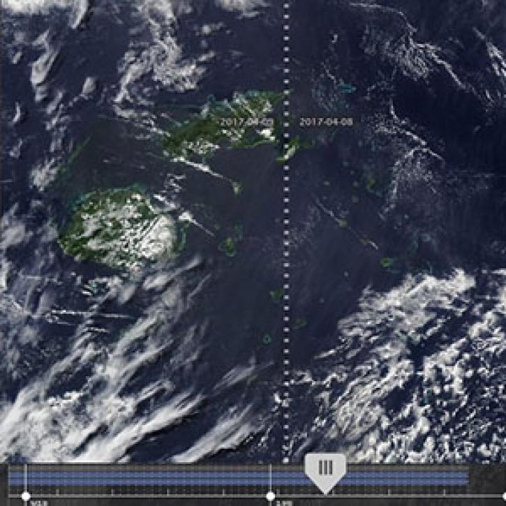
Explore the stunning autumn foliage in Eastern Asia from space with NASA remote sensing data.
Data in Action
Nov. 9, 2016

Learn how satellite data supported landslide detection in the French Alps, flowering pattern analysis for beekeepers, and mangrove ecosystem monitoring in Bangladesh and India.
Data in Action
Oct. 29, 2016

View LP DAAC's presentation at the Black Hills Digital Mapping Association's 2016 annual conference.
Webinar
Oct. 4, 2016

Researchers used ASTER data to generate a map identifying exposed minerals on the Conterminous United States.
Data in Action
Sept. 20, 2016

This ARSET training covers NASA soil moisture and evapotranspiration products and how to access and apply them for water resource management.
Training
Sept. 1-29, 2016

Join us on at 2pm ET to learn about Arctic Boreal Vulnerability Experiment (ABoVE) Data Management Best Practices.
Webinar
Aug. 31, 2016
SHOWING 8 OF 235
Terra News
View All News
Filters

Scientists at NASA's Short-Term Prediction Research and Transition (SPoRT) project use near real-time data to help the operational weather community with hurricane forecasting.
Feature Article
Nov. 4, 2020
New features in Worldview 1.4.0 (along with new imagery to view using Worldview) allow you to more easily and completely explore the planet using NASA Earth science data.
Feature Article
Nov. 4, 2020

Observe changes in land surface temperature over the course of 2017, with NASA Terra Moderate Resolution Imaging Spectroradiometer (MODIS) images.
Feature Article
Nov. 4, 2020

MODIS Terra Collection 6 Aerosol, Cloud, and other Atmospheric Level-2 and Level-3 Data
News
Nov. 4, 2020

As of 1 April 2016, all Advanced Spaceborne Thermal Emission Reflection Radiometer (ASTER) data products are available at no charge from LP DAAC.
News
Nov. 4, 2020

After more than 20 years in space, the five instruments aboard NASA’s Terra satellite continue their singular achievement of compiling a climate data record of Earth.
Feature Article
Nov. 4, 2020
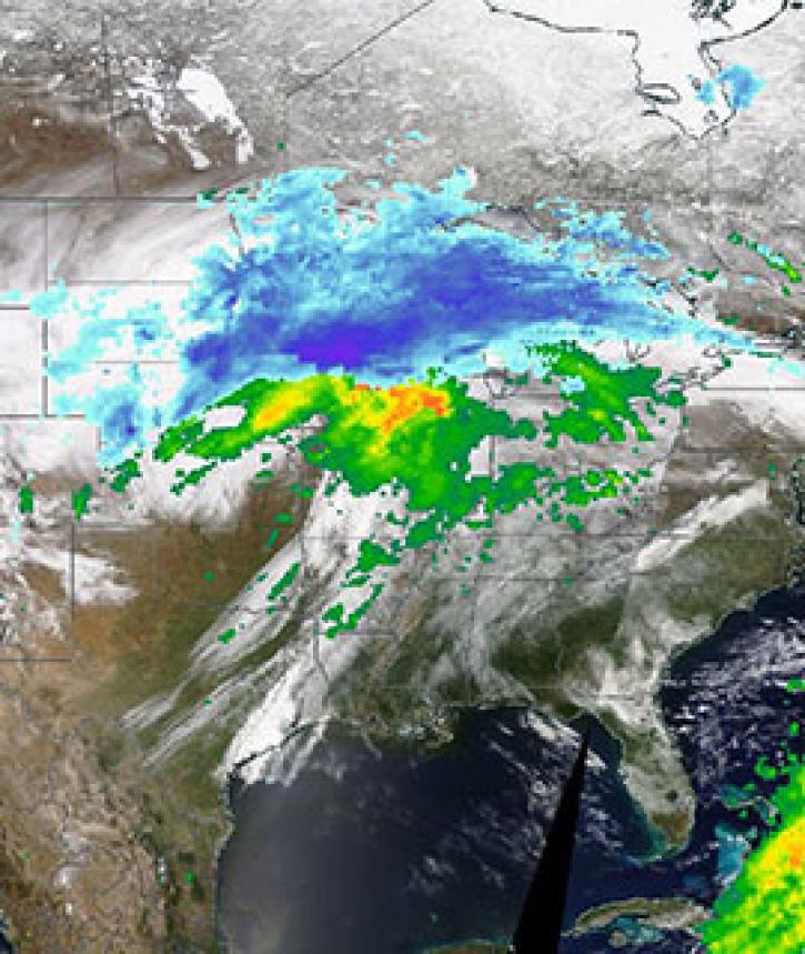
Image captured on 11 April 2019, by the MODIS instrument, aboard the Terra satellite and overlaid with IMERG Rain and Snow rates.
Worldview Image of the Week
Nov. 4, 2020

Image captured on 11 January 2020, by the MODIS instrument, aboard the Terra satellite.
Worldview Image of the Week
Nov. 4, 2020
SHOWING 8 OF 450
Frequently Asked Questions
Earthdata Forum
Our online forum provides a space for users to browse thousands of FAQs about research needs, data, and data applications. You can also submit new questions for our experts to answer.
Submit Questions to Earthdata Forumand View Expert Responses