We are in the process of migrating all NASA Earth science data sites into Earthdata from now until end of 2026. Not all NASA Earth science data and resources will appear here until then. Thank you for your patience as we make this transition.
Read about the Web Unification Project
Terra Resources
Terra Learning Resources

Explore how MODIS data supports research on tick-borne disease spread in Kansas, water stress in African rangelands, and long-term greenness trends in Alaska’s boreal ecosystems.
Data in Action
Oct. 28, 2014

Read highlights from the Spring/Summer 20214 term of NASA's DEVELOP program.
Data in Action
Oct. 21, 2014

ASTER data are used to evaluate the affects of Hurricane Ivan, a unique and destructive storm, after making two U.S. landfalls.
Data in Action
Sept. 30, 2014

Learn about intensified coastal warming along central-to-southern California in 2014 using satellite sea surface temperature imagery.
Data in Action
Sept. 4, 2014

See how digital elevation models are used to create three-dimensional data visualizations, which provide an insightful perspective on landscapes.
Data in Action
Aug. 18, 2014

Satellite data derived from ASTER imagery help tea growers in India assess crop health.
Data in Action
Aug. 14, 2014

See how NASA's remote sensing data was used to assess the destruction of the city after Typhoon Haiyan.
Data in Action
May 29, 2014

Discover how MODIS data were used to depict cloud-free, global variations in vegetation cover.
Data in Action
April 11, 2014
SHOWING 8 OF 235
Terra News
View All News
Filters

A summary of datasets, products, and resources released by NASA’s Distributed Active Archive Centers (DAACs) in November 2023.
News
Dec. 5, 2023

NASA Earth science data help scientists like Dr. James G. Allen develop processes for better satellite retrievals of ocean parameters.
Data User Story
Nov. 30, 2023

MISR L1 and L2 Product Generation Resumes with New Data Product Format
News
Nov. 6, 2023

NASA Earth science data help Dr. Gonzalo González Abad produce retrievals of formaldehyde and other atmospheric trace gases.
Data User Story
Oct. 26, 2023

A summary of datasets, products, and resources released by NASA’s Distributed Active Archive Centers (DAACs) in September 2023.
News
Sept. 29, 2023
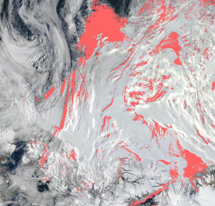
View a list of the layers that now show previously hidden pixel classifications.
Blog
Sept. 12, 2023

Image captured July 26, 2023, by the MODIS instrument aboard NASA’s Terra satellite.
Worldview Image of the Week
July 27, 2023

NASA Earth science data help scientists like Dr. Dan Runfola estimate the socioeconomic status of individuals around the globe.
Data User Story
July 27, 2023
SHOWING 8 OF 450
Frequently Asked Questions
Earthdata Forum
Our online forum provides a space for users to browse thousands of FAQs about research needs, data, and data applications. You can also submit new questions for our experts to answer.
Submit Questions to Earthdata Forumand View Expert Responses