We are in the process of migrating all NASA Earth science data sites into Earthdata from now until end of 2026. Not all NASA Earth science data and resources will appear here until then. Thank you for your patience as we make this transition.
Read about the Web Unification Project
Terra Resources
Terra Learning Resources

Esta capacitación de ARSET cubre los fundamentos de la modelación de riesgo de amenazas naturales y desarrollo de exposición.
Training
Oct. 3-10, 2023

Learn how to use NASA's Fire Information for Resource Management System (FIRMS) and its enhanced User Interface that provides additional services and analysis capabilities for wildfire management.
Webinar
Sept. 29, 2023

This advanced-level training focuses on using remote sensing observations for monitoring post-fire impacts on watershed health.
Training
July 6-13, 2023

Satellite data provides indicators of El Niño events.
Data in Action
June 15, 2023

This training will cover how soil moisture is modeled within LIS in to improve drought monitoring.
Training
May 17-31, 2023

The eBird tool leverages NASA's remote sensing data to monitor bird populations and habitats and aid in conservation efforts.
Data in Action
May 8, 2023

Join us April 26 at 2 p.m., EDT [UTC -4], to learn about NASA's LAADS DAAC data migration to the cloud and what this means for data users regarding schedule and data access. A live demo of Amazon Simple Storage Service (S3) direct access in the cloud will be provided.
Webinar
April 9, 2023

The virtual Terra, Aqua, Aura Drifting Orbits Workshop takes place Nov 1-2, 2022, from 10 a.m. to 6 p.m., EDT [UTC -4], each day. The workshop is free and registration is open to the public.
Webinar
Oct. 25, 2022
SHOWING 8 OF 235
Terra News
View All News
Filters

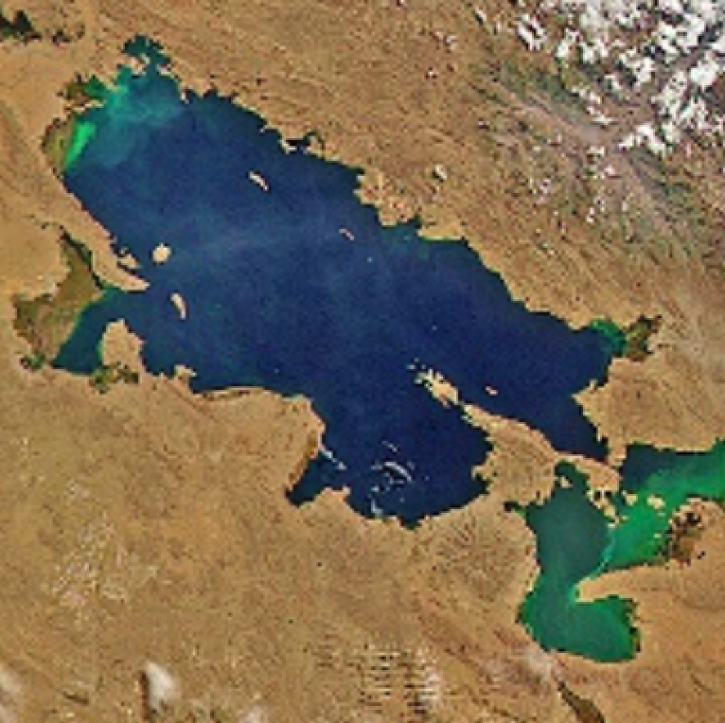
Images captured on Oct 11 and 12, 2021, by the MODIS instrument aboard the Aqua and Terra satellites.
Worldview Image of the Week
Dec. 21, 2021
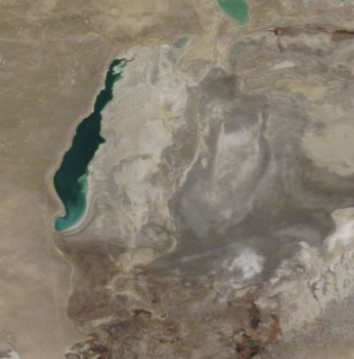
Worldview Image of the Week: Comparison image of Aral Sea
Worldview Image of the Week
Dec. 7, 2021
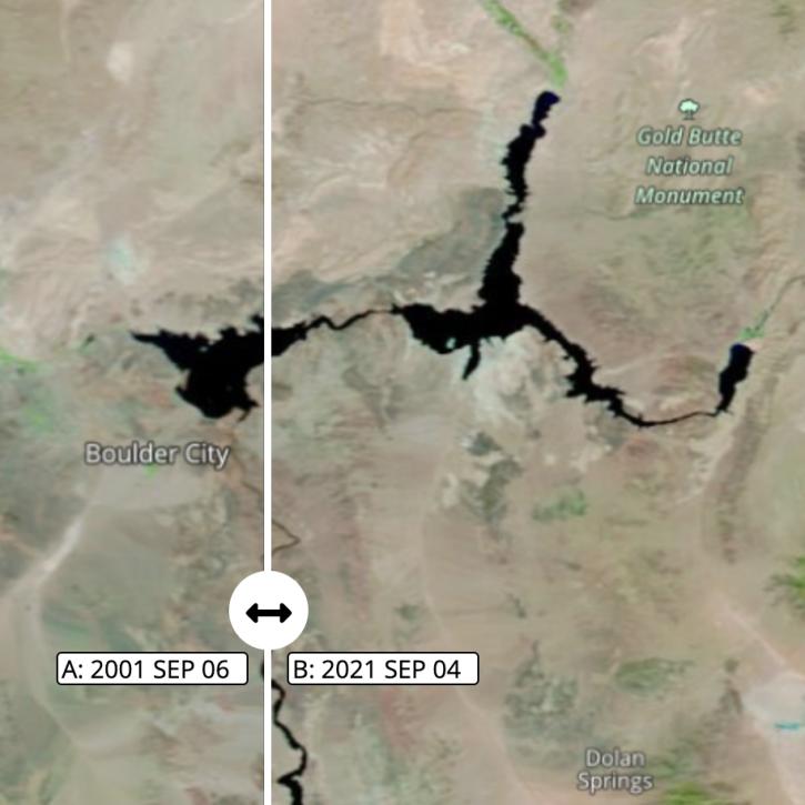
Images captured on Sep 6 and Sep 4, 2021, by the MODIS instrument aboard the Terra satellite.
Worldview Image of the Week
Nov. 1, 2021

Image captured on Aug 16, 2021, by the MODIS instrument aboard NASA's Terra satellite.
Worldview Image of the Week
Nov. 1, 2021

Satellites provide crucial information for researchers to monitor and help improve agricultural productivity in India.
Feature Article
Oct. 22, 2021
With its high-resolution HawkEye instrument, SeaHawk has shown CubeSats are an inexpensive and timely way to obtain high-quality ocean color data.
Feature Article
Oct. 20, 2021

Data available from NASA’s LP DAAC helps scientists like Dr. Robert Wright develop systems for autonomously detecting volcanic eruptions from space.
Data User Story
Oct. 20, 2021

POWER is releasing new user-defined analytic capabilities in version 2.
News
Aug. 16, 2021
SHOWING 8 OF 450
Frequently Asked Questions
Earthdata Forum
Our online forum provides a space for users to browse thousands of FAQs about research needs, data, and data applications. You can also submit new questions for our experts to answer.
Submit Questions to Earthdata Forumand View Expert Responses