We are in the process of migrating all NASA Earth science data sites into Earthdata from now until end of 2026. Not all NASA Earth science data and resources will appear here until then. Thank you for your patience as we make this transition.
Read about the Web Unification Project
Terra Resources
Terra Learning Resources

Join us to learn how to discover, subset, access and visualize both MODIS and VIIRS data products using a suite of user-friendly tools developed by NASA's ORNL DAAC.
Webinar
April 19, 2022

Through NASA FIRMS, users can interactively view fire data via the Fire Map, search for both VIIRS and MODIS active fires/hotspots and sign-up to receive automated Fire Email Alerts for their geographic areas of interest. Join us to learn more!
Webinar
April 19, 2022

Want to learn how to use R and Python to work with remote sensing data? Join us as we demonstrate how to perform basic data preparation, processing, computation, and visualization techniques using ASTER and VIIRS Surface Reflectance data.
Webinar
April 18, 2022

Learn how SeaBASS can be leveraged for data search, discovery, and access, and will demonstrate how SeaBASS supports NASA’s ocean color satellite products and the broader scientific community.
Webinar
April 18, 2022
NASA GLOBE Clouds is an international citizen science program that collects cloud observations from participants around the world and compares them with satellite data. Learn more about the benefits and limitations of this citizen science data for scientific inquiry.
Webinar
April 15, 2022

Cette formation ARSET explique comment appliquer les données de télédétection du UN Biodiversity Lab pour la conservation et le développement durable.
Training
April 14 - May 4, 2022
Esta capacitación de ARSET cubre cómo usar datos del UN Biodiversity Lab para conservación y desarrollo sostenible.
Training
April 14 - May 4, 2022
This ARSET training shares how to apply UN Biodiversity Lab remote sensing/geospatial data for conservation and sustainable development priorities.
Training
April 14 - May 4, 2022
SHOWING 8 OF 235
Terra News
View All News
Filters
AppEEARS allows users to subset data spatially, temporally, and by layer, reducing the amount of data they need to download.
Feature Article
April 3, 2023

Image of a three-day flood composite ending Mar 22, 2023, from the MODIS instruments aboard the Terra and Aqua satellites, overlaid on a true color corrected reflectance image.
Worldview Image of the Week
March 22, 2023

A new Request for Information (RFI) with responses due by April 4 seeks input for determining Terra, Aqua, and Aura mission data product continuity needs, capabilities, and gaps.
News
March 6, 2023
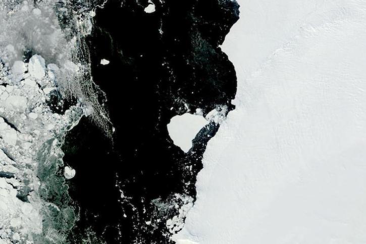
Image captured on Feb 28, 2023, by the MODIS instrument aboard NASA's Terra satellite.
Worldview Image of the Week
March 1, 2023

Data from NASA’s ORNL DAAC help Dr. Kyla Dahlin better understand how remote sensing can improve predictive ecological models.
Data User Story
Feb. 28, 2023
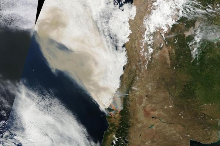
Image captured on Feb 4, 2023, by the MODIS instrument aboard NASA's Terra satellite.
Worldview Image of the Week
Feb. 7, 2023

NASA near real-time data help Lori Schultz respond to agencies that reach out to NASA in the wake of natural disasters.
Data User Story
Jan. 31, 2023

MODIS V6 land data products suffer from known calibration issues discovered after the completion of V6 reprocessing.
News
Jan. 30, 2023
SHOWING 8 OF 450
Frequently Asked Questions
Earthdata Forum
Our online forum provides a space for users to browse thousands of FAQs about research needs, data, and data applications. You can also submit new questions for our experts to answer.
Submit Questions to Earthdata Forumand View Expert Responses