We are in the process of migrating all NASA Earth science data sites into Earthdata from now until end of 2026. Not all NASA Earth science data and resources will appear here until then. Thank you for your patience as we make this transition.
Read about the Web Unification Project
Terra Resources
Terra Learning Resources

Join us to learn how to discover, subset, access and visualize both MODIS and VIIRS data products using a suite of user-friendly tools developed by NASA's ORNL DAAC.
Webinar
April 19, 2022

Through NASA FIRMS, users can interactively view fire data via the Fire Map, search for both VIIRS and MODIS active fires/hotspots and sign-up to receive automated Fire Email Alerts for their geographic areas of interest. Join us to learn more!
Webinar
April 19, 2022

Want to learn how to use R and Python to work with remote sensing data? Join us as we demonstrate how to perform basic data preparation, processing, computation, and visualization techniques using ASTER and VIIRS Surface Reflectance data.
Webinar
April 18, 2022

Learn how SeaBASS can be leveraged for data search, discovery, and access, and will demonstrate how SeaBASS supports NASA’s ocean color satellite products and the broader scientific community.
Webinar
April 18, 2022
NASA GLOBE Clouds is an international citizen science program that collects cloud observations from participants around the world and compares them with satellite data. Learn more about the benefits and limitations of this citizen science data for scientific inquiry.
Webinar
April 15, 2022

Cette formation ARSET explique comment appliquer les données de télédétection du UN Biodiversity Lab pour la conservation et le développement durable.
Training
April 14 - May 4, 2022
Esta capacitación de ARSET cubre cómo usar datos del UN Biodiversity Lab para conservación y desarrollo sostenible.
Training
April 14 - May 4, 2022
This ARSET training shares how to apply UN Biodiversity Lab remote sensing/geospatial data for conservation and sustainable development priorities.
Training
April 14 - May 4, 2022
SHOWING 8 OF 235
Terra News
View All News
Filters

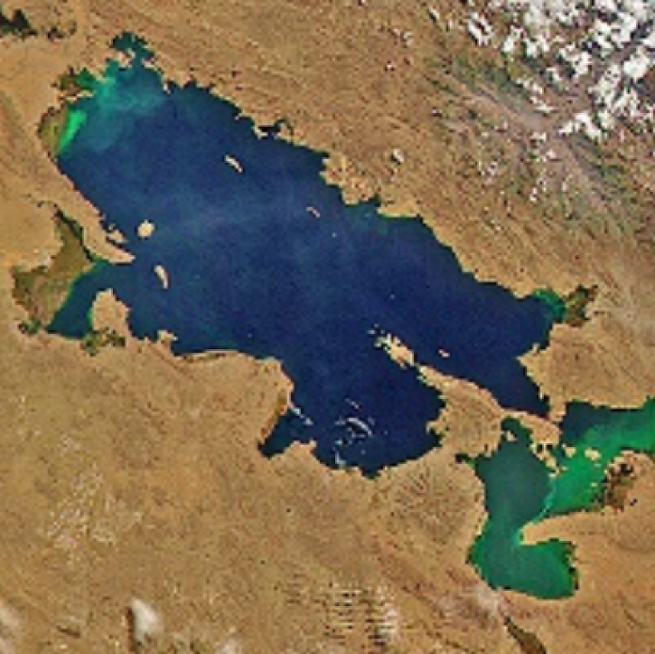
Images captured on Oct 11 and 12, 2021, by the MODIS instrument aboard the Aqua and Terra satellites.
Worldview Image of the Week
Dec. 21, 2021
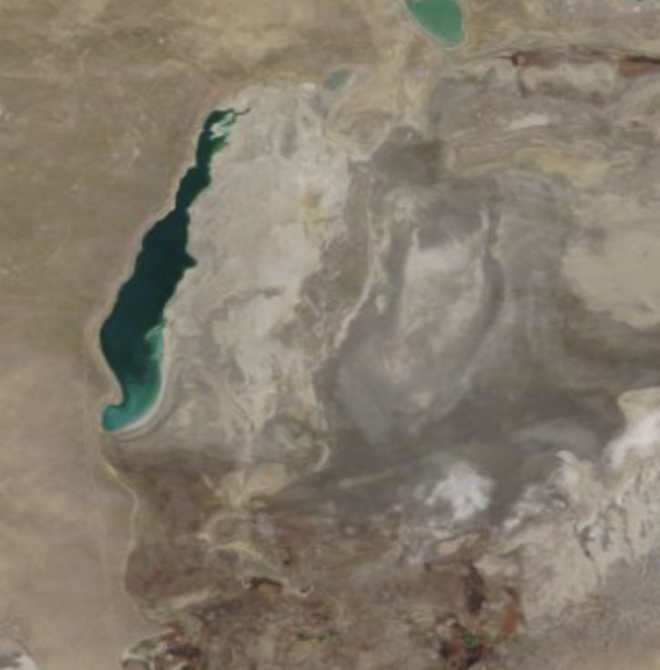
Worldview Image of the Week: Comparison image of Aral Sea
Worldview Image of the Week
Dec. 7, 2021
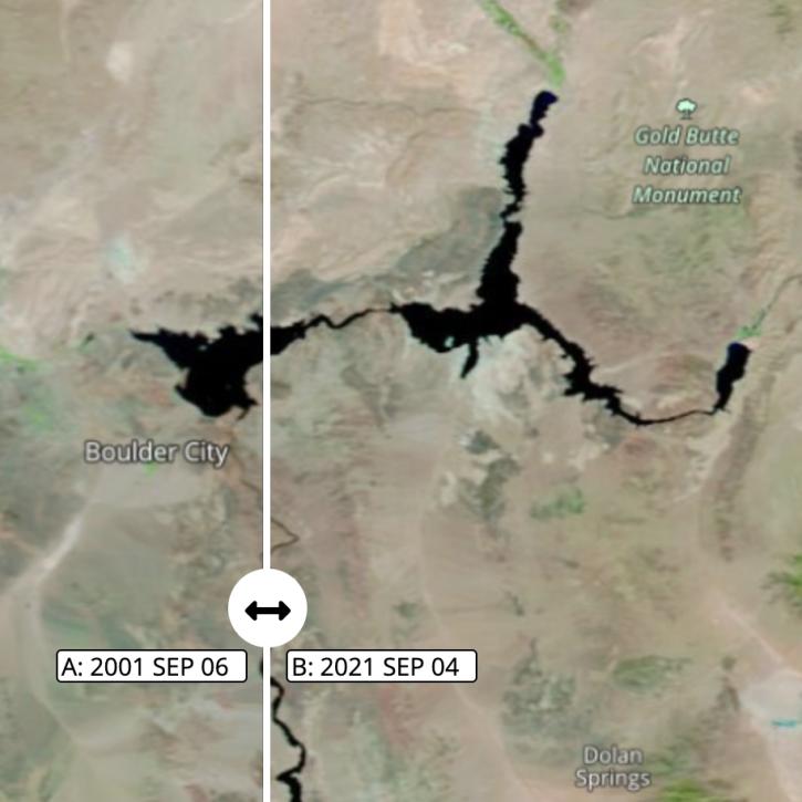
Images captured on Sep 6 and Sep 4, 2021, by the MODIS instrument aboard the Terra satellite.
Worldview Image of the Week
Nov. 1, 2021

Image captured on Aug 16, 2021, by the MODIS instrument aboard NASA's Terra satellite.
Worldview Image of the Week
Nov. 1, 2021

Satellites provide crucial information for researchers to monitor and help improve agricultural productivity in India.
Feature Article
Oct. 22, 2021
With its high-resolution HawkEye instrument, SeaHawk has shown CubeSats are an inexpensive and timely way to obtain high-quality ocean color data.
Feature Article
Oct. 20, 2021

Data available from NASA’s LP DAAC helps scientists like Dr. Robert Wright develop systems for autonomously detecting volcanic eruptions from space.
Data User Story
Oct. 20, 2021

POWER is releasing new user-defined analytic capabilities in version 2.
News
Aug. 16, 2021
SHOWING 8 OF 450
Frequently Asked Questions
Earthdata Forum
Our online forum provides a space for users to browse thousands of FAQs about research needs, data, and data applications. You can also submit new questions for our experts to answer.
Submit Questions to Earthdata Forumand View Expert Responses