We are in the process of migrating all NASA Earth science data sites into Earthdata from now until end of 2026. Not all NASA Earth science data and resources will appear here until then. Thank you for your patience as we make this transition.
Read about the Web Unification Project
Terra Resources
Terra Learning Resources

Read highlights of three publications that detail how NASA Earth observation data are used to map wildfire fuel loads, analyze volcanic ash composition, and improve soil respiration models in agricultural systems.
Data in Action
March 15, 2022

Satellite observations complement other sensors to gauge Earth’s energy imbalance (EEI) more accurately.
Data in Action
Feb. 18, 2022

Learn how researchers used NASA data to map Amazon carbon flux, mosquito disease transmission zones, and volcanic activity patterns for environmental monitoring and risk assessment.
Data in Action
Feb. 3, 2022

NASA Models Reveal Climate-Induced and Management Impacts on the Mississippi River Delta
StoryMap
Feb. 1, 2022

NASA Models and Datasets Capture Irrigation and Groundwater Depletion Impacts
StoryMap
Feb. 1, 2022

Esta capacitación de ARSET cubre el Kit de herramientas de observación de la Tierra para ciudades y asentamientos humanos sostenibles.
Training
Jan. 27 - Feb. 10, 2022
This ARSET training provides an overview of the Earth Observations Toolkit for Sustainable Cities and Human Settlements.
Training
Jan. 27 - Feb. 10, 2022

This ARSET training reviews pre-fire risk assessment and post-fire mapping using open-source tools like Google Earth Engine.
Training
Jan. 18-20, 2022
SHOWING 8 OF 235
Terra News
View All News
Filters

The new Sea Level Change Data Pathfinder highlights the different datasets used to piece together the status and drivers of sea level rise.
Feature Article
Feb. 18, 2022

Image captured on Jan 11, 2022 by the MODIS instrument aboard the Terra satellite.
Worldview Image of the Week
Feb. 1, 2022
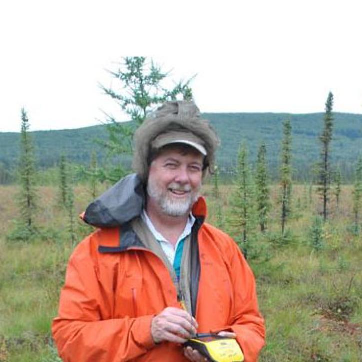
Data from NASA’s ORNL DAAC helps scientists like Dr. Kevin Schaefer detect climate-induced thawing of permafrost throughout the Arctic.
Data User Story
Jan. 31, 2022
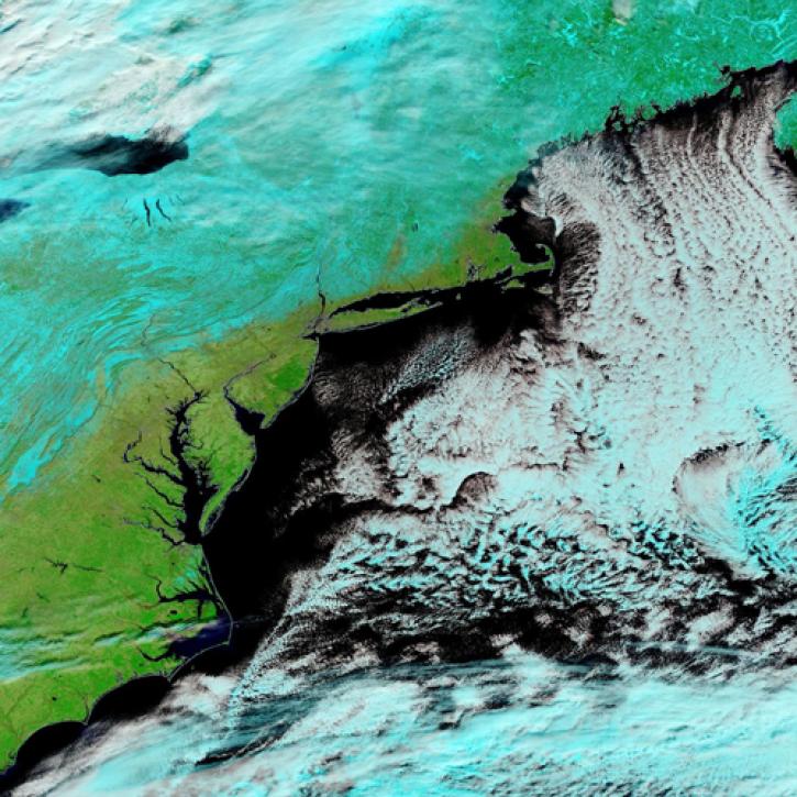
Image captured Jan 30, 2022, by the MODIS instrument aboard the Terra satellite.
Worldview Image of the Week
Jan. 31, 2022

Image captured on Dec. 11, 2021, by the MODIS instrument aboard the Terra satellite.
Worldview Image of the Week
Jan. 29, 2022
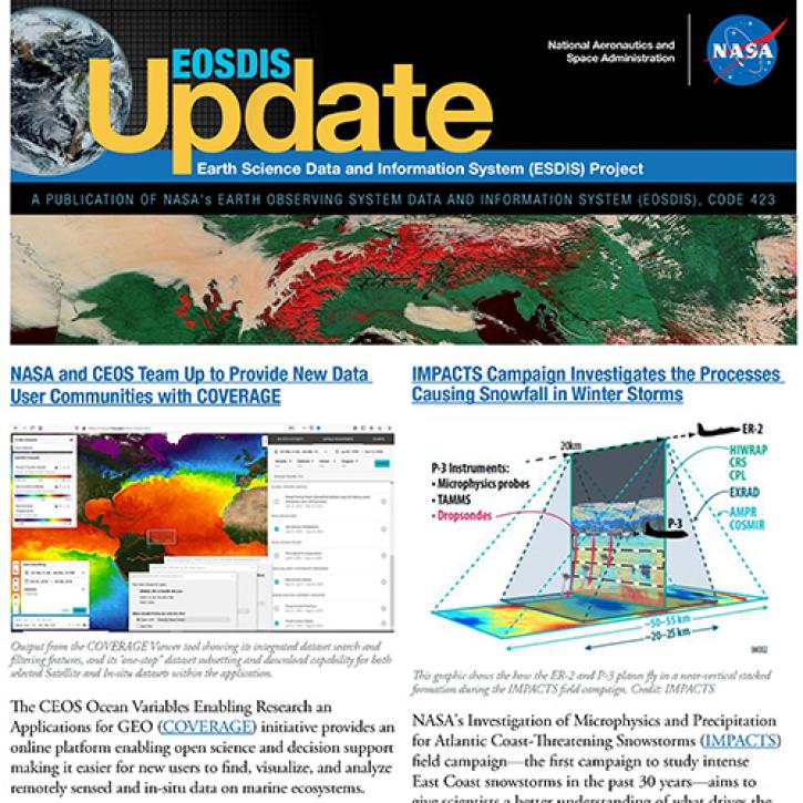
Read about the latest EOSDIS work in the Fall 2021 EOSDIS Update newsletter.
News
Jan. 26, 2022

GeoColor imagery’s quality, frequency, and interpretability will boost the amount of near real-time imagery available in Worldview, making it even more valuable to users.
Feature Article
Jan. 25, 2022

Worldview now has temperature conversion and new tour stories, and GIBS is moving to the cloud!
Blog
Jan. 19, 2022
SHOWING 8 OF 450
Frequently Asked Questions
Earthdata Forum
Our online forum provides a space for users to browse thousands of FAQs about research needs, data, and data applications. You can also submit new questions for our experts to answer.
Submit Questions to Earthdata Forumand View Expert Responses