We are in the process of migrating all NASA Earth science data sites into Earthdata from now until end of 2026. Not all NASA Earth science data and resources will appear here until then. Thank you for your patience as we make this transition.
Read about the Web Unification Project
Terra Resources
Terra Learning Resources

Read highlights of three publications that detail how NASA Earth observation data are used to map wildfire fuel loads, analyze volcanic ash composition, and improve soil respiration models in agricultural systems.
Data in Action
March 15, 2022

Satellite observations complement other sensors to gauge Earth’s energy imbalance (EEI) more accurately.
Data in Action
Feb. 18, 2022

Learn how researchers used NASA data to map Amazon carbon flux, mosquito disease transmission zones, and volcanic activity patterns for environmental monitoring and risk assessment.
Data in Action
Feb. 3, 2022

NASA Models Reveal Climate-Induced and Management Impacts on the Mississippi River Delta
StoryMap
Feb. 1, 2022

NASA Models and Datasets Capture Irrigation and Groundwater Depletion Impacts
StoryMap
Feb. 1, 2022

Esta capacitación de ARSET cubre el Kit de herramientas de observación de la Tierra para ciudades y asentamientos humanos sostenibles.
Training
Jan. 27 - Feb. 10, 2022
This ARSET training provides an overview of the Earth Observations Toolkit for Sustainable Cities and Human Settlements.
Training
Jan. 27 - Feb. 10, 2022

This ARSET training reviews pre-fire risk assessment and post-fire mapping using open-source tools like Google Earth Engine.
Training
Jan. 18-20, 2022
SHOWING 8 OF 235
Terra News
View All News
Filters

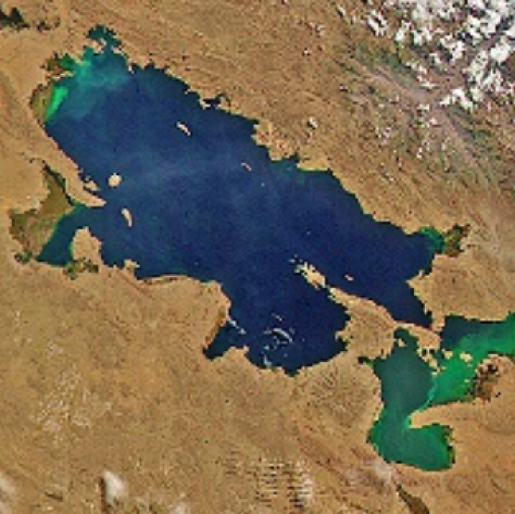
Images captured on Oct 11 and 12, 2021, by the MODIS instrument aboard the Aqua and Terra satellites.
Worldview Image of the Week
Dec. 21, 2021
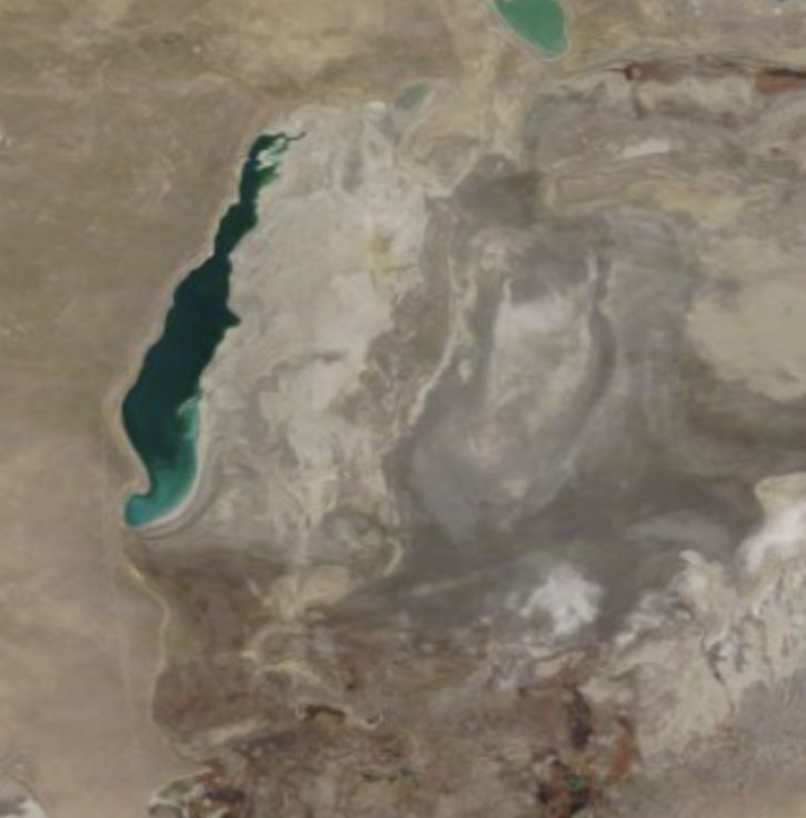
Worldview Image of the Week: Comparison image of Aral Sea
Worldview Image of the Week
Dec. 7, 2021
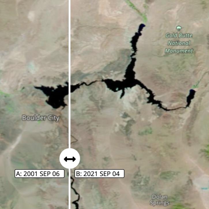
Images captured on Sep 6 and Sep 4, 2021, by the MODIS instrument aboard the Terra satellite.
Worldview Image of the Week
Nov. 1, 2021

Image captured on Aug 16, 2021, by the MODIS instrument aboard NASA's Terra satellite.
Worldview Image of the Week
Nov. 1, 2021

Satellites provide crucial information for researchers to monitor and help improve agricultural productivity in India.
Feature Article
Oct. 22, 2021
With its high-resolution HawkEye instrument, SeaHawk has shown CubeSats are an inexpensive and timely way to obtain high-quality ocean color data.
Feature Article
Oct. 20, 2021

Data available from NASA’s LP DAAC helps scientists like Dr. Robert Wright develop systems for autonomously detecting volcanic eruptions from space.
Data User Story
Oct. 20, 2021

POWER is releasing new user-defined analytic capabilities in version 2.
News
Aug. 16, 2021
SHOWING 8 OF 450
Frequently Asked Questions
Earthdata Forum
Our online forum provides a space for users to browse thousands of FAQs about research needs, data, and data applications. You can also submit new questions for our experts to answer.
Submit Questions to Earthdata Forumand View Expert Responses