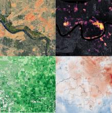
From the Arctic to the Amazon, terrestrial and marine ecosystems are changing rapidly in response to human activity and a changing climate. Understanding these changes is essential to the sustainability of all life on Earth, including human well-being. Satellites and airborne instruments take observations of the world's land, fresh water, oceans, and atmosphere every day, opening up new opportunities for studying ecosystem change. Since 1994, NASA and other federal agencies have made these remotely sensed data free for use by scientists and managers, providing new opportunities for ecological research and applications. But there are many unanswered questions in the fields of biological diversity and ecology that these data could inform.

Traditional field research, where researchers document the presence of plants, animals, and other environmental factors directly, can be limited by the time it takes to make the measurements and the geographic range of the research. Remotely sensed data can complement traditional field data and help researchers directly measure the distribution of plants and animals, or indirectly estimate their distribution and abundance, based on environmental conditions such as temperature, vegetation health, precipitation, and other factors that affect the suitability of species' habitats.
There are a number of examples of how researchers and managers have used remotely sensed data in their activities. In one such example, researchers at the U.S. Forest Service used satellite and ground-based data to assess the status of the Northern Spotted Owl, which has been listed as “threatened” by the U.S. Fish and Wildlife Service. The number of Northern Spotted Owls is declining by an average of 4 percent each year across its geographical range. Ecologists at the Forest Service used Landsat data of land cover in Olympic National Forest to estimate where spotted owls might be present (see the Earth Observatory story, Spotting the Spotted Owl: 30 Years of Habitat Change). By relating the satellite views of forest cover to ground-based observations of where spotted owls nest and roost, scientists were able to map their habitat and detect where the habitat is being disturbed by timber harvesting, fires, and insect damage.
In a similar way, a NASA-funded initiative coordinated by NOAA called WhaleWatch uses satellite data to predict where blue whales might be in order to prevent them being hit by ships during migration in the Pacific Ocean.

Harnessing this new world of data can help scientists and managers answer many pressing ecological questions, but too many are unaware of the data that's available and how to use it. Over the next few months, NASA's Earthdata team will be highlighting biodiversity-related data, research, and resources. We will be focusing on the different types of data available and how they can be used to understand essential variables in biological and ecological research. We are kicking off our efforts with a Biological Diversity Data Toolkit, a curated set of resources and data. We will also be publishing a Data Pathfinder to help researchers navigate data relevant to their field of interest as well as other articles on biodiversity topics. All of these resources will be posted in the Learn section of the Earthdata website.