Earthdata logo Earthdata logo
  • Data

    Data

    Find and use NASA Earth science data fully, openly, and without restrictions.

    Get Started Find Data Use Data
    • Earthdata Search
    • Data Tools
    • Data Recipes
    • Worldview
    • Worldview Snapshots
    • Global Imagery Browse Services (GIBS)
    • Common Metadata Repository (CMR)
    • Near Real-Time Data
    • Fire Information for Resource Management System (FIRMS)
      • Active Fire Data
      • Fire Email Alerts
      • Fire Map (Global)
      • Fire Map (US/Canada)
  • Topics

    Topics

    Recognizing the connections between interdependent Earth systems is critical for understanding the world in which we live.

    Image
    Topics navigation graphic - a globe and magnifying glass.
    • Atmosphere

      Atmosphere

      The atmosphere is a gaseous envelope surrounding and protecting our planet from the intense radiation of the Sun and serves as a key interface between the terrestrial and ocean cycles.

      Atmosphere icon

    • Biosphere

      Biosphere

      The biosphere encompasses all life on Earth and extends from root systems to mountaintops and all depths of the ocean. It is critical for maintaining species diversity, regulating climate, and providing numerous ecosystem functions.

      Biosphere

    • Cryosphere

      Cryosphere

      The cryosphere encompasses the frozen parts of Earth, including glaciers and ice sheets, sea ice, and any other frozen body of water. The cryosphere plays a critical role in regulating climate and sea levels.

      Cryosphere icon

    • Human Dimensions

      Human Dimensions

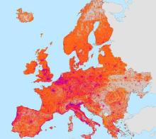
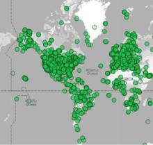
      The human dimensions discipline includes ways humans interact with the environment and how these interactions impact Earth’s systems. It also explores the vulnerability of human communities to natural disasters and hazards.

      Human Dimensions icon

    • Land Surface

      Land Surface

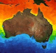
      The land surface discipline includes research into areas such as shrinking forests, warming land, and eroding soils. NASA data provide key information on land surface parameters and the ecological state of our planet.

      Land Surface icon

    • Ocean

      Ocean

      The ocean covers almost a third of Earth’s surface and contains 97% of the planet’s water. This vast, critical reservoir supports a diversity of life and helps regulate Earth’s climate.

      Oceans icon

    • Solid Earth

      Solid Earth

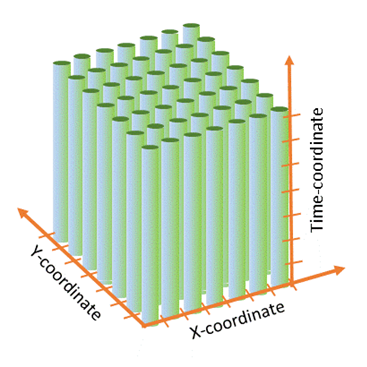
      Processes occurring deep within Earth constantly are shaping landforms. Although originating from below the surface, these processes can be analyzed from ground, air, or space-based measurements.

      Solid Earth icon

    • Sun-Earth Interactions

      Sun-Earth Interactions

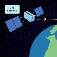
      The Sun influences a variety of physical and chemical processes in Earth’s atmosphere. NASA continually monitors solar radiation and its effect on the planet.

      Sun-Earth Interactions icon

    • Terrestrial Hydrosphere

      Terrestrial Hydrosphere

      The terrestrial hydrosphere includes water on the land surface and underground in the form of lakes, rivers, and groundwater along with total water storage.

      Terrestrial Hydrosphere icon

    Home
  • Learn

    Learn

    Whether you are a scientist, an educator, a student, or are just interested in learning more about NASA’s Earth science data and how to use them, we have the resources to help. Get information and guides to help you find and use NASA Earth science data, services, and tools.

    Image
    Learn navigation graphic - an illustration of 3 students.
    • Get Started
    • Backgrounders
    • Data Pathfinders
    • Data Toolkits
    • Webinars and Tutorials
    • Data Stories
      • Articles
      • Data Chats
      • Data User Profiles
  • Engage

    Engage

    We provide a variety of ways for Earth scientists to collaborate with NASA.

    Image
    Engage navigation graphic - an illustration of multiple data users/consumers.
    • Open Data, Services, and Software Policies
      • Open Source Software Policy
      • Application Programming Interfaces (APIs)
      • Earthdata Code Collaborative (ECC)
    • Standards
      • Data Standards and Requirements
      • Data Use Policy
      • Data Citations and Acknowledgements
    • Adding New Data to EOSDIS
    • Public & Private Partnerships
    • Memberships & Affiliations
  • About

    About

    Making NASA's free and open Earth science data interactive, interoperable, and accessible for research and societal benefit both today and tomorrow.

    Image
    About navigation graphic - an illustration of a satellite.
    • Earth Science Data Systems (ESDS) Program
      • ESDS Program Components
      • Commercial Smallsat Data Acquisition (CSDA) Program
      • Competitive Programs
      • Interagency Implementation and Advanced Concepts Team (IMPACT)
    • Earth Science Data and Information System (ESDIS) Project
    • Earth Observing System Data and Information System (EOSDIS)
      • Distributed Active Archive Centers (DAAC)
      • System Performance and Metrics
      • System Components
      • Data System Interfaces
search icon
data
find data
use data
earthdata search
common metadata repository (cmr)
data tools
data recipes
worldview snapshots
global imagery browse services (gibs)
near real-time data
worldview
fire information for resource management system (firms)
active fire data
fire email alerts
fire map (global)
fire map (us/canada)
topics
atmosphere
biosphere
cryosphere
human dimensions
land surface
ocean
solid earth
sun-earth interactions
terrestrial hydrosphere
learn
get started
backgrounders
data pathfinders
data toolkits
webinars and tutorials
data stories
articles
data chats
data user profiles
engage
public & private partnerships
memberships & affiliations
open data, services, and software policies
open source software policy
application programing interfaces (APIs)
earthdata code collaborative (ECC)
standards
data standards and requirements
data use policy
data citations and acknowledgements
adding new data to eosdis
about
earth science data systems (esds) program
commercial smallsat data acquisition (csda) program
competitive programs
esds program components
interagency implementation and advanced concepts team (impact)
earth science data and information system (esdis) project
earth observing system data and information system (eosdis)
distributed active archive centers (daacs)
system performance and metrics
system components
data system interfaces
  1. Earthdata
  2. Learn
  3. Articles

Articles

Has taxonomy terms (with depth)
This map shows air temperature anomalies across the continental United States and Canada on June 27, 2021.
Nov 19, 2021
Urban Extreme Heat Dataset Offers Population Exposure Estimates for More Than 13,000 Urban Settlements Worldwide
Image generated by GIS
Nov 17, 2021
Celebrate GIS Day 2021!
COVERAGE image showing ocean with colors indicating ocean temperatures.
Nov 15, 2021
NASA and CEOS Team Up to Provide New Data User Communities with COVERAGE
Graphic representing open science as layers, with open science at the center, open science focus areas in the middle, and data program-specific strategies that enable open science in the outer layer.
Nov 4, 2021
Open-source Science: The NASA Earth Science Perspective
Shaded relief rendering of EarthDEM data showing the Virgin River, Nevada. DEM derived from Maxar imagery.
Oct 29, 2021
New in CSDA: High Resolution Digital Elevation Models
Image from the Moderate Resolution Imaging Spectroradiometer (MODIS) aboard NASA’s Terra satellite shows an area of New Jersey and New York impacted by a winter storm that hit in February, 2021.
Oct 26, 2021
IMPACTS Campaign Investigates the Processes Causing Snowfall in Winter Storms
This MODIS image shows areas of flooding in south-central United States on April 4, 2021.
Oct 25, 2021
Near Real-Time MODIS Global Flood Product Now Available from NASA’s LANCE
my NASA data logo
Oct 6, 2021
Reading, Writing, and Remote Sensing: NASA Earth Observing Data Go to School
Open Science square logo
Oct 5, 2021
NASA Science Mission Directorate (SMD) Scientific Information Policy on Open Science
Image of four ESDIS new hires
Sep 16, 2021
New ESDIS Team Members Ensure Users Can Access and Use the Ever-Growing Volumes of NASA Earth Science Data
space app challenge
Sep 7, 2021
Nine Space-Agency Partners Join NASA to Expand Global Participation in 10th Annual International Space Apps Challenge
Image from the HawkEye imager aboard the SeaHawk cubesat
Aug 31, 2021
SeaHawk Mission Proves CubeSats Are a Viable Option for Collecting Credible Scientific Data

Pagination

  • « First First page
  • ‹ Previous Previous page
  • 1
  • 2
  • 3
  • 4
  • 5
  • 6
  • 7
  • 8
  • 9
  • …
  • Next › Next page
  • Last » Last page
Contact Us
Subscribe
Follow Us
fb_icon twitter_icon yt_icon

Data
Find Data
Earthdata Search
Common Metadata Respository (CMR)
International Directory Network (IDN)
Use Data
Data Tools
Data Recipes
Worldview
Worldview Snapshots
Global Imagery Browse Services (GIBS)
Near Real-Time Data
FIRMS
Active Fire Data
Fire Email Alerts
Fire Map (Global)
Fire Map (US/Canada)
Topics
Atmosphere
Biosphere
Cryosphere
Human Dimensions
Land Surface
Ocean
Solid Earth
Sun-Earth Interactions
Terrestrial Hydrosphere
Learn
Get Started
Backgrounders
Data Pathfinders
Data Toolkits
Webinars and Tutorials
Data Stories
Articles
Data User Profiles
Data Chats
Engage
Open Data, Services, and Software Policies
Open Source Software Policy
Earthdata Developer Resources & APIs
Earthdata Code Collaborative
Standards
Data Standards and Requirements
Data Use Policy
Data Citations and Acknowledgements
Adding Data to EOSDIS
Public/Private Partnerships
Members and Affiliations
About
ESDS Program
ESDS Program Components
Commercial Smallsat Data Acquisition (CSDA) Program
Competitve Programs
Interagency Implementation and Advanced Concepts Team (IMPACT)
ESDIS Project
ESDIS Project Library
EOSDIS
DAACs
System Performance and Metrics
System Components
Data System Interfaces

More From Earthdata
  • Contact Us
  • Earthdata Forum
  • Community Forums
  • Support
Related Links
  • NASA Official: Cerese Albers
  • Web Privacy Policy
  • Data and Information Policy
  • Communications Policy
  • Freedom of Information Act
  • USA.gov
  • Sitemap

NASA Official: Cerese Albers