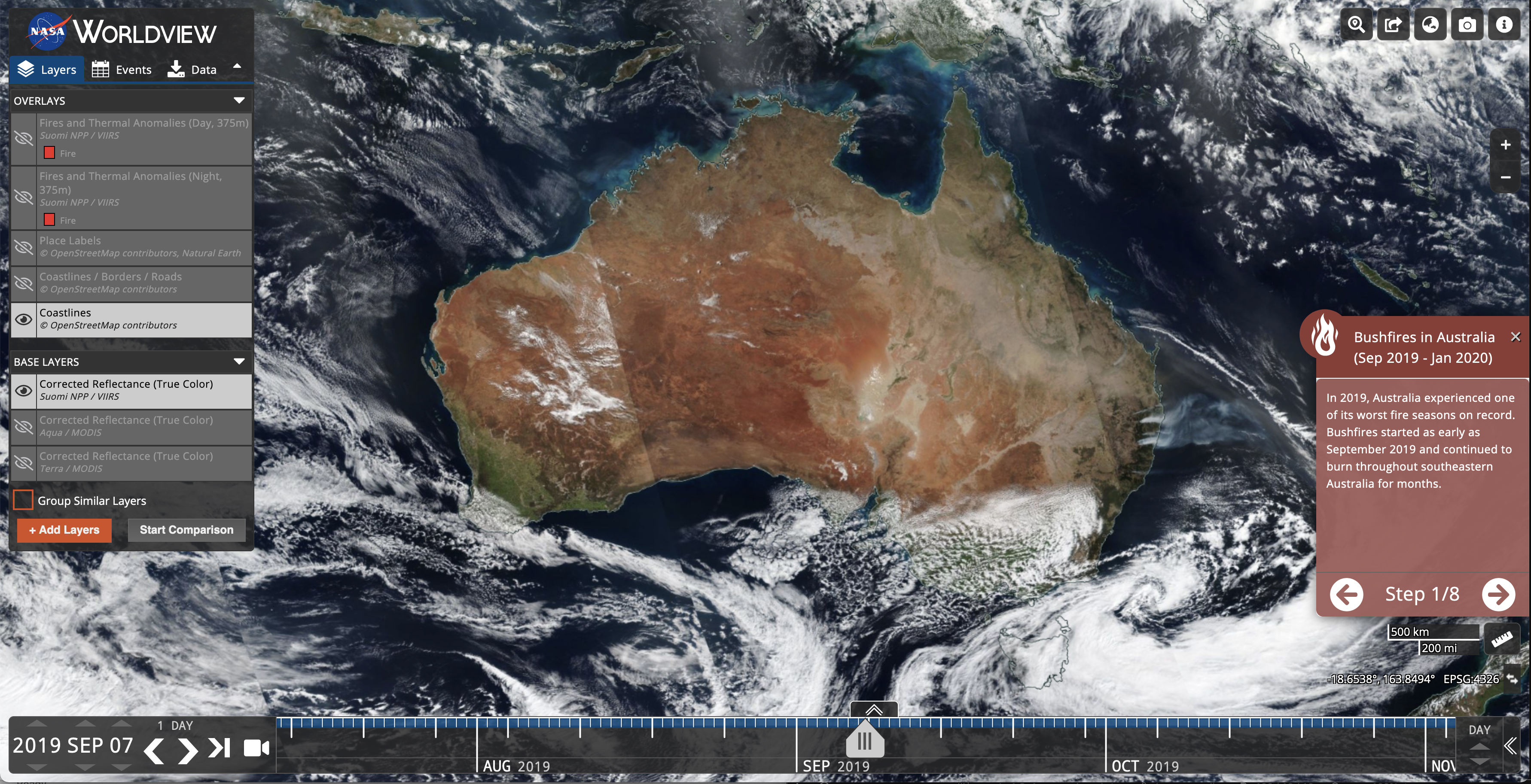
The Worldview tool from NASA's Earth Science Data and Information System (ESDIS) provides the capability to interactively browse over 1,200 global, full-resolution satellite imagery layers and then download the underlying data. Many of the imagery layers are updated daily and are available within three hours of observation - essentially showing the entire Earth as it looks "right now". This supports time-critical application areas such as wildfire management, air quality measurements, and flood monitoring. View current natural hazards and events using the Events tab which reveals a list of natural events, including wildfires, tropical storms, and volcanic eruptions. Animate the imagery over time. Geostationary imagery layers are also now available. These are provided in ten minute increments for the last 90 days. These full disk hemispheric views allow for almost real-time viewing of changes occurring around most of the world. Arctic and Antarctic views of many products are also available for a "full globe" perspective. Worldview is mobile-friendly, embeddable into other sites, and includes storytelling capabilities.
Also available is Worldview Snapshots, a lightweight tool for creating image snapshots from a selection of popular NASA satellite imagery layers. Users can preview and download imagery in different band combinations and add overlays on the imagery of active fire detections, coastlines, borders, and roads. Worldview Snapshots is ideal for users with low/limited bandwidth access or for users who want to rapidly retrieve georeferenced satellite imagery of the same area each day.
Taken together, these tools and services dramatically lower the barriers to using NASA’s Earth observations across a wide range of use cases. Their open source code has also been reused and customized by others inside and outside of NASA to support a variety of needs.
Goals
The vision for ESDIS visualization efforts is to provide visual access to all of NASA's Earth observations, with the caveat that not all observations are practical to be visualized.
The mission of these efforts is to make ESDIS’ rich archive of Earth observations more understandable and usable by:
- Facilitating visual discovery of scientific phenomena (science)
- Supporting timely decision making for natural hazards (applications)
- Educating the next generation of scientists and making imagery of our planet more accessible to the media and public (education and outreach)
Resources
- View weekly images showcasing data and visualizations available in Worldview in the weekly image archive
- Article: Data Tool in Focus: NASA Worldview (March 2024)
- Tutorial: Getting Started with NASA Worldview (December 2021)
- Webinar: NASA Worldview - Explore the Earth from Past to Present with Global Satellite Observations (May 2021)
- Animated GIF Tutorial: View and Share your Planet with Worldview (April 2020) Tutorial en español
- Brochure: How to Use Worldview (November 2019)
- MODIS Video: NASA's Worldview: Two decades of Earth Data at your Fingertips (June 2018)
Powered by GIBS
Worldview uses NASA's Global Imagery Browse Services (GIBS) to rapidly retrieve its imagery for an interactive browsing experience. While Worldview uses OpenLayers as its mapping library, GIBS imagery can also be accessed from Cesium, ArcGIS, GDAL, several other clients. We encourage interested developers to build their own clients or integrate NASA imagery into their existing ones using these services.
Comments/suggestions/problem reports are welcome via Earthdata Support. View frequently asked questions (FAQ) about Worldview.
To receive notifications from GIBS and Worldview about updates, announcements, data issues and scheduled maintenance, subscribe to the GIBS mailing list by sending an email to eosdis-gibs-announce-join@lists.nasa.gov (no subject or text in the body is needed).
