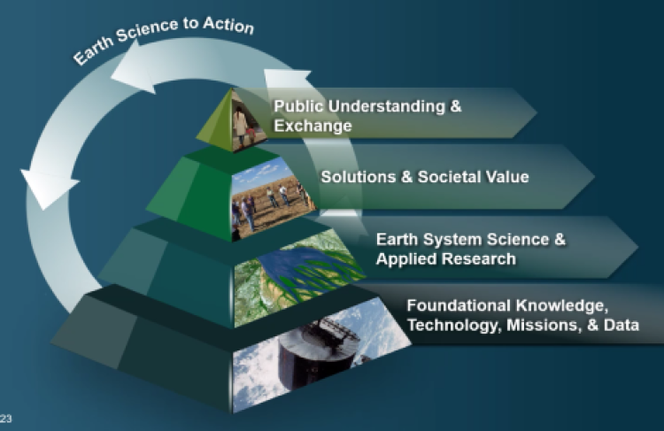
ESDS achieves its vision of making NASA’s free and open Earth science data interactive, interoperable, and accessible for research and societal benefit today and tomorrow through various components.

Data System Evolution Program | Earth Observing System Data and Information System
Earth Science Data System Working Groups | Commercial SmallSat Data Acquisition Program | Standards and Interoperability Coordination and Development | Understanding Needs to Broaden Outside Use of NASA Data

Data System Evolution and Competitive Programs

The Data System Evolution (DSE) element of ESDS funds various research opportunities, as well as interagency initiatives and promotion of data and service interoperability through development and implementation of standards. DSE is composed of three competitive components: Advancing Collaborative Connections for Earth System Science (ACCESS), Citizen Science for Earth Systems Program (CSESP) and Making Earth System Data Records for Use in Research Environments (MEaSUREs). DSE also supports the Interagency Implementation and Advanced Concepts Team (IMPACT) activity, and the development of long-term data records needed by NASA scientists.

  • Competitive Programs
  • Earth Science Data Systems Geographic Information Systems Team (EGIST)
    EGIST serves as the subject matter expert for geographical information systems (GIS) to ESDS program components, provides guidance, evaluates GIS technology and engages the community in developing program-wide strategy.
  • Interagency Implementation and Advanced Concepts Team (IMPACT)
    IMPACT builds partnerships with other Federal agencies, the applications community, decision makers, non-governmental organizations, and other organizations to encourage the adoption of NASA Earth observation data into their workflows and operational models.
  • Multi-Mission Algorithm and Analysis Platform (MAAP)
    MAAP is jointly developed by NASA and ESA in order to establish a collaboration framework to share data, science algorithms, and compute resources for the purpose of fostering and accelerating scientific research. IMPACT is leading the data curation effort and the data systems component development for this project.
  • Science Tools and Portals
    Science portals comprehensively address and communicate information about a specific scientific topic in collaboration with research and analysis programs. The Sea Level Change portal provides access to data, analysis tools, and simulations of glaciers, ice sheets, sea level, and the solid Earth.

Earth Observing System Data and Information System (EOSDIS)

EOSDIS ingests, processes, archives, and distributes data from NASA’s fleet of Earth-observing satellites and provides end-to-end capabilities for managing NASA’s Earth science data from diverse sources including satellites, aircraft, field measurements, and various other programs.

EOSDIS is managed by the Earth Science Data and Information System (ESDIS) Project and includes the following activities and products:

  • Science Investigator-led Processing Systems (SIPS)
    Most of the Earth Observing System (EOS) standard products are produced at facilities under the direct control of the instrument Principal Investigators/Team Leaders (PIs/TLs) or their designees.
  • Distributed Active Archive Centers (DAACs)
    EOSDIS is designed as a distributed system. The DAACs, located throughout the United States, process, archive, document, and distribute data from NASA's past and current Earth-observing satellites and field measurement programs.
  • Core System Components
    EOSDIS core components support users across all DAACs, and include the Common Metadata Repository, Global Imagery Browse Services, Worldview, metrics and Earthdata Login.
  • Land, Atmosphere Near real-time Capability for Earth Observations (LANCE)
    LANCE provides access to near real-time products from the Atmospheric Infrared Sounder (AIRS), Advanced Microwave Scanning Radiometer 2 (AMSR2), Lightning Imaging Sensor (LIS) on the International Space Station (LIS ISS), Multi-angle Imaging SpectroRadiometer (MISR), Microwave Limb Sounder (MLS), Moderate Resolution Imaging Spectroradiometer (MODIS), Measurement of Pollution in the Troposphere (MOPITT), Ozone Monitoring Instrument (OMI), Ozone Mapping Profiler Suite (OMPS) and Visible Infrared Imaging Radiometer Suite (VIIRS, including VIIRS Land and VIIRS Atmosphere) instruments. Products are available within 3 hours from observation.

Earth Science Data System Working Groups (ESDSWG)

ESDSWG focuses on the exploration and development of recommendations derived from pertinent community insights of NASA's heterogeneous and distributed Earth science data systems.

Commercial SmallSat Data Acquisition (CSDA) Program

In December 2017, NASA’s Earth Science Division (ESD) launched the Commercial SmallSat Data Acquisition (CSDA) program, formerly known as the Private-Sector Small Constellation Satellite Data Product Pilot Project. Project objectives are identification, evaluation, and acquisition of remote sensing imagery and data that supports NASA’s Earth science research and application activities. In December 2018, the Pilot Project was established to evaluate the usefulness of imagery and data provided by three private sector vendors currently operating satellite constellations in low earth orbit.

Standards and Interoperability Coordination and Development

NASA's ESDIS Standards Coordination Office (ESCO) assists in formulating standards policy, coordinates standards activities within ESDIS, and provides technical expertise and assistance with standards related tasks within NASA's ESDSWG.

ESCO conducts reviews of proposed standards, practices, and technical information relevant to the ESDIS Project mission. Documents are reviewed as part of the ESDIS standards process. Approved documents are published and listed on the Standards and Requirements page, along with related technical information and useful ESDS references. ESCO also leads the ESCO Standards Interest Group (SIG) to facilitate discussion about data systems standards, conventions, and best practices relevant to NASA's EOSDIS.

Understanding Needs to Broaden Outside Use of NASA Data (UNBOUND)

NASA data are a comprehensive and accurate resource for addressing many vital global issues, but these data often aren’t used to their full potential. UNBOUND matches target data users outside the NASA research community with NASA data scientists and other experts to identify barriers to data use. Once identified, solutions to these barriers are implemented to help these outside user communities put NASA Earth science data at the forefront of their policy decisions and dramatically broaden the use of these data.

Last Updated