Earth Observation Data Basics

The life cycle of Earth observation data is rich and complex, with many points of entry along the pipeline. From collection to visualization, we dive deep into the basics to demystify the incredible data in our catalog.

Remote Sensing

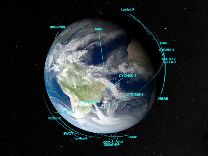
Remote sensing is the acquiring of information from a distance. NASA observes Earth and other planetary bodies via remote instruments on space-based platforms (e.g., satellites or spacecraft) and on aircraft that detect and record reflected or emitted energy. Remote instruments, which provide a global perspective and a wealth of data about Earth systems, enable data-informed decision making based on the current and future state of our planet.

For more information, check out the Fundamentals of Remote Sensing training from the Applied Remote Sensing Training (ARSET) program.

Get Data

Explore the world’s largest repository of open-access Earth science data.

Remote Sensing Data Basics

Understanding Metadata

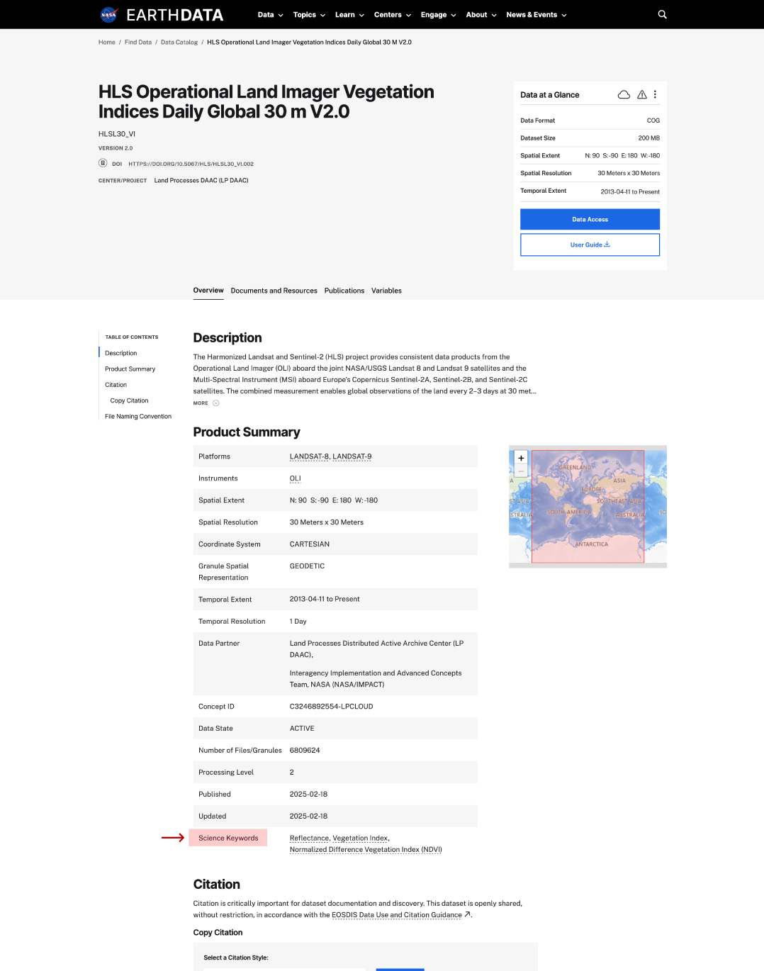
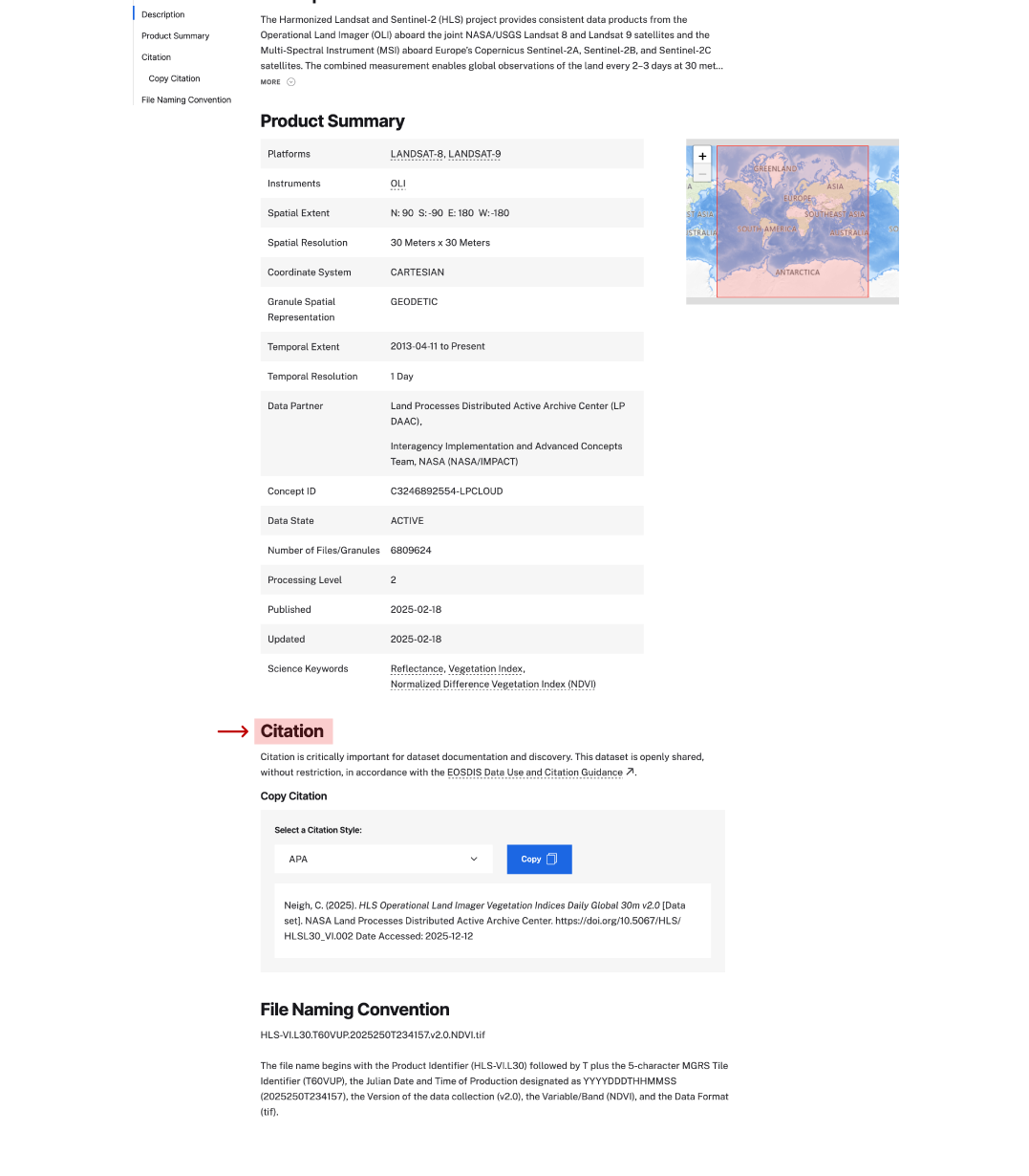
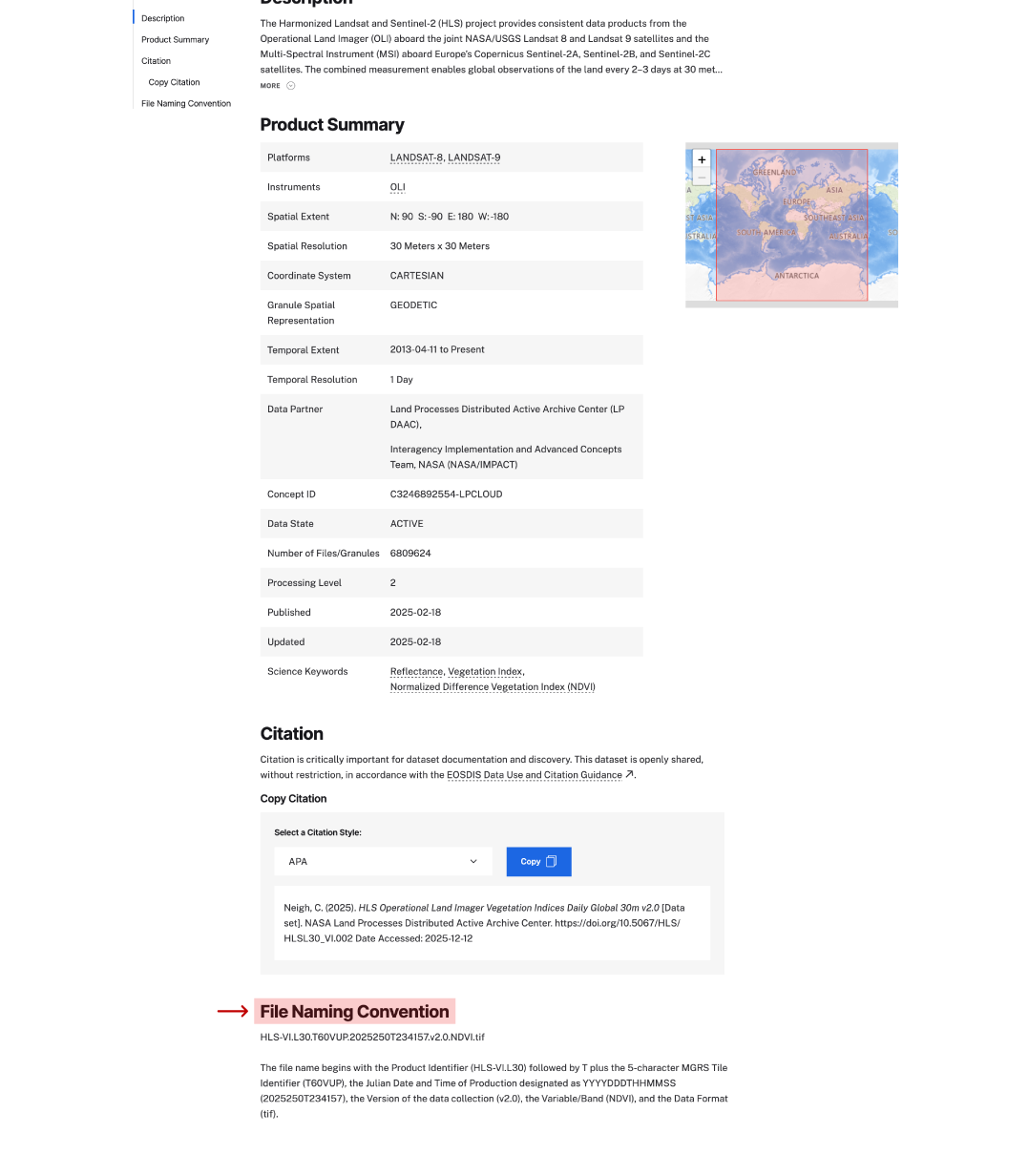
This interactive tool helps users navigate and understand essential metadata on our Earth science dataset landing pages. Through guided examples and hands-on exploration, learn critical context about our data to aid you in your own scientific discoveries.
Interactive

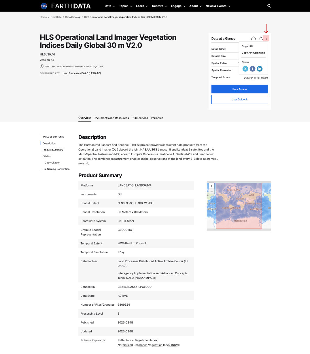
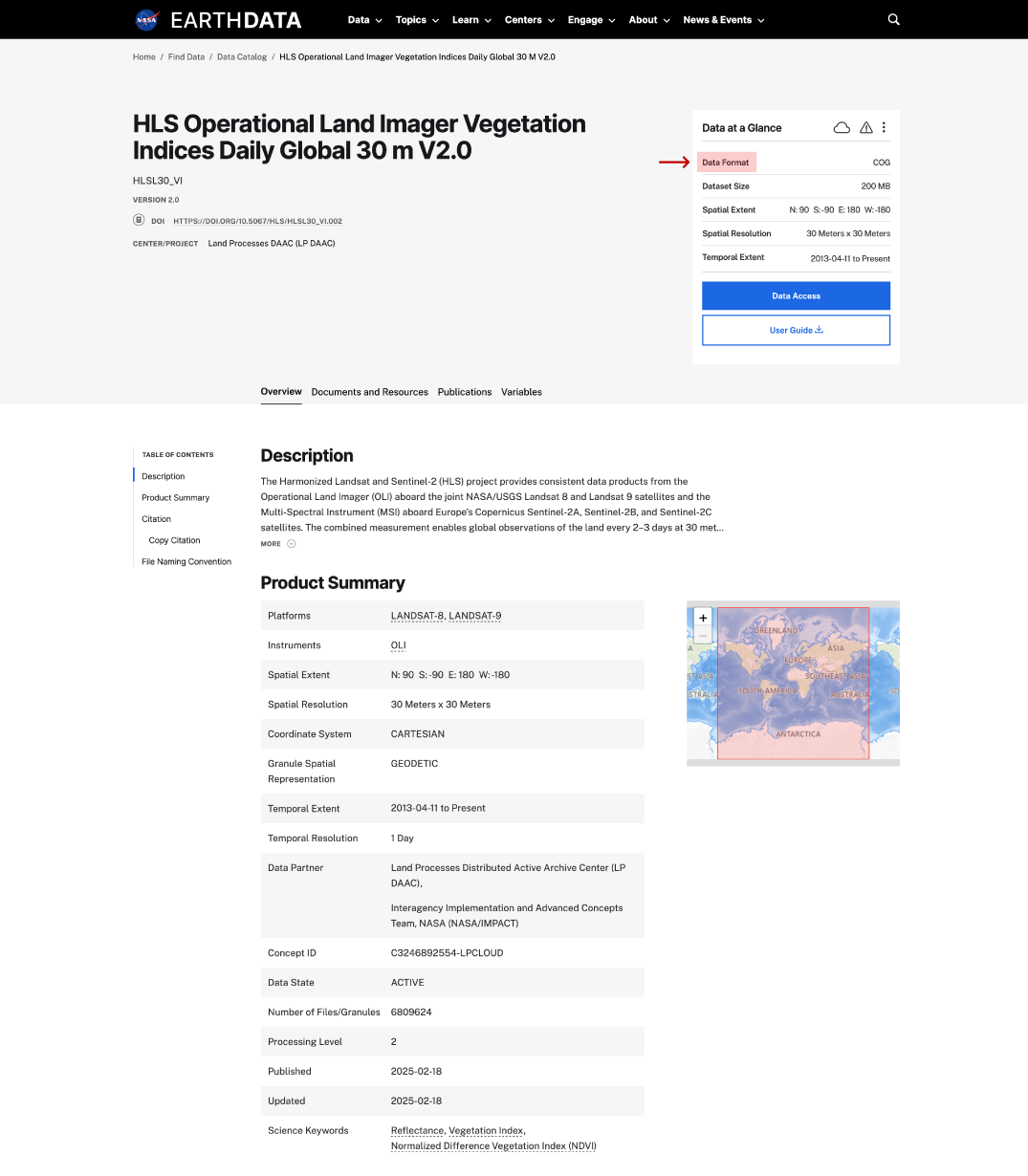
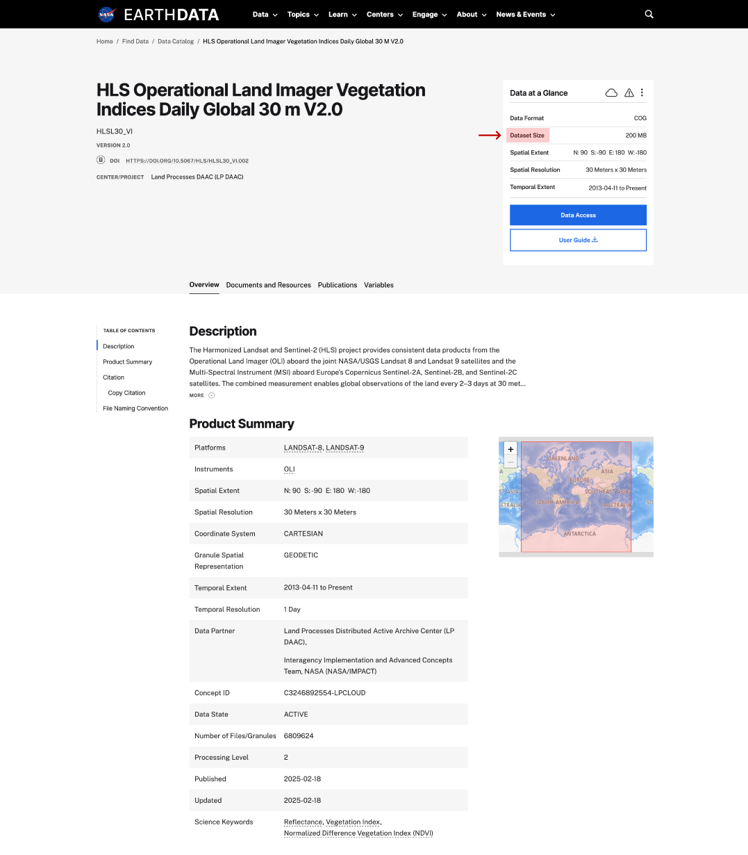
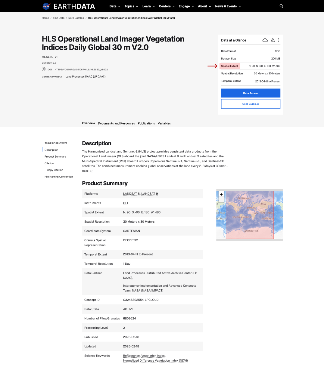
Parts of the Earthdata Dataset Landing Page

Explore
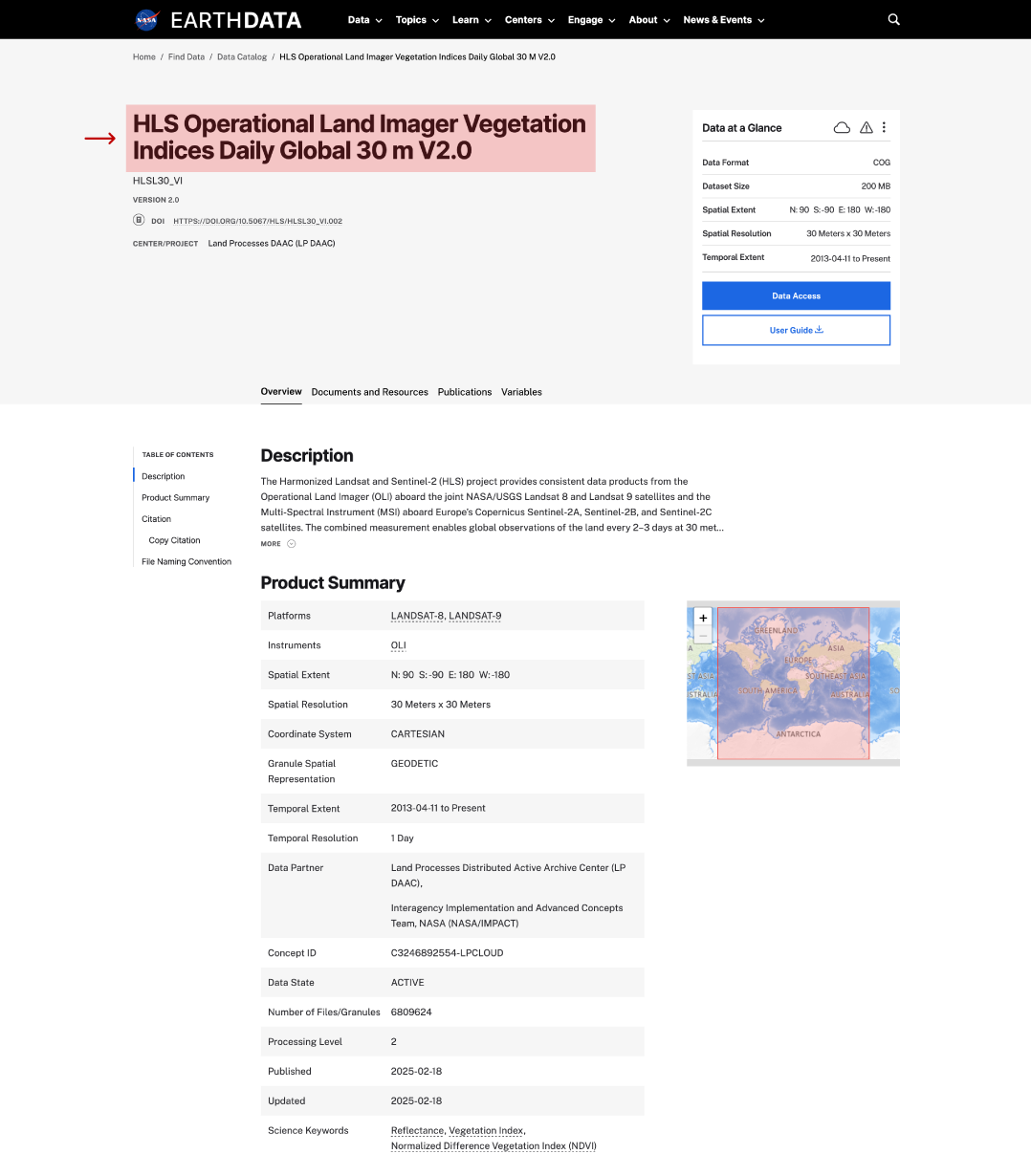
long name on dataset page
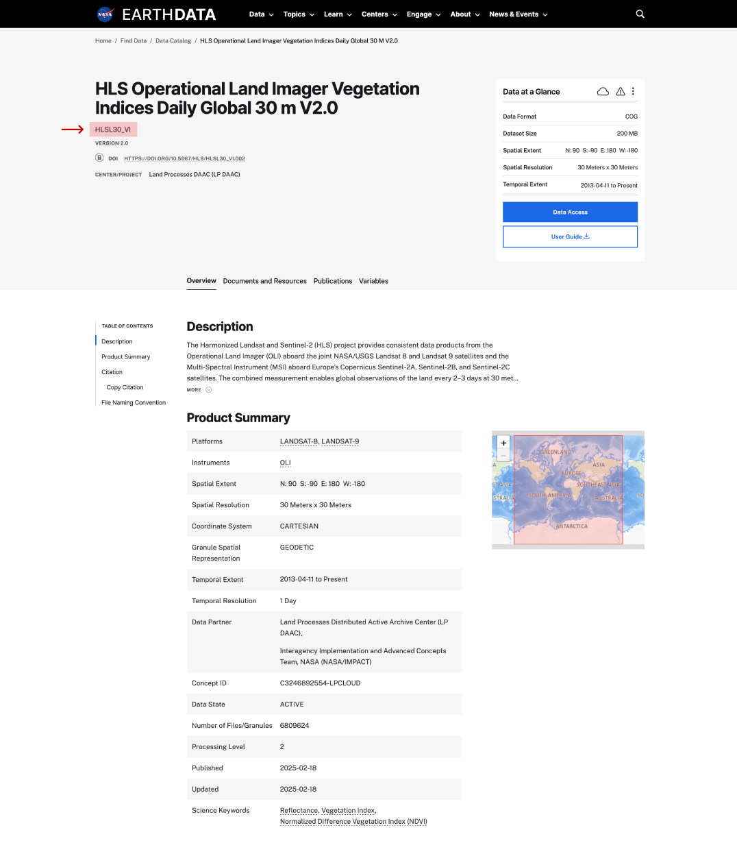
short name on dataset page
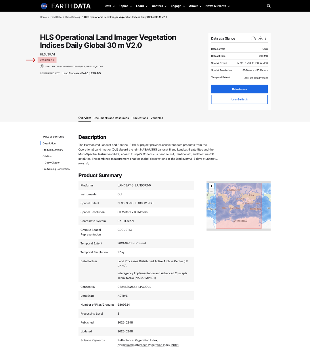
version on dataset page
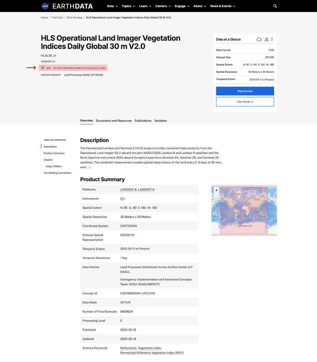
DOI on dataset page
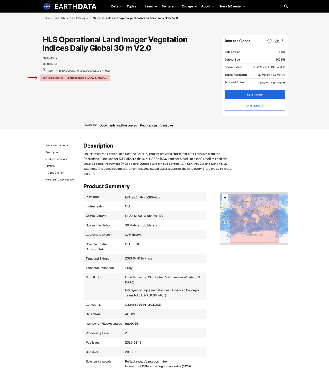
center/project on dataset page
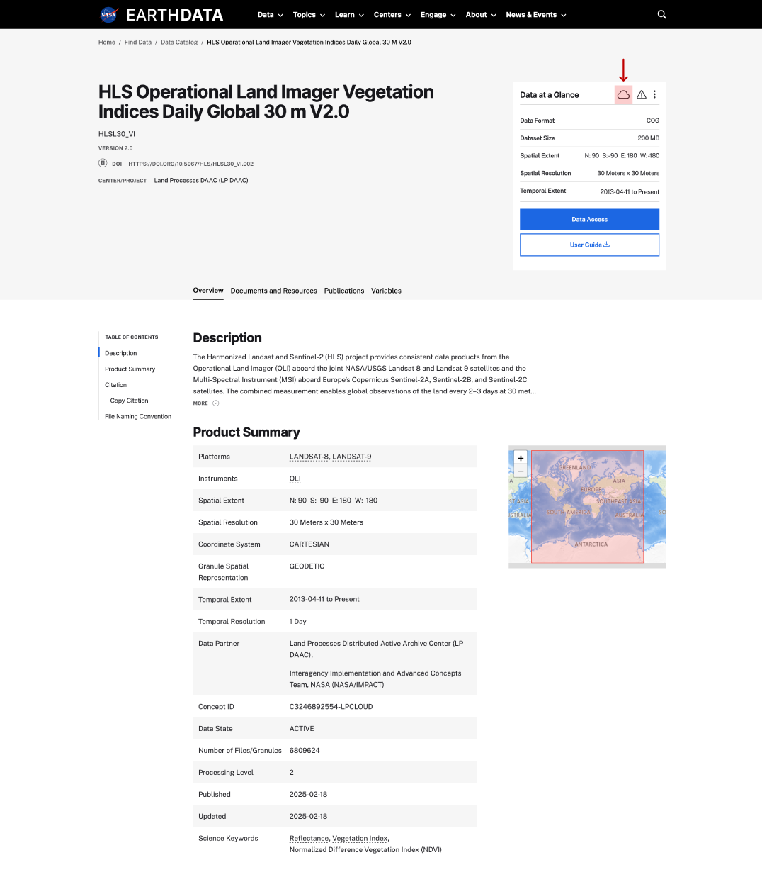
cloud icon on dataset page
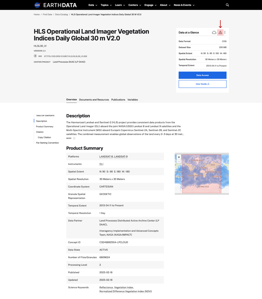
This is a screenshot of a dataset landing page showing the location of the alert icon.
copy URL/API on dataset page
data format on dataset page
dataset size on dataset page
spatial extent on dataset page
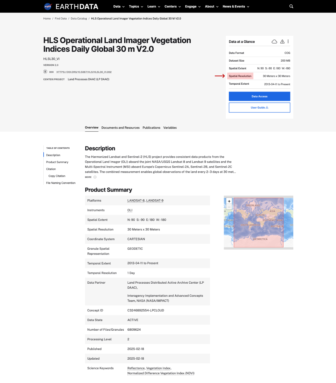
spatial resolution on dataset page
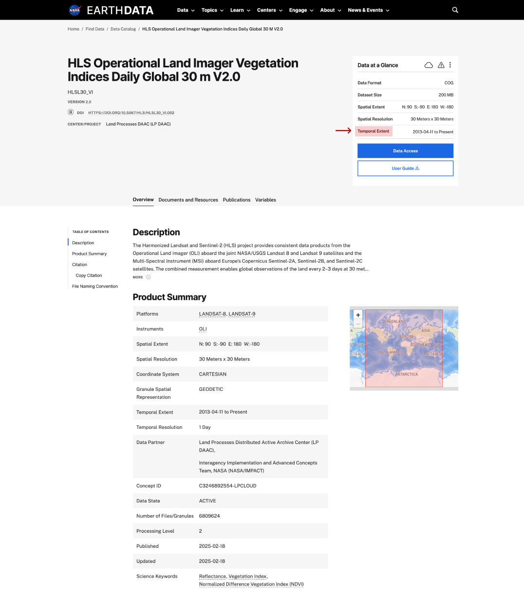
temporal extent on dataset page
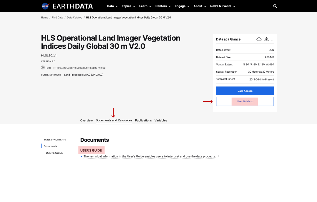
user guide on dataset page
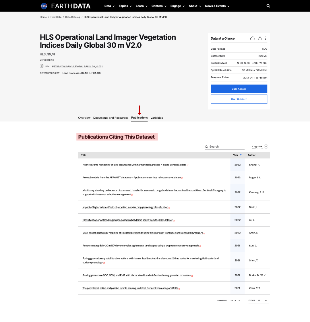
publications on dataset page
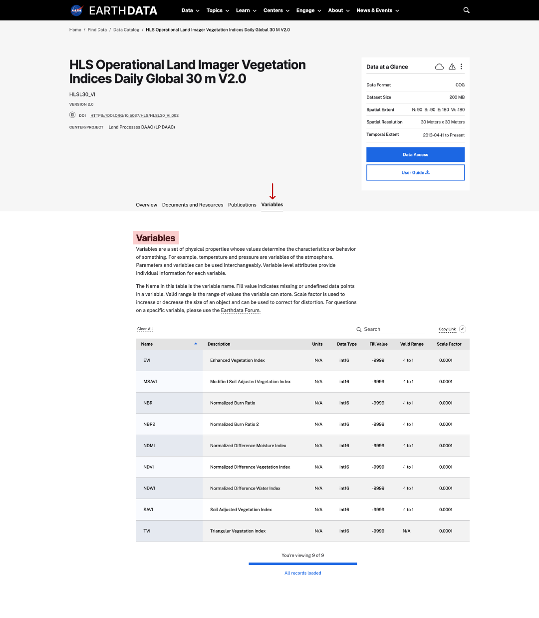
variables on dataset page
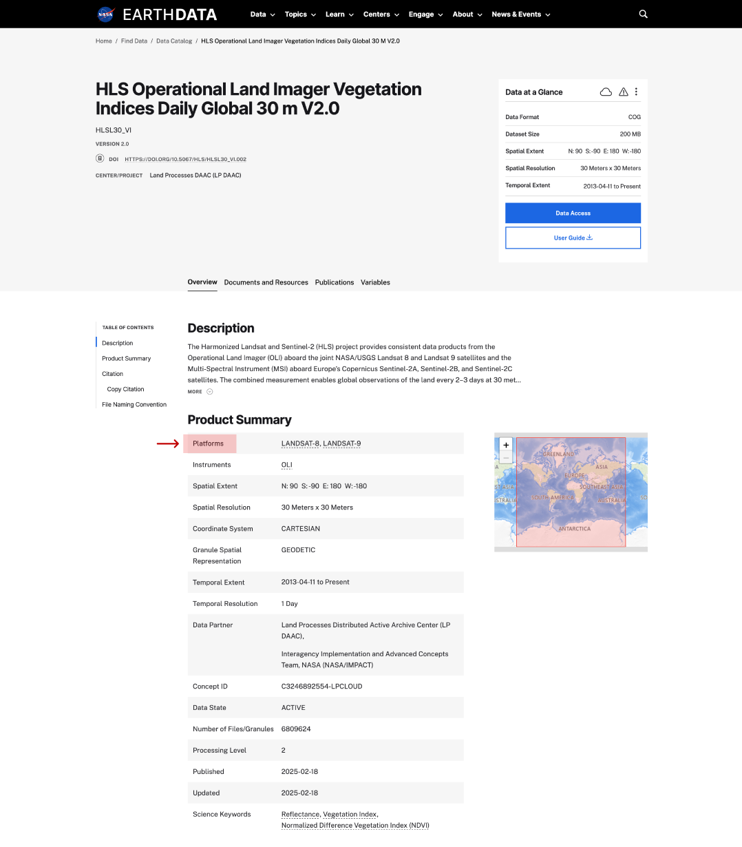
platforms on dataset page
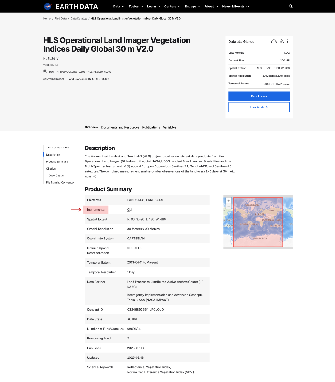
instruments on dataset page
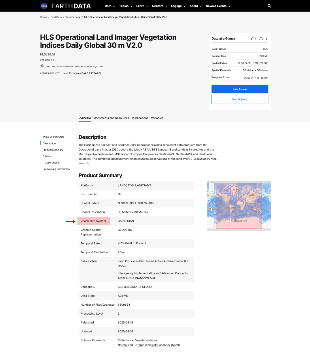
coordinate system on dataset page
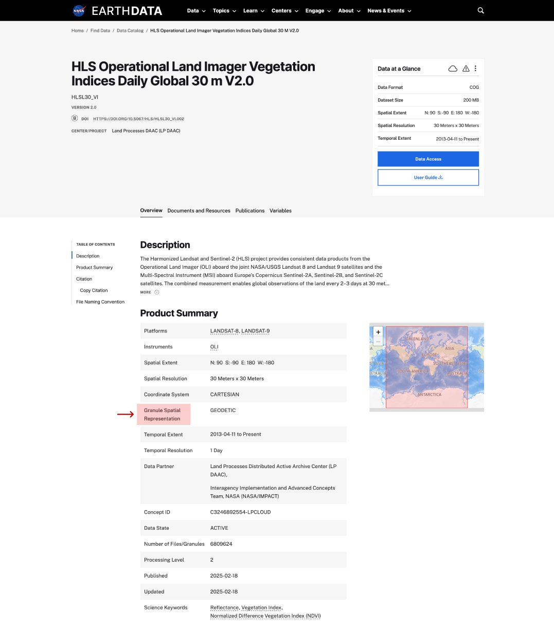
granule spatial representation on dataset page
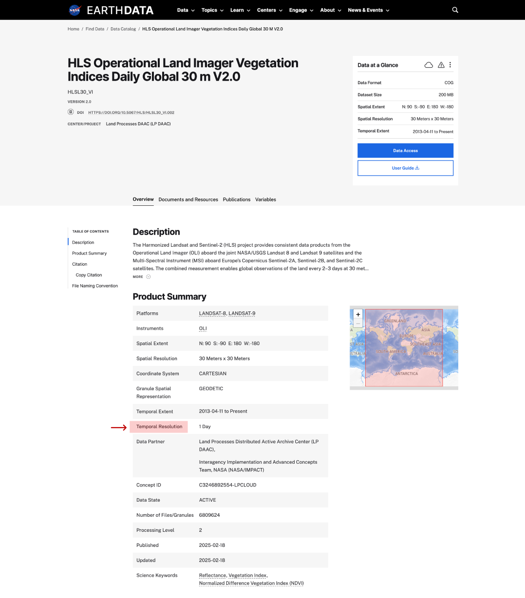
temporal resolution in dataset page
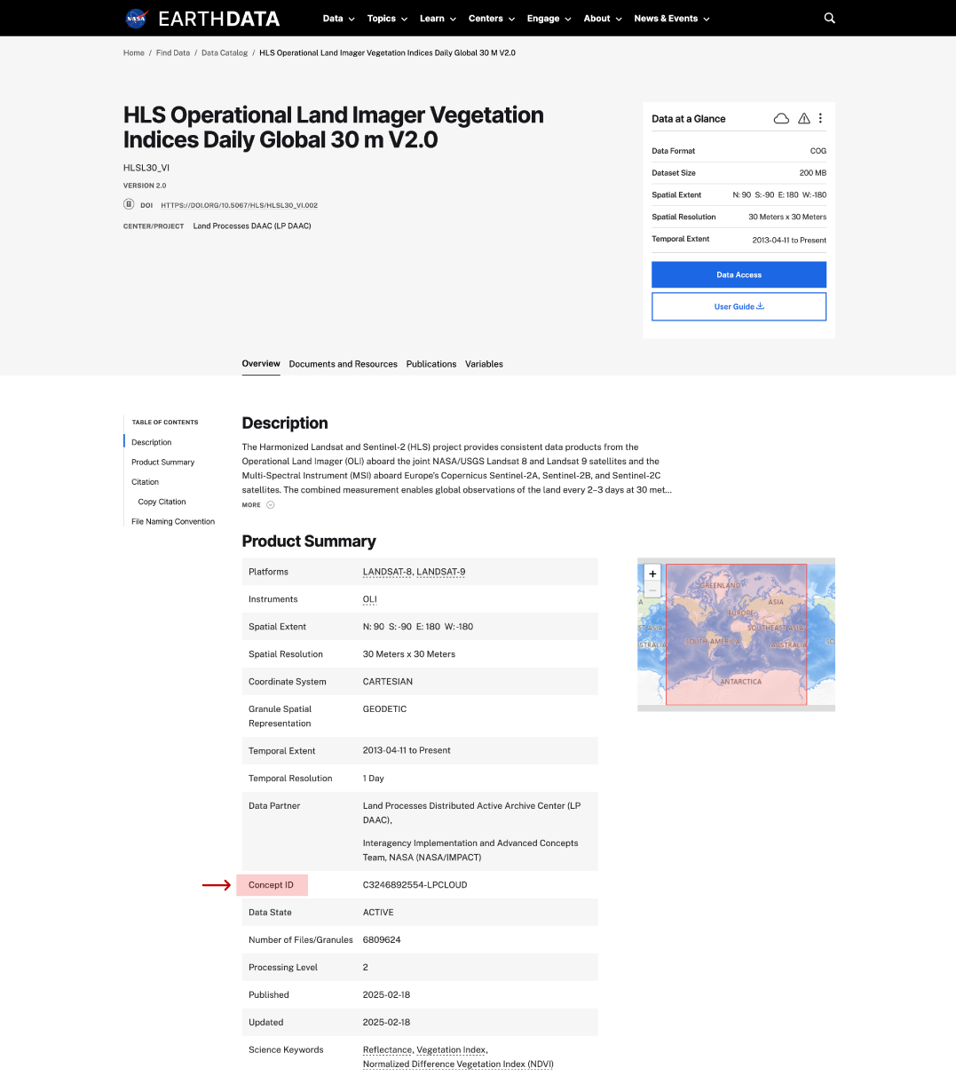
concept ID on dataset page
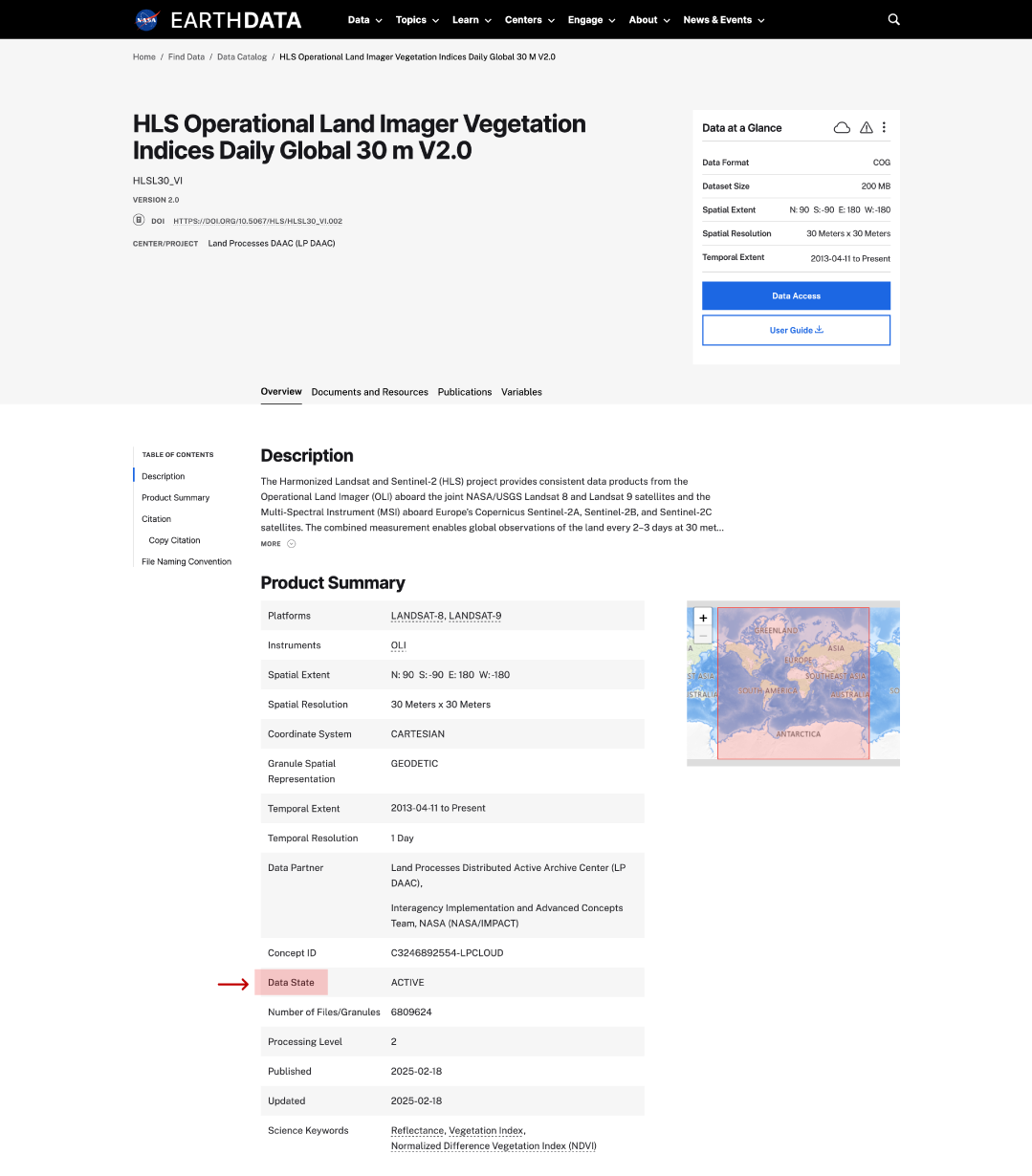
data state on dataset page
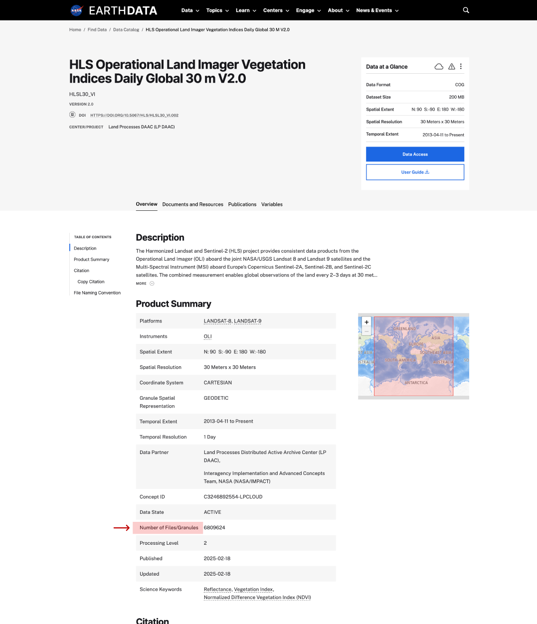
Number of files or granules
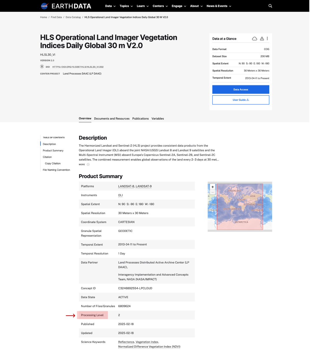
data processing level on dataset ppage
science keywords on dataset page
citation on dataset page
file naming convention on dataset page

Technology

Innovations in artificial intelligence, climate models, and cloud computing are improving the ways users work with Earth science data, especially massive datasets like those expected from NISAR. NASA leverages modern computing approaches to optimize the quality of data collected and the speed at which users are able to drill down to the details they need to support on-the-ground science.

Image

Cloud Computing

Nearly all of NASA’s Earth science data is accessible through Earthdata Cloud, making access, analysis, and visualization more efficient and cost effective. We offer resources including Python libraries, tutorials, and data recipes to help users optimize working with data in the cloud.

Image

Earth Observation Data and Artificial Intelligence

The application of artificial intelligence (AI) to Earth science data makes it possible to search through large amounts of data to find relationships.

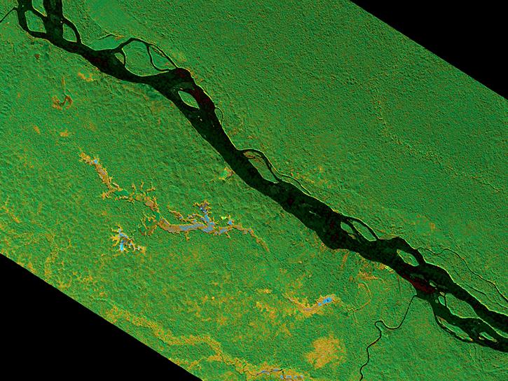
Synthetic Aperture Radar

Glossary of Terms

Reference the Earth Observation Data Basics Glossary to better understand terms related to the data provided by our program.
All
A B C D E F G H I J K L M N O P Q R S T U V W X Y Z
Acquisition Strategy Meeting (ASM)

An ASM is a forum where senior Agency management reviews major acquisitions in programs and projects before authorizing significant budget expenditures. The ASM is held at the Mission Directorate/Mission Support Office level, implementing the decisions that flow out of the earlier Agency acquisition strategy planning. The ASM is typically held early in Formulation, but the timing is determined by the Mission Directorate. The ASM focuses on considerations such as impacting the Agency workforce, maintaining core capabilities and make-or-buy planning, and supporting Center assignments and potential partners.

Aerosol Angstrom Exponent

The aerosol angstrom exponent is an exponent that expresses the spectral dependence of aerosol optical thickness (τ) with the wavelength of incident light (λ). The spectral dependence of aerosol optical thickness can be approximated (depending on size distribution) by, τa = β λα where α is Angstrom exponent (β = aerosol optical thickness at 1 μm).

Angstrom exponent (computed from τ measurements on two different wavelengths) can be used to find τ on another wavelength using the relation.

The Angstrom exponent provides additional information on the particle size (larger the exponent, the smaller the particle size), aerosol phase function and the relative magnitude of aerosol radiances at different wavelengths.

Aerosol Back Scattering Ratio

Also known as: back scatter. 

The aerosol back scattering ratio is a measure of scattering in a backward direction ( i.e. towards the incident direction, at a scattering angle of 180°, sometimes also applied to scattering at an angle larger than 90°) for light encountering atmospheric aerosol particles. 

Aerosol Effective Radius

Also known as: aerosol particle size.

Aerosol effective radius is an area weighted mean radius of aerosol particles.

To characterize the size of atmospheric particles, aerosols are usually divided into three modes: the Aitken mode (diameter less than 0.5 μm), the accumulation mode (0.5 to 2.5 μm), and the coarse mode (greater than 2.5 μm). The Aitken and accumulation modes are collectively referred to as fine particles. Human produced emissions (e.g biomass burning in southern Africa and South America and Industrial pollutions) are examples of small mode aerosols. Example of the coarse mode particles are the large Africa's Sahara Desert dust particles that cross Atlantic ocean and reach America

In air pollution studies PM-2.5 aerosols are referred to particulate matter smaller than 2.5 μm that is suspended in the air. In general, submicron aerosols (particles smaller than 1 micron in diameter) affect human health by penetrating to the deepest part of human lungs.

Aerosol Extinction Profiles

Also known as: extinction coefficient definition.

Aerosol extinction profiles are a measure of attenuation of the light passing through the atmosphere due to the scattering and absorption by aerosol particles. Extinction coefficient is the fractional depletion of radiance per unit path length (also called attenuation especially in reference to radar frequencies). It has units of km-1. The integrated extinction coefficient over a vertical column of unit cross section is called aerosol optical depth or optical thickness.

Aerosol Index

Also known as: UV aerosol index, aerosol absorbing index, or aerosol absorbing indicator.

The aerosol index is an index that indicates the presence of uv-absorbing aerosols such as dust and soot.

UV aerosol index (AI) is based on a spectral contrast method in a UV region where the ozone absorption is very small. It is the difference between the observations and model calculations of absorbing and non absorbing spectral radiance ratios. For TOMS & OMI, AI is defined as

AI = 100 * [ log10 (I360/I331)measured - log10 (I360/I331)calculated]

Positive values of the aerosol index generally represent absorbing aerosols (dust and smoke) while small or negative values represent non-absorbing aerosols and clouds. The index can be interpreted in terms of optical depth if the index of refraction, particle size distribution, and the height of the aerosol layer are known from other measurements.

GOME (ERS-2) defines a similar index called the absorbing aerosols indicator (AAI). Following TOMS AI definition GOME AI also uses two wavelength intervals around 340 nm and 380 nm.

However, POLDER on ADEOS-1 & 2 define aerosol index (for small size particles) as the product of the retrieved aerosol optical thickness and Angstrom exponent.

UV Aerosol Index Data Pathfinder

Aerosol Mass Concentration

Also known as: aerosol concentration, aerosol density.

Aerosol mass concentration is a measure of aerosol density.

The columnar aerosol mass concentration (μgm/cm2 ) is the total aerosol mass in a vertical column of atmosphere.

Aerosol Optical Thickness

Also known as: aerosol optical depth, τ, tau

Aerosol optical thickness is the degree to which aerosols prevent the transmission of light by absorption or scattering of light. The aerosol optical depth or optical thickness (τ) is defined as the integrated extinction coefficient over a vertical column of unit cross section. Extinction coefficient is the fractional depletion of radiance per unit path length (also called attenuation especially in reference to radar frequencies). The optical thickness along the vertical direction is also called normal optical thickness (compared to optical thickness along slant path length).

Aerosol Optical Depth/Thickness Data Pathfinder

Aerosol Radiance

Also known as: scattering contribution, Mie contribution, aerosol contribution, atmospheric radiance

Aerosol radiance is the radiance contribution due to aerosol scattering to the observed Earth-atmosphere radiances (as measured by satellite). The satellite viewing a surface (e.g ocean) receives radiance contributions from different sources. These include contribution due to Rayleigh scattering, aerosol scattering (Mie scattering), solar glint, sea foam/whitecap and surface/water leaving radiances. Aerosol radiance contributions depend on wavelength and size distribution of aerosol particles.

Aerosol Single Scattering Albedo

Also known as:ω , ωo.

Aerosol single scattering albedo is a measure of the effectiveness of scattering relative to extinction for the light encountering the atmospheric aerosol particles.

In radiative transfer studies, single scattering albedo is the ratio of scattering optical depth to the total optical depth (scattering + extinction) of the atmosphere. It is a dimensionless quantity and ranges from 0 to 1.

Aerosols

 A gaseous suspension of fine solid or liquid particles that can travel vast distances form their original source, affecting air quality and visibility. These particles might serve as nuclei for condensation in the atmosphere. These particles can also absorb and scatter light when sufficiently large, impacting Earth's radiative budget.

Albedo

 The ratio of radiation reflected by a surface compared to the amount it receives.

Clouds are the chief cause of variations in the Earth's albedo since clouds have highly varying albedo, dependent upon thickness and composition. Old snow is about 55% (0.55), new snow around 80% (0.8). water surfaces vary from very low about 5% (0.05) at high sun elevation to at least 70% (0.70) at low sun angles.

Aldehyde

Organic chemical compound derived from the oxidation of primary alcohols, having the common group CHO. Used in manufacturing of dyes, resins, and organic acids.

Algorithm

A formula or set of steps used, sometimes repetitively, to solve a problem. Algorithms implemented as software are delivered to NASA's Science Investigator-led Processing System (SIPS) or to NASA's Science Data Processing Segment (SDPS) by a science investigator (principal investigator, team leader, or Interdisciplinary Investigator) to use as primary tools in the generation of science products. The term includes executable code, source code, job control scripts, and documentation.

Algorithm Theoretical Basis Document (ATBD)

An ATBD describes the physical and mathematical description of the algorithms to be used in the generation of data products. It includes a description of variance and uncertainty estimates and considerations of calibration and validation, exception control, and diagnostics. In some cases, internal and external data product flows are required.

Ancillary Data

Data which are not obtained from the sensor itself (usually provided in the science telemetry) and have the primary purpose to serve the processing of instrument data. This can be divided into data referred to as spacecraft ‘engineering’, ‘core housekeeping’ or ‘subsystem’ data obtained from other parts of the platform and includes parameters such as orbit position and velocity, attitude and its range of change, time, temperatures, pressures, jet firings, water dumps, internally produced magnet fields, and other environmental measurements. Ancillary refers to data that exist purely to serve the data processing; auxiliary data, while helping the process, are also data sets in their own right.

Anticyclone

Extensive wind system, of high barometric pressure, that circulates clockwise in the Northern hemisphere and counterclockwise in the Southern hemisphere.

Apogee

 The farthest point of an elliptical orbit. For an Earth-centered orbit, this is the point where the orbiting body is farthest from the center of the Earth.

Application Programming Interface (API)

A system access point or library function that has a well-defined syntax and is accessible from application programs or user code to provide well-defined functionality. Check out the Earthdata Developer Portal for a list of APIs managed by the ESDS Program.
Definition from NIST

Archive

The archive stores data products, guaranteeing their preservation for future use. This function includes all operations to identify, store and retrieve the data and ensure their integrity.

Archiving, Distribution and User Services Requirements Document

(ADURD) A document which provides generic requirements for data archiving, data distribution and user services for EOSDIS-supported data.

Attitude

Orientation of a satellite relative to its direction of movement.

Attitude Data

Data that represent spacecraft orientation and onboard pointing information. Attitude data includes: attitude sensor data used to determine the pointing of the spacecraft axes, calibration and alignment data, Euler angles or quaternions, rates and biases, and associated parameters. Attitude generated onboard in quaternion or Euler angle form. Refined and routine production data related to the accuracy or knowledge of the attitude.


Attribute

An element of metadata, e.g., title, summary, format, dataset language.

Big Data

Big data is a broad term for data sets so large or complex that traditional data processing applications are inadequate. Challenges include analysis, capture, data curation, search, sharing, storage, transfer, visualization, querying and information privacy. 

Bromine Monoxide

Bromine monoxide (BrO) plays an important role in the chemistry of the atmosphere because of its very high efficiency as a catalyst of the ozone destruction.

BrO enters the atmosphere as a result of both natural and anthropogenic activities. In the atmosphere BrO is produced from the destruction of methyl bromide (both natural and anthropogenic in origin). The chemical reaction involving BrO and chlorine dioxide (OClO) result in the depletion of ozone in the stratosphere.

Browse Data

1. Subsets of data set other than the directory and metadata that facilitates user selection of specific data having the required characteristics. For example, for image data, browse data could be a single channel of multi-channel data, and with degraded resolution. The form of browse data is generally unique for each type of data set and depends on the nature of the data and the criteria used for data selection within the related science discipline.

2. Data produced primarily to provide other investigators with an understanding of the type and quality of data available. Typically, browse data sets are limited in size or resolution. The specific form of browse data depends on the type of instrument or discipline with which the browse data is related. Browse data is sometimes considered to be a sample of available data.

3. Browse data facilitates access to real-time or priority playback data which receive minimal processing and are forwarded to the user for his review/use. The user may provide additional processing to suit his requirements.

Browse Image

Visual representation of a product (as an image) to help and support product selection in the frame of the user service facility. Synonyms are: Browse, Quick-look, and Preview.

Calibration

The process of quantitatively defining the system responses to known, controlled signal inputs.

Calibration Data

The collection of data required to perform calibration of the instrument science data, instrument engineering data, and the spacecraft or platform engineering data. It includes pre-flight and in-flight calibration measurements, calibration equation coefficients derived from calibration software routines, and ground truth data that is to be used in the data calibration processing routine.

Campaign

An observational study used to acquire targeted observations or samples to support a clearly defined science or research objectives. Also called (or at least related to) what some stakeholders call a Mission, Project, Field Campaign, or Field Investigation. A campaign may be a multi-year program with multiple projects, such as the Arctic-Boreal Vulnerability Experiment (ABoVE), an Earth Ventures Suborbital (EVS) mission, such as Delta-X, or a single project targeting a specific set of measurements, such as the CARbon Atmospheric Flux Experiment (CARAFE).

Definition from Airborne Data and Management Group (ADMG) Catalog of Suborbital Earth Science Investigations (CASEI)

CFC-12

Halocarbon compound used in air conditioning systems as a refrigerant. One of two primary chlorofluorocarbons that photolyze at high altitudes to release chlorine atoms. An important factor in ozone depletion. Also known as dichlorofluoromethane.

Chapman Reactions: stratospheric reactions in which ozone dissociates into molecular oxygen and atomic oxygen, and the resulting free oxygen atoms recombine with ozone to form molecular oxygen. The process was first described by a British physicist named Sydney Chapman in 1930.

Climate and Forecast Metadata Conventions

A set of metadata conventions that were invented for climate and weather forecast data but have since been applied to describe other kinds of Earth Science data, with the intention of promoting the processing and sharing of data.

Clouds

 A visible aggregate of minute water droplets and/or ice crystals in the atmosphere above the Earth's surface.

Collection

See Data Set Series

Collection or aggregate metadata

These are metadata elements that describe an entire set of data products or files. Values of collection metadata apply to all of the products in a specific collection. Collections may represent the same release of any given data product, sets of data generated during an experiment, a campaign or an algorithmic test.

Content Organization Scheme

A means for enhancing the addressing and access of elements contained in a digital object in the cloud.

Coverage Map

 A two dimensional graphical representation of the geographic coverage of selected inventory granules.

Critical Design Reviews (CDR)

CDRs evaluate the integrity of the program integrated design, including its projects and ground systems. CDRs also help meet mission requirements with appropriate margins and acceptable risk within cost and schedule constraints. CDRs also determine if the integrated design is appropriately mature to continue with the final design and fabrication phase.

Critical Events Readiness Reviews (CERR)

CERRs evaluate the readiness of the program and its projects to execute a critical event during the flight operations phase of the life cycle.

Data

Scientific or technical measurements, values calculated therefrom, observations, or facts that can be represented by numbers, tables, graphs, models, text, or symbols which are used as a basis for reasoning and further calculation.

For NASA's Earth Science Program and according to NASA's Earth Science Data & Information Policy, the term 'data' includes observation data, metadata, products, information, algorithms, including scientific source code, documentation, models, images, and research results.

Data Assimilation

Data assimilation is defined as the process of combining observations with model simulations to enhance the accuracy of predictions.

Definition from ScienceDirect

Data Collection

A major release of a data product, or of a set of closely related data products, which can be followed by minor releases within the same collection.

See also: Data Set Series on this page.

Data Distributor

An entity responsible for archiving and distributing data products. 

See also: DAAC.

Data Format

A standard way that information is encoded for storage in a computer file (see more about data formats). An example is HDF5.

Data Format Control Documents (DFCD)

Data Format Control Documents (DFCDs), and other data format documents (e.g., Data Format Requirements Documents (DFRDs)), define the formats of data units that are transferred across an interface and the control codes used in the data formats.

Data Management

As defined for an OAIS entity that contains the services and functions for populating, maintaining, and accessing a wide variety of information. Some examples of this information are catalogs and inventories on what may be retrieved from Archival Storage, processing algorithms that may be run on retrieved data, Consumer access statistics, Consumer billing, Event Based Orders, security controls, and OAIS schedules, policies, and procedures.

Data Maturity Levels

Beta
Products intended to enable users to gain familiarity with the parameters and the data formats. 

Provisional
Product was defined to facilitate data exploration and process studies that do not require rigorous validation. These data are partially validated and improvements are continuing; quality may not be optimal since validation and quality assurance are ongoing. 

Validated
Products are high quality data that have been fully validated and quality checked, and that are deemed suitable for systematic studies such as climate change, as well as for shorter term, process studies.

Stage 1 Validation: Product accuracy is estimated using a small number of independent measurements obtained from selected locations and time periods and ground-truth/field program efforts. 

Stage 2 Validation: Product accuracy is estimated over a significant set of locations and time periods by comparison with reference in situ or other suitable reference data.

Stage 3 Validation: Product accuracy has been assessed. Uncertainties in the product and its associated structure are well quantified from comparison with reference in situ or other suitable reference data.

Stage 4 Validation: Validation results for stage 3 are systematically updated when new product versions are released and as the time-series expands.

Data Model

An Earth science metadata model, which supports the data standardization necessary for total system interoperability within a heterogeneous, open systems environment. The Data Model includes diagrams, which graphically illustrate the relationships of classes, the attributes contained within the classes, the characteristics of the relationships between classes, and the attribute specifications.

Data Processing Level

The level of processing that results in data products ranging from raw instrument data to refined analyses that use inputs from various sources. See also: Data Maturity Levels.

Join Our Community of NASA Data Users

While NASA data are openly available without restriction, an Earthdata Login is required to download data and to use some tools with full functionality.

Learn About the Benefits of Earthdata Login

Frequently Asked Questions

Earthdata Forum

Our online forum provides a space for users to browse thousands of FAQs about research needs, data, and data applications. You can also submit new questions for our experts to answer.

Submit Questions to Earthdata Forumand View Expert Responses

Earthdata
Forum