We are in the process of migrating all NASA Earth science data sites into Earthdata from now until end of 2026. Not all NASA Earth science data and resources will appear here until then. Thank you for your patience as we make this transition.
Read about the Web Unification Project
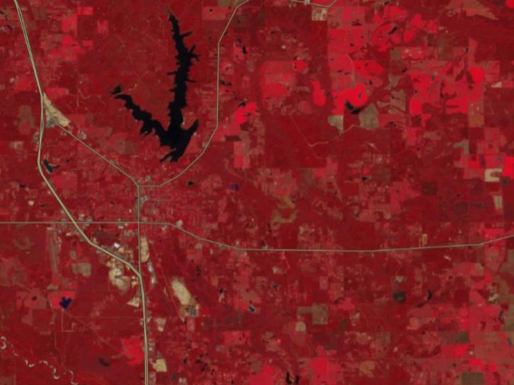
The Fire Information for Resource Management System (FIRMS) enables access to global near real-time satellite imagery, active fire/hotspots, and related products to identify the location, extent, and intensity of wildfire activity. FIRMS tools and applications provide geospatial data, products, and services to support the broader fire management community and to inform the general public. Global data are available within 3 hours of satellite observation; some U.S. and Canada active fire detections are available in real-time.
The Fire Information for Resource Management System (FIRMS) was developed to provide near real-time active fire locations to natural resource managers that faced challenges obtaining timely satellite-derived fire information. In partnership with the U.S. Forest Service, a FIRMS US/Canada map service was launched in January 2021.
FIRMS was developed in 2007 by the University of Maryland, with funds from NASA’s Applied Sciences Program and the United Nations Food and Agriculture Organization (UN FAO), to provide near real-time active fire locations to natural resource managers that faced challenges obtaining timely satellite-derived fire information.
A version of FIRMS, known as the Global Fire Information Management System (GFIMS) ran at the UN FAO from 2010–2012, where it complemented the FAO’s existing suite of projects that deliver near real-time information to ongoing monitoring and emergency projects, to other UN organizations as well as providing information to the general public. GFIMS is no longer actively supported.
FIRMS US/Canada
FIRMS US/Canada provides the USDA Forest Service, partner agencies, and the general public access to tools and data to visualize and monitor the location, extent, intensity, and impacts of wildfire activity in the U.S. and Canada. The source of low latency satellite imagery, science data products, and enabling technologies to FIRMS US/Canada include: the NASA Land, Atmosphere Near real-time Capability for EO (LANCE) and other partners. Data from the Moderate Resolution Imaging Spectroradiometer (MODIS) and the Visible Infrared Imaging Radiometer Suite (VIIRS) are the foundational satellite data sources of the current FIRMS US/Canada application. Additional geospatial data and information from various agencies are also integrated to provide context for current/recent wildfire activity. Sources for these additional data include the National Interagency Fire Center, Department of the Interior Office of Wildland Fire, National Oceanic and Atmospheric Administration, National Weather Service, Canadian Interagency Fire Centre, and Natural Resources Canada
FIRMS US/Canada builds on a longstanding partnership between NASA and the Forest Service. In 2001, NASA's Goddard Space Flight Center in Greenbelt, Maryland, (GSFC) and the University of Maryland (UMD) developed the MODIS Land Rapid Response System to provide time-critical, science grade data products to the Forest Service and other users. That same year, the Forest Service implemented the Active Fire Mapping (AFM) Program to ingest near real-time data from the, now decommissioned, MODIS Land Rapid Response System to produce and disseminate value-added geospatial fire products. AFM since evolved to leverage and ingest MODIS and VIIRS satellite direct readout data and the NASA LANCE MODIS/VIIRS data stream.
FIRMS US/Canada is a joint NASA/Forest Service effort to modernize and optimize the legacy AFM Program data and product delivery capabilities that have provided imagery and geospatial fire products for the United States and Canada since 2001. The initial release of FIRMS US/Canada was launched in January 2021 and provides an updated platform for delivery of near real-time satellite data products as well as mapping and visualization capabilities. Data from additional near real-time satellite sources and other technical capabilities are also planned for the FIRMS US/Canada application after the initial early-2021 release.
MODIS Active Fire Products
Each MODIS active fire/thermal hotspot location represents the center of a 1km pixel that is flagged by the algorithm as containing one or more fires within the pixel. Combined (Terra and Aqua) MODIS NRT active fire products (MCD14DL) are processed using the standard MOD14/MYD14 Fire and Thermal Anomalies algorithm.
MODIS Collection 61 has been available since April 2021. C61 processing does not contain any change to the science algorithm; the update is from changes and enhancements to the calibration approach used in the generation of the Terra and Aqua MODIS Level 1B products. For further details on C61 calibration changes and other changes user is encouraged to refer to the PDF summarizing Collection 6.1 specific changes. For the most up to date information, please refer to the MODIS Collection 6 and 6.1 Version 1.0 Active Fire Product User's Guide (updated May 2021).
VIIRS (375m) Active Fire Products
Each VIIRS active fire/thermal hotspot location represents the center of a 375m pixel. The VIIRS data complement the MODIS fire detections but the improved spatial resolution of the 375 m data provides a greater response of fires over relatively small areas and has improved nighttime performance. Read more on VIIRS active fire products.
VIIRS NRT 375 m active fire products are from: Suomi NPP (VNP14IMGTDL_NRT); NOAA-20, formally known as JPSS-1 (VJ114IMGTDL_NRT); and NOAA-21, formally known as JPSS-2 (VJ214IMGTDL_NRT).
Active Fire Data Attributes for MODIS and VIIRS
View data attribute tables for NRT MODIS active fire data and NRT VIIRS 375m active fire data.
NASA supports full and open sharing of data. We ask that if you provide data or imagery from FIRMS to a third party, you follow the guidelines below and replicate or provide a link to our disclaimer. View LANCE FIRMS's citation and acknowledgments as part of the broader Earth Science Data and Information System (ESDIS) Project Data Use Guidance.
Acknowledgments
We acknowledge the use of data and/or imagery from NASA's Fire Information for Resource Management System (FIRMS) part of NASA's Land, Atmosphere Near real-time Capability for Earth observations (LANCE) and NASA's Earth Science Data and Information System (ESDIS).
Disclaimer
LANCE is operated by the ESDIS Project. The information presented through LANCE, GIBS, Worldview, and FIRMS are provided “as is” and users bear all responsibility and liability for their use of data, and for any loss of business or profits, or for any indirect, incidental or consequential damages arising out of any use of, or inability to use, the data, even if NASA or ESDIS were previously advised of the possibility of such damages, or for any other claim by you or any other person. Due to the spatial resolution and other characteristics of these data, their use for tactical decision-making or informing about conditions at a local scale are not advised.
ESDIS makes no representations or warranties of any kind, express or implied, including implied warranties of fitness for a particular purpose or merchantability, or with respect to the accuracy of or the absence or the presence or defects or errors in data, databases of other information. The designations employed in the data do not imply the expression of any opinion whatsoever on the part of ESDIS concerning the legal or development status of any country, territory, city or area or of its authorities, or concerning the delimitation of its frontiers or boundaries. For more information please contact Earthdata Support: earthdata-support@nasa.gov.
User Guides
Visible Infrared Imaging Radiometer Suite (VIIRS) 375 m Active Fire Algorithm User Guide (Updated July 2018)
MODIS Collection 6 Active Fire Product User's Guide, Revision B (Updated December 2018)
MODIS Collection 5 Active Fire Product User’s Guide, v2.5 (Updated 31 March 2013)
FIRMS, Active Fire, and Burned Area Publications
The publications listed below describe FIRMS, the MODIS Active Fire and Burned Area Products, and explore the level of accuracy of the products.
Read about FIRMS in the Earthdata article Fires from Space, and how near real-time MODIS fire detections are used in NASA's Sensing Our Planet publication Orbiting Watchtowers.
Giglio L., Schroeder, W., & Justice, C.O. (2016). The collection 6 MODIS active fire detection algorithm and fire products. Remote Sensing of Environment, 178: 31-41. doi:10.1016/j.rse.2016.02.054 PDF
Schroeder, W., Oliva, P., Giglio, L., & Csiszar, I. A. (2014). The New VIIRS 375m active fire detection data product: algorithm description and initial assessment. Remote Sensing of Environment, 143: 85-96. doi:10.1016/j.rse.2013.12.008 PDF
Justice, C.O., Giglio, L., et al. (2011). MODIS-Derived Global Fire Products. Land Remote Sensing and Global Environmental Change. B. Ramachandran, C.O. Justice, and M.J. Abrams, Springer New York. 11: 661-679. doi:10.1007/978-1-4419-6749-7_29
Davies, D.K., Ilavajhala, S., Wong, M.M., & Justice, C.O. (2009). Fire Information for Resource Management System: Archiving and Distributing MODIS Active Fire Data. IEEE Transactions on Geoscience and Remote Sensing, 47(1): 72-79. doi:10.1109/TGRS.2008.2002076
Schroeder, W., Prins, E., Giglio, L., Csiszar, I., Schimdt, C., Morisette, J., & Morton, D. (2008). Validation of GOES and MODIS active fire detection products using ASTER and ETM+ data. Remote Sensing of Environment, 112 (2008): 2711-2726. doi:10.1016/j.rse.2008.01.005
Csiszar, I., Morisette, J., & Giglio, L. (2006). Validation of active fire detection from moderate resolution satellite sensors: the MODIS example in Northern Eurasia. IEEE Transactions on Geoscience and Remote Sensing, 44(7): 1757-1764. doi:10.1109/TGRS.2006.875941
Giglio, L., van derWerf, G.R., Randerson, J.T., Collatz, G.J., & Kasibhatla, P. (2006). Global estimation of burned area using MODIS active fire observations. Atmospheric Chemistry and Physics, 6: 957-974. doi:10.5194/acp-6-957-2006
Wooster, M.J., Roberts, G., Perry, G.L.W., & Kaufman, Y.J. (2005). Retrieval of biomass combustion rates and totals from fire radiative power observations: FRP derivation and calibration relationships between biomass consumption and fire radiative energy release. Journal of Geophysical Research, 110, D24311. doi:10.1029/2005JD006318
Morisette, J.T., Giglio, L., Csiszar, I., Setzer, A., Schroeder, W., Morton, D., & Justice, C.O. (2005). Validation of MODIS active fire detection products derived from two algorithms. Earth Interactions, 9(9): 1-25. doi: 10.1175/EI141.1
Morisette, J.T., Giglio, L., Csiszar, I., & Justice, C.O. (2005). Validation of the MODIS Active fire product over Southern Africa with ASTER data. International Journal of Remote Sensing, 26: 4239-4264. doi:10.1080/01431160500113526
Wooster, M.J., Zhukov, B., & Oertel, D. (2003). Fire radiative energy for quantitative study of biomass burning: Derivation from the BIRD experimental satellite and comparison to MODIS fire products. Remote Sensing of Environment, 86(1): 83-107. doi:10.1016/S0034-4257(03)00070-1 PDF
Giglio, L., Descloitres, J., Justice, C.O., & Kaufman, Y. (2003). An enhanced contextual fire detection algorithm for MODIS. Remote Sensing of Environment, 87: 273-282. doi: 10.1016/S0034-4257(03)00184-6
Justice, C.O., Giglio, L., Korontzi, S., Owens, J., Morisette, J., Roy, D., Descloitres, J., Alleaume, S., Petitcolin, F., & Kaufman, Y.J. (2002). The MODIS fire products. Remote Sensing of Environment, 83: 244-262. doi:10.1016/S0034-4257(02)00076-7
Kaufman, Y.J., Justice, C.O., Flynn, L.P., Kendall, J.D., Prins, E.M., Giglio, L., Ward, D.E., Menzel, W.P., & Setzer, A.W. (1998). Potential global fire monitoring from EOS‐MODIS.Journal of Geophysical Research: Atmospheres (1984–2012), 103(D24): 32215-32238. doi:10.1029/98jd01644
The following links maybe useful for users wanting to learn more or connect with other fire networks/see other fire applications.
Background/Framework
Global Observations of Forest and Land Cover Dynamics (GOFC-GOLD) Fire Monitoring and Mapping Implementation (GOFC-Fire)
Science
- MODIS Active Fire and Burned Area products
- MODIS Fire and Thermal Anomalies
- VIIRS Fire and Thermal Anomalies
Other regional fire applications may provide users with additional value-added products. These include:
- Comisión nacional para el conocimiento y uso de la biodiversidad (CONABIO)
- Instituto Nacional De Pesquisas Espaciais (INPE), Brazil
- European Forest Fire Information System (EFFIS), Italy
- Digital Earth Australia Hotspots
Tool at a Glance
Data Tool Type
Access
Visualization

NASA's Fire Information for Resource Management System now provides swath outlines, showing the extent of Earth's surface within view of a sensor.
Blog
June 25, 2026

The VIIRS instrument aboard NOAA-20 captured these images of fires near the Yenisei River.
Worldview Image of the Week
June 17, 2026

The TiTiler-CMR service generates dynamic, on-demand map tile layers that can be incorporated into GIS software and visualization applications. Two NASA mapping applications – Worldview and FIRMS – have harnessed the versatility of this service.
Feature Article
April 29, 2026

The Geostationary Ring Natural Color RGB imagery layer is an additional option for users to visualize the progression of wildfires and their effects throughout the day.
Blog
Dec. 11, 2025
SHOWING 4 OF 72
FIRMS Learning Resources

Learn how the Fire Information for Resource Management System (FIRMS) uses timely composite imagery to identify fire fronts, burned areas, and smoke.
Webinar
June 17, 2026
FIRMS has incorporated additional capabilities into the HLS dropdown menu of its interactive map, including four vegetation indices and the ability for user to create their own red, green, blue (RGB) image composites through the TiTiler-CMR service.
Tutorial
April 29, 2026

This ARSET training introduces participants to several capabilities within FIRMS that were not included in the previous ARSET training.
Training
Jan. 14-21, 2026
Esta capacitación de dos partes familarizará a los participantes con varias capacidades dentro de FIRMS que no se incluyeron en la capacitación de ARSET anterior.
Training
Jan. 14-21, 2026
SHOWING 4 OF 28
Join Our Community of NASA Data Users
While NASA data are openly available without restriction, an Earthdata Login is required to download data and to use some tools with full functionality.
Learn About the Benefits of Earthdata LoginFrequently Asked Questions
Earthdata Forum
Our online forum provides a space for users to browse thousands of FAQs about research needs, data, and data applications. You can also submit new questions for our experts to answer.
Submit Questions to Earthdata Forumand View Expert Responses