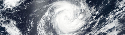
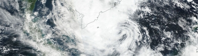
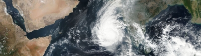
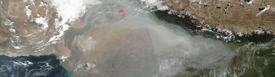
The Visible Infrared Imaging Radiometer Suite (VIIRS) is aboard the joint NASA/NOAA Suomi National Polar-orbiting Partnership (Suomi NPP) and NOAA-20 satellites. VIIRS collects visible and infrared imagery along with global observations of Earth's land, atmosphere, cryosphere, and ocean. VIIRS extends observational records collected by similar instruments aboard previously-launched satellites, such as NASA's Moderate Resolution Imaging Spectroradiometer (MODIS) and NOAA's Advanced Very High Resolution Radiometer (AVHRR). VIIRS snow cover and sea ice algorithms are specifically designed for compatibility with MODIS snow cover and sea ice datasets, which ensures continuity between MODIS and VIIRS data products and supports comparison of snow and sea ice data over the lives of MODIS, VIIRS, and beyond to facilitate long-term climate data records.