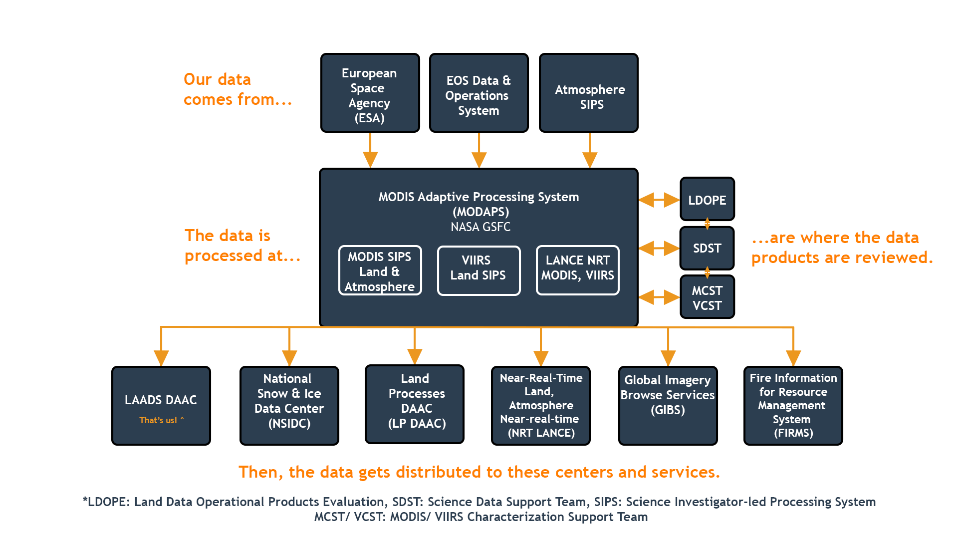
The primary mission of the LAADS DAAC is to archive and distribute MODIS science data products and NASA versions of VIIRS science data products to the global Earth science research and applications community. Our focus is on level 1 calibrated and geolocated moderate resolution instrument data and level 2 and 3 atmosphere products. The two MODIS instruments are onboard NASA's Terra and Aqua satellites. The three current VIIRS instruments are onboard the joint NASA/NOAA Suomi NPP satellite and the NOAA-20 and NOAA-21 (formerly named JPSS-1 and -2) satellites.
LAADS DAAC also distributes other moderate resolution science datasets, including the European Space Agency's (ESA) Envisat Medium Resolution Imaging Spectrometer (MERIS) and Copernicus-Sentinel-3 Sea and Land Surface Temperature Radiometer (SLSTR) and Ocean and Land Colour Instrument (and OLCI) collections. In addition, we archive and distribute the MODIS Airborne Simulator (MAS) and Autonomous Modular Sensor (AMS) airborne collections, and other NASA datasets. We also serve as a secondary DAAC for distributing MODIS and VIIRS land products.
The LAADS DAAC keeps its user community up to date on all data product information—including known issues that affect product quality—and provides tools and services to improve data use and understanding.