Harmonized Landsat Sentinel-2 (HLS) Data

Harmonized Landsat Sentinel-2 (HLS) imagery is produced from data acquired by the Operational Land Imager (OLI) and OLI-2 instruments aboard the joint NASA/USGS Landsat 8 and Landsat 9 satellites and the Multi-Spectral Instrument (MSI) aboard the ESA (European Space Agency) Sentinel-2A and Sentinel-2B satellites.

HLS data is available from Earthdata Search.
You Might Also Be Interested In

Filter By

Content type
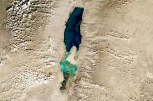
True color image of the Dead Sea and Salt Evaporation Ponds on 21 December 2022 from the MSI instrument aboard ESA's Sentinel 2A and 2B satellites
Worldview Image of the Week
Headshot of Dr. Brice Grunert, assistant professor at Cleveland State University who uses data from the OB.DAAC and other sources in his research on carbon cycling in the ocean
Data User Profile
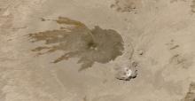
Image of Tarso Tousside and Trou au Natron, Chad on 9 November 2022 captured by the MSI instrument aboard ESA's Sentinel 2A and B satellite.
Worldview Image of the Week
Placeholder image
Blog Post
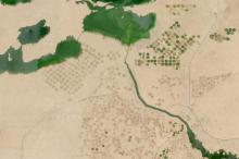
Image of pivot irrigation circles and canals of the New Valley Project in Egypt on 4 November 2022 (Sentinel 2A &B/MSI)
Worldview Image of the Week
Swirls of phytoplankton in Lake Michigan on 22 October 2022 (HLS/Sentinel 2A & 2B)
Worldview Image of the Week
True color Landsat 9 image of Shasta Lake at low capacity, exposing the brown shoreline of the reservoir, on 14 August 2022
Worldview Image of the Week