Worldview Release 3.7.0 includes lots of new goodies!
- Layer Picker: Layer descriptions are more easily discovered, we've added more search functionality with options to filter the layers by different facets such as by temporal period, category, measurements, whether the imagery was obtained during the daytime or nighttime, and many more.
- Timeline Availability Panel: Visually determine whether layers you have loaded have temporally coincident imagery using the timeline availability panel.
- Distraction free mode: Too much stuff on top of the map? Click on the "i" button to turn on distraction free mode and get rid the Layer List, Timeline, Measurement Tool and other buttons so you can concentrate solely on the imagery!
- Vector capabilities: We've adding the ability to interact with vector layers such as Settlements, Dams, Reservoirs and Nuclear Power Plants. You can now zoom in and query a point or polygon for these layers to find out more about them. The settlements layer provides settlement name, estimated population in 2000, and whether the settlement is urban or rural. More to come in forthcoming releases...fire/thermal anomalies layers next!
For more information, read this short article on the Earthdata website: New Imagery and Functionality Available in NASA Worldview.
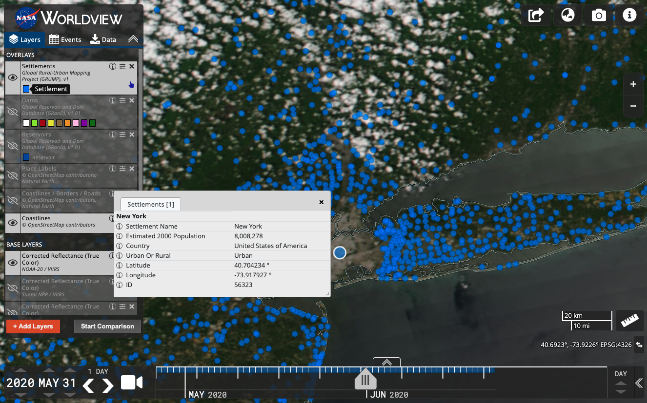
Interacting with the Settlements vector layer brings up more detailed information.
New Imagery Layers in GIBS and Worldview
We've added quite a few new imagery layers into GIBS and the latest version (3.7.0) of Worldview - a total of 35 new layers!
NOAA-20/Visible Infrared Imaging Radiometer Suite (VIIRS) (5 Daily layers)
- True color Corrected Reflectance
- False color (Bands M3-I3-M11) Corrected Reflectance - this band combination is good for identifying snow and ice.
- False color (Bands M11-I2-I1) Corrected Reflectance - this band combination good for identifying burn scars and flood waters.
- Brightness Temperature (Day and Night)
This means that we now have 4 sets of similar imagery from 4 different satellite/sensor combinations! This is useful for cross comparison and for continuity for when older missions retire.
Suomi NPP/Visible Infrared Imaging Radiometer Suite (VIIRS) (4 Daily layers)
- Chlorophyll a
- Sea Surface Temperature (Day and Night)
- Photosynthetically Available Radiation
Aqua and Terra/Moderate Resolution Imaging Spectroradiometer (MODIS) (8 Daily layers)
- Chlorophyll a - Terra and Aqua
- Sea Surface Temperature (Day) - Terra and Aqua; (Night) - Terra and Aqua
- Photosynthetically Active Radiation - Terra and Aqua
Group for High Resolution Sea Surface Temperature (GHRSST) (7 Daily layers)
- Sea Surface Temperature (GAMSSA GDS2, MUR25)
- Sea Surface Temperature Anomalies (MUR, MUR25)
- Sea Ice Concentration (GAMSSA GDS2, MUR, MUR25)
MEaSUREs (1 5-Day layer)
GCOM-W1/Advanced Microwave Scanning Radiometer 2 (AMSR2) - Unified algorithm (10 Daily layers)
- Wind Speed (Day and Night)
- Total Precipitable Water (Day and Night)
- Surface Precipitation (Day and Night)
- Columnar Cloud Liquid Water (Day and Night)
- Columnar Water Vapor (Day and Night)
The unified algorithm layers will replace the existing AMSR2 layers as the older imagery is processed.

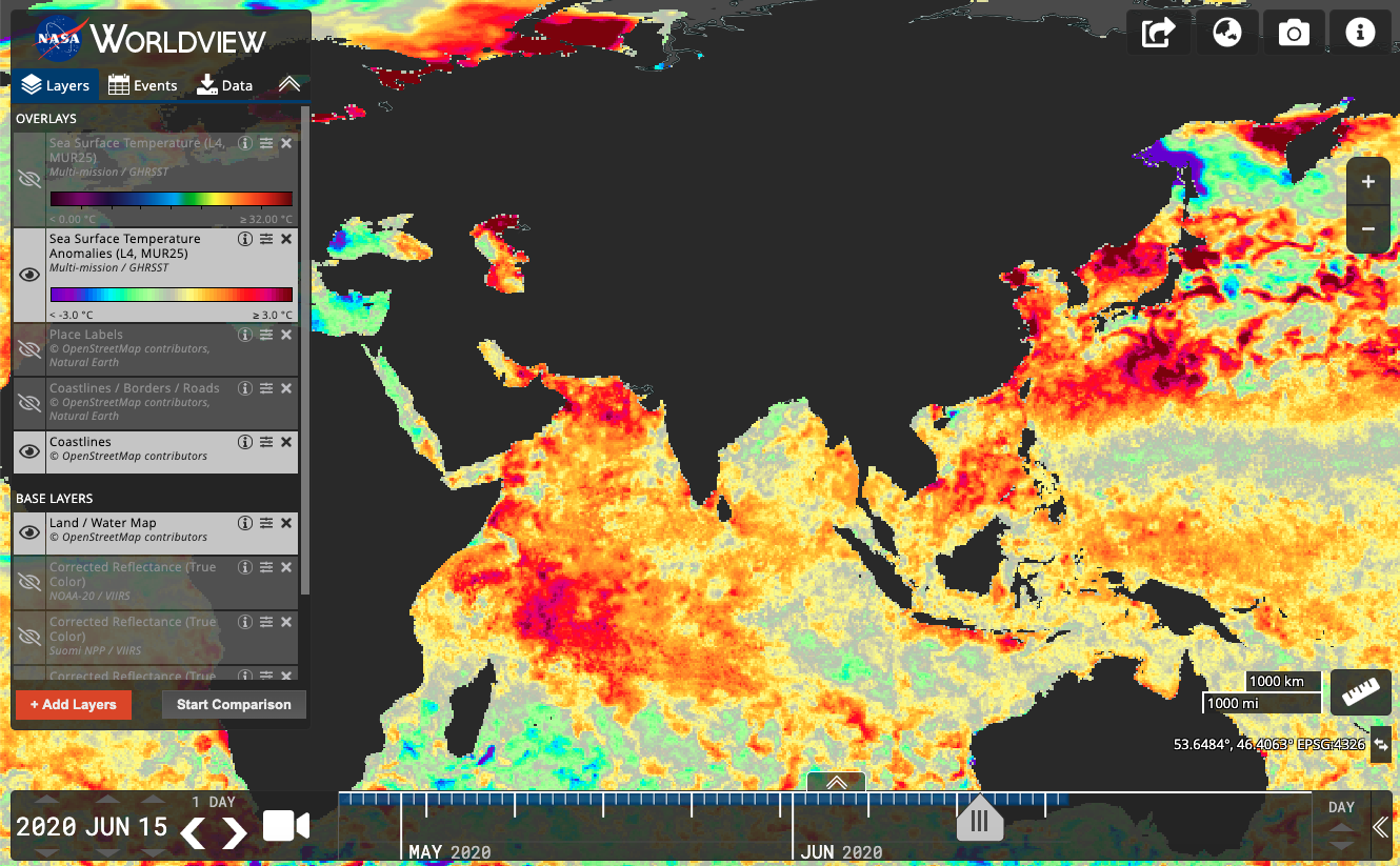
Sea Surface Temperature (MUR25) at the top and Sea Surface Temperature Anomalies (MUR25) at the bottom from GHRSST.