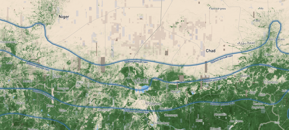
Results from a NASA-funded study provide better estimates of carbon sequestered by trees in sub-Saharan Africa and is the cover story in the March 2, 2023, issue of Nature. NASA's Compton Tucker, lead author of the study, and a NASA and multi-national research team used more than 300,000 satellite images to map more than 9.9 billion tree crowns across semi-arid sub-Saharan Africa north of the Equator. Tree crowns were converted into tree carbon using allometry provided by three team members.
The research results established a framework for mapping carbon stocks at the level of individual trees at a sub-continental scale, will help improve ecosystem models, and will be a tool for restoration efforts. The research team's work is available via a data visualization tool that can be accessed locally using browsers that support WebGL: Chrome, Safari 9 and above, the latest Firefox, and Microsoft Edge 13 with Win10.
The study utilized data made available through NASA's Commercial Smallsat Data Acquisition (CSDA) program. CSDA is a component of NASA's Earth Science Data Systems (ESDS) Program and works to identify, evaluate, and acquire commercial small-satellite data that compliment NASA's Earth science observations and that can be used for NASA research and application goals. Maxar commercial very-high-resolution satellite images were acquired through NASA under the National Geospatial-Intelligence Agency's (NGA) NextView Imagery License Agreement. Derived products produced by the study for all 9.9 billion trees are publicly available at NASA's Oak Ridge National Laboratory Distributed Active Archive Center (ORNL DAAC), which is the home of NASA Earth science data related to terrestrial biogeochemistry, ecology, and environmental processes.


