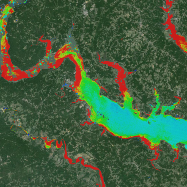
The Satellite-based analysis Tool for Rapid Evaluation of Aquatic environMents (STREAM) is a rapid water quality monitoring tool that processes satellite imagery to create maps showing chlorophyll-a, total suspended solids, and water clarity at 20-30 meter resolution. Using advanced neural networks, STREAM delivers water quality assessments within 6 hours of satellite observation, enabling quick detection of water quality changes for timely decision-making.
The system uses United States Geological Survey (USGS) Landsat 8/9 imagery and Copernicus Sentinel-2, covering the continental U.S., Hawaii, Alaska, and key regions in South America and Africa including Peru, Uruguay, and several West and East African countries.
STREAM features an interactive map for visualizing water quality products, a data archive for downloads, and an application programming interface (API) for remote data access. The tool supports the United Nations (U.N.) Sustainable Development Goal 6 monitoring and is designed for researchers, water managers, and environmental professionals.
Key Features
- Interactive water quality mapping
- Data archive and download capabilities
- API for programmatic access
- Near real-time processing (< 6 hours)
- Multiple water quality parameters
Developed through NASA's Applied Sciences programs in partnership with the U.N. Environment Programme, STREAM launched in June 2024 and represents ongoing collaboration between NASA's Goddard Space Flight Center and Science Systems and Applications, Inc. since 2018.
Note: STREAM is currently in beta development with continuous improvements planned.


