Launched in December 2022, the Surface Water and Ocean Topography (SWOT) mission provides an unprecedented look at Earth's water. A joint mission by NASA and CNES (Centre National D'Etudes Spatiales) with contributions from CSA (Canadian Space Agency) and the United Kingdom Space Agency, SWOT measurements for surface water extent and water body elevation for rivers, lakes, and the ocean are now publicly available for scientific research and applications.
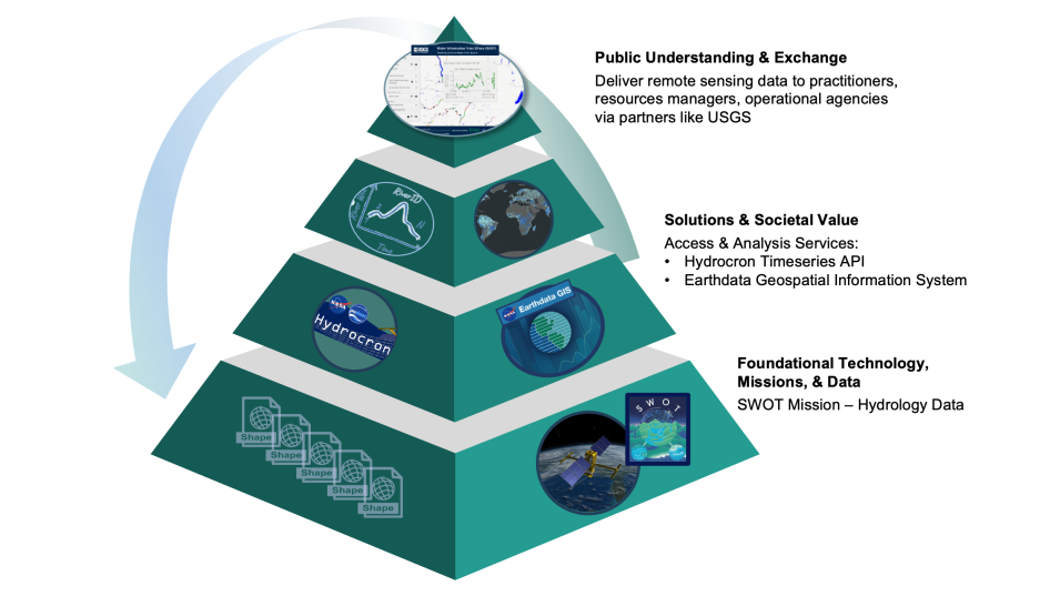
This webinar will explore SWOT hydrology data collections of rivers and lakes, highlighting tools provided by both NASA's Physical Oceanography Distributed Active Archive Center (PO.DAAC) and United States Geological Survey (USGS). These tools ease user access and analysis and help towards delivering solutions and societal value. Webinar participants will learn how to works with SWOT hydrology datasets using Hydrocron, the Water Information from Space (WISP) dashboard, and NASA’s Earthdata Geographic Information System (EGIS) GIS Feature Service, developed by NASA PO.DAAC, for the SWOT River Reach collection.
The following tools will be featured in the webinar demonstrations:
- Hydrocron is an API developed by NASA’s PO.DAAC that simplifies access to SWOT hydrology datasets by converting them into formats optimized for time-series analysis. Users can retrieve SWOT observations in CSV or GeoJSON by specifying a reach or lake identifier along with a few basic parameters.
- The WISP dashboard, developed by USGS, leverages Hydrocron to provide interactive visualization and download of SWOT data alongside USGS gauge measurements.
- The EGIS Feature Service can be added to your preferred GIS desktop software or accessed programmatically to visualize and analyze river data while avoiding the need to download.
