Flood Detection Challenge

Participants will develop algorithms to identify flood pixels after training their algorithm against a training set of synthetic aperture radar images.
author-share

Flood events result in devastating consequences for people, ecosystems, and economies. Floods occur throughout the world, and a single major flood event can result in multiple billions of dollars in damages. Flood extent is difficult to acquire on the ground as it is hazardous to operate in a flood zone, and physical access by roads is limited. Being able to detect flood extent provides automated ways to assist disaster response during flood events. Accurately detecting floods and flood extent via remote means greatly aids in the process of mitigating and responding to these destructive events.
Image
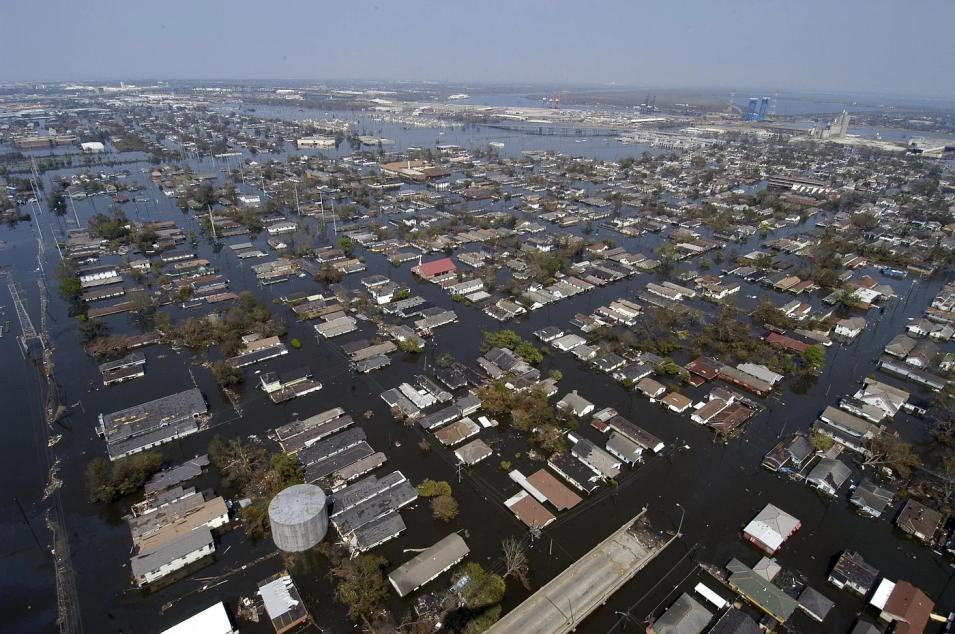
A neighborhood is flooded with water
Flooding caused by Hurricane Katrina

IMPACT, in collaboration with the IEEE GRSS Earth Science Informatics Technical Committee, is organizing the ETCI 2021 Competition on Flood Detection. The challenge involves a supervised learning task — participants will develop algorithms to identify flood pixels after training their algorithm against a training set of synthetic aperture radar (SAR) images. Participants are required to submit binary classification maps, and performance will be evaluated using the intersection over union (IOU) score. Over the summer, IMPACT machine learning team assembled a team of students across the world to label these dataset that were provided by the Alaska Satellite Facility, a NASA Earth science distributed active archive center. NASA MSFC disaster team provided subject matter expertise and worked closely with the students to generate the flood extent datasets. These collaborative efforts and data science competitions align with IMPACT and the Earth Science Data Systems program’s goal of promoting open science.

Image
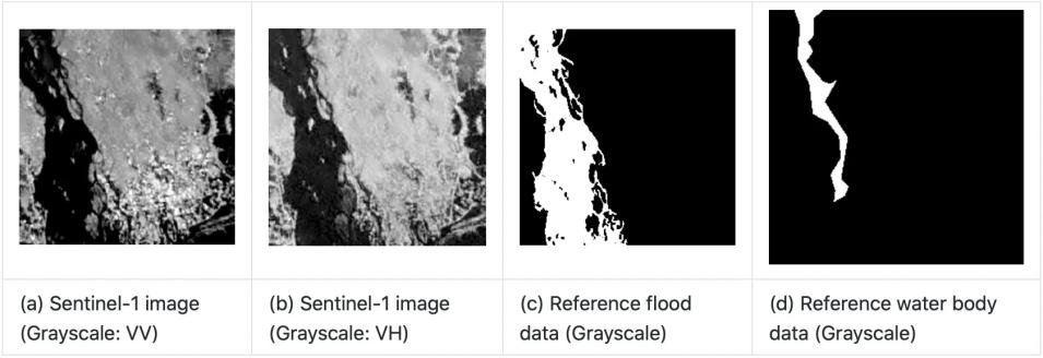
Four sequential black-and-white images, the first two showing satellite images, and the second two showing reference data
Visual examples of satellite images (a), (b) and reference data (c) and (d)

IMPACT team member and POC for the challenge Shubhankar Gahlot explains one of the key goals of the challenge:

This challenge aims to promote innovation in the detection of flood events and water bodies, as well as to provide objective and fair comparisons among methods.

The ETCI 2021 Competition on Flood Detection timeline is as follows:

  • April 14, 2021 — Contest opens
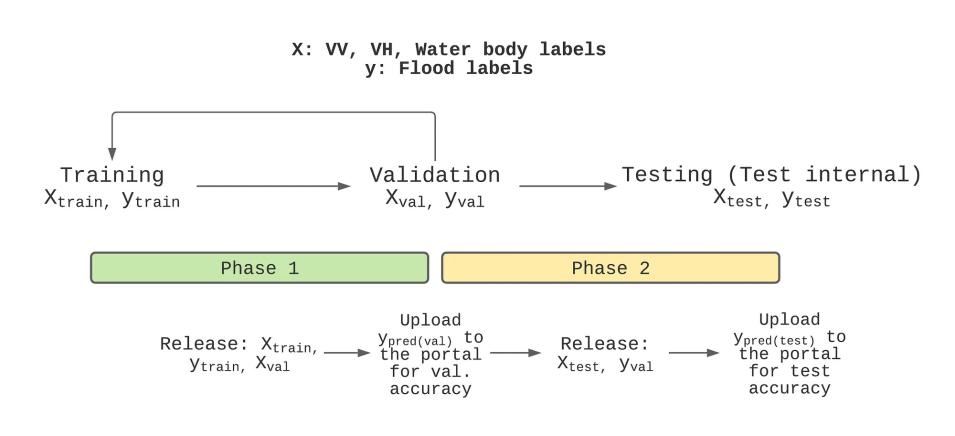
  • April 15, 2021 — Phase 1 (Development); release of training data and validation data; begin accepting submissions for validation set data
  • May 15, 2021 — Release of test and validation references for model tuning; begin accepting test submissions
  • June 30, 2021 — Phase 2 (Test); end accepting submissions
  • July 1, 2021 — Winner announced
Image
Graphic showing the phases of the flood detection competition: training, validation, and testing
Competition phases

Complete details are available here.

You can sign up for the challenge here.

More information about IMPACT can be found at NASA Earthdata and the IMPACT project website.

Last Updated