Kirsten de Beurs trod out into yet another field, her boots sinking into the soft dark soil. She stopped for a moment to write her Global Positioning System (GPS) coordinates in a lined notebook, then lifted her camera to snap a photo. The lush rows of young green wheat stretched as far as she could see, broken only by the occasional dirt road or wooden shack. Samara Oblast in southern Russia is still the center of the Russian grain belt and one of the most productive farming regions in the country. Yet even here, farmers are raising fewer cattle and leaving some of their fields fallow.
Foot and Plow
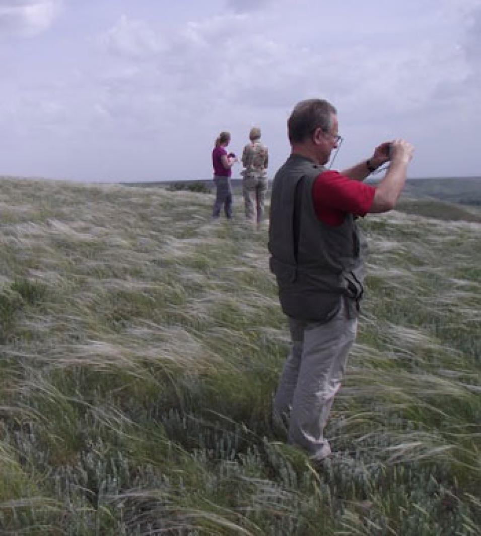
In the spring of 2010, de Beurs and her colleagues were on a road trip of sorts through the Russian countryside, taking copious notes and photographs, and interviewing farmers and officials in farming regions around the country. De Beurs, a geographer at the University of Oklahoma, had come there to study how agriculture is changing. “We know that agriculture in Russia declined in the early 1990s,” she said, “but what is happening now?” While the fields in Samara remained productive, many of the fields the team visited in other regions had been abandoned, reclaimed by forests or overtaken by weeds. Just how much land had been left behind? De Beurs said, “It’s important for us to understand what is going on in these areas because we want to know how it is going to change in the future.” Russia supplies food not only for its own 140 million inhabitants, but also for the rest of the world.
Waves of grain
In the early 1990s, farming changed dramatically in Russia. Where the Soviet government had once determined everything about agriculture, running huge, centralized farms all over the country, farmers were now largely left to their own devices to navigate the new market economy.
“When the Soviet Union collapsed, the whole economic system collapsed, and they pulled back a lot of the subsidies for fertilizers and pesticides and machinery,” De Beurs said. “The farmers had to figure out for themselves: is this sustainable?” In many cases, she said, those large farms were neither sustainable nor profitable. The Soviet government had pushed agriculture far beyond the country’s most fertile regions, spreading north into inhospitably cold environments, and south into areas with desert-like conditions and bad soil.
After the Soviet Union broke up, many farmers, particularly young people, gave up on their traditional livelihoods. By 1998, crop-farming output was only 56 percent of what it was in 1990, according to geographer Grigory Ioffe. Ioffe has studied Russian agriculture and population for years, first in the Soviet Union and now as a professor of Geography at Radford University in Virginia. He said, “In areas which are far from the major urban cores, the population has been leaving in droves. At some point lands would be abandoned because there is nobody to work that land.” The left-behind fields were overgrown by weeds or conquered by the surrounding forest. In 2006, Ioffe and colleagues estimated that 20 to 30 million hectares of farmland had been abandoned in European Russia, the area west of the Ural Mountains.
Russia provides much of the grain in the global food market, and the country became an even more important grain producer after cattle farming dramatically declined in the early 1990s. But a continued decline in agriculture could threaten food availability around the world, especially in poor regions that rely on cheap grain from large producers like Russia. Some initial research in the early 2000s suggested that farming was starting to recover. But in such a large country, it is difficult to say exactly how farming is evolving. And what will happen in the future as the country deals with a mobile population and a changing climate that could bring more challenges to farmers? Researchers expect climate change to lead to more droughts and wildfires that may prove damaging to crop production.
Abandoned lands
De Beurs invited Ioffe to work together to address the looming questions about agriculture in Russia, combining Ioffe’s expertise in Russian agriculture with de Beurs’ remote sensing background. While fieldwork would give the researchers a first-hand view of the situation, an exhaustive field study would be impossible to manage over Russia’s vast countryside. De Beurs thought that remote sensing could provide another window into agriculture in fast-changing areas of Russia.
The two researchers outlined a project that looked at four different areas in Russia: the northern region of Kostroma, the southern region of Stavropol, and two middle-latitude areas called Chuvash and Samara. They visited each area during the summer of 2010 and the fall of 2011, along with colleague Tatyana Nefedova, a researcher at the Russian Academy of Sciences in Moscow. The team talked to farmers, agricultural officials, and other experts in the area to gain a local perspective on farming. They took photographs of fields and farms, noting where fields had been left vacant and taken over by weeds, and where farmers were growing crops year after year. And they collected any available statistics for the regions of their study. De Beurs said, “We did a ton of interviews. We spoke with whoever we could find who could tell us something about agriculture in the region.”
But just looking at fields and talking to people did not tell them everything they needed to know. The areas were vast, and the local agricultural data were sometimes sparse. In addition, De Beurs said, “There has been a push from the government to bring some agricultural areas back into production.” So sometimes, farmers would bring an unused area back into production, but then do not use it every year, giving the appearance of greater production, but growing no more crops than before.
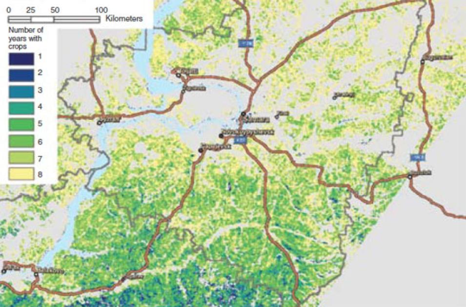
This map of the Samara region uses the NASA Moderate Resolution Imaging Spectroradiometer (MODIS), Landsat, and field studies to locate where crops were grown and for how many years. Blue areas show land that was cropped for one year, while green and yellow show land that was cropped for multiple years during the study from 2002 to 2009. Beige areas indicate locations where crops were not grown. Gray indicates where satellites did not collect data. (Courtesy K. de Beurs)
Satellite data added another layer of information about what was really happening on the ground, and allowed the researchers to look at changes over a longer period, from 2002 to 2009. De Beurs said, “What we were after is where there are crops and where there are no crops. In addition, we want to know for every year, is the land cropped or not?” She accessed vegetation data from NASA's Moderate Resolution Imaging Spectroradiometer (MODIS) instrument archived at NASA's Land Processes Distributed Active Archive Center (LP DAAC), and land cover data from the joint NASA–U.S. Geological Survey (USGS) Landsat satellite. MODIS can sense vegetation greenness, indicating the start and end of the growing season, while the Landsat data help to classify land into different land-cover types such as forest or prairie. With those two data sets, de Beurs could classify and compare broad swaths of land year by year.
De Beurs and Ioffe are now working to make sense of the data. Their preliminary analysis showed a few trends, for example that farmlands in southern regions and near cities were doing better than more remote areas, such as Kostroma to the north. Ioffe said, “In Russia, the quality of life depends upon proximity to a large city. The closer you are, the better the quality of life.” Farms in remote parts of Russia remain cut off from many of the luxuries of modern life, lacking reliable roads and plumbing.
Whether farmers stick to their land also depends on tradition and culture, the researchers found. For example, the Tatar ethnic group, a significant minority group in the Samara region, has held on to farming to a greater extent than many of their neighbors. Ioffe said, “The tenacity with which some people are holding onto land despite the general trends is really surprising. Some people are continuing to do crop farming or animal husbandry in desperate circumstances.”
Feeding Russia and the world
The researchers say that changing populations and agriculture are transforming the Russian countryside into something new. But the results of those changes remain hard to predict. Ioffe said, “Land abandonment is transforming Russia from a blanket of human colonization, to more of an archipelago, islands of settlement with nothing in between. This is a crucial change in a significant part of northern Eurasia, and it affects the ecology, environment, and Russia’s ability to feed itself.” It also affects how much food Russia provides for the rest of the world. In addition to producing food for its own people, Russia is a major player in the global food economy. That became vividly clear in the summer of 2010, when seven people were killed in food riots in Mozambique after grain shortages in Russia caused the price of bread to rise morethan 30 percent in just a couple of weeks.
References
de Beurs, K.M., G. Ioffe, and T. Nefedova. 2012. Agricultural change in the Russian grainbelt: A case study of Samara Oblast. Geography, Environment, Sustainability 2(5): 95–110.
de Beurs, K., C. K. Wright, and G. M. Henebry. 2009. Dual scale trend analysis for evaluating climatic and anthropogenic effects on the vegetated land surface in Russia and Kazhakstan. Environmental Research Letters 4, doi:10.1088/1748-9326/4/4/045012.
Ioffe, G., T. Nefedova, and I. Zaslavsky. 2006. The End of Peasantry: The Disintegration of Rural Russia. University of Pittsburg Press.
Patel, R. 2010. Mozambique’s food riots—the true face of global warming. The Guardian.
For more information
NASA Land Processes Distributed Active Archive Center (LP DAAC)
Moderate Resolution Imaging Spectroradiometer (MODIS)
| About the remote sensing data used | |||
| Satellite | Terra | Terra | Terra |
| Sensor | Moderate Resolution Imaging Spectroradiometer (MODIS) | MODIS | MODIS |
| Data sets | Nadir Bidirectional Reflectance Distribution Function (BDRF) Adjusted Reflectance (NBAR) | Normalized Difference Vegetation Index (NDVI) | Land Surface Temperature (LST)/Emissivity |
| Resolution | 500 meters | 500 meters | 1,000 meters |
| Parameter | Reflectance | Vegetation | Land surface temperature |
| DAAC | NASA Land Processes Distributed Active Archive Center (LP DAAC) | NASA LP DAAC | NASA LP DAAC |
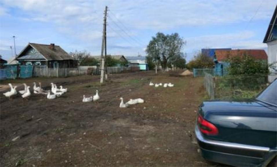
The photograph in the title graphic shows a typical farm in the Samara Region in central Russia. Many farms in Russia are in remote areas hundreds of miles from major cities, and may lack modern amenities such as telephones and television. (Courtesy K. de Beurs)


