Malaria by the Numbers

Scientists use a combination of field research, census data, and population projections to address the malaria problem in Africa.
author-share

When Bob Snow of the Kenya Medical Research Institute/Wellcome Trust Collaborative Programme in Nairobi travels through Africa, he sees firsthand the effects of malaria. Children suffer from fevers, chills, seizures, and anemia, and then often lapse into comas and die. Sometimes the victims get the medicine they need, but more often, parents who can't afford food or school fees must go without the drugs that could save their children.

The World Health Organization (WHO) estimates that more than a million people in Africa die from malaria every year, including 3,000 children each day. "It's a huge problem," said Snow, who is also a professor of tropical public health at the University of Oxford. "The New York Times reported 150,000 deaths from the recent tsunamis in Indonesia, but that number is only the margin of error for malaria deaths in Africa." Despite 20 years of research in Africa on ways to combat the burden posed by malaria, Snow said he hasn't seen much progress in the fight against the disease.

Malaria is caused by a parasite carried by the female mosquito Anopheles. Mosquitoes transmit the parasite to humans through their bite, and they also contract it by biting already-infected humans. The parasite travels first to the liver, where it reproduces, then proceeds to the bloodstream, where it reproduces again and destroys the red blood cells. In Africa, a particularly dangerous strain of malaria, known as Plasmodium falciparum, resists most drugs and often kills its victims.

Problems in Africa are compounded by the fact that malaria helps create a "circle of poverty." Because of high infant mortality, women tend to have more children to ensure that some survive. With many children to care for, mothers can't leave the home to help provide for their families. So, malaria burdens individual households, as well as local health services.
 

Image
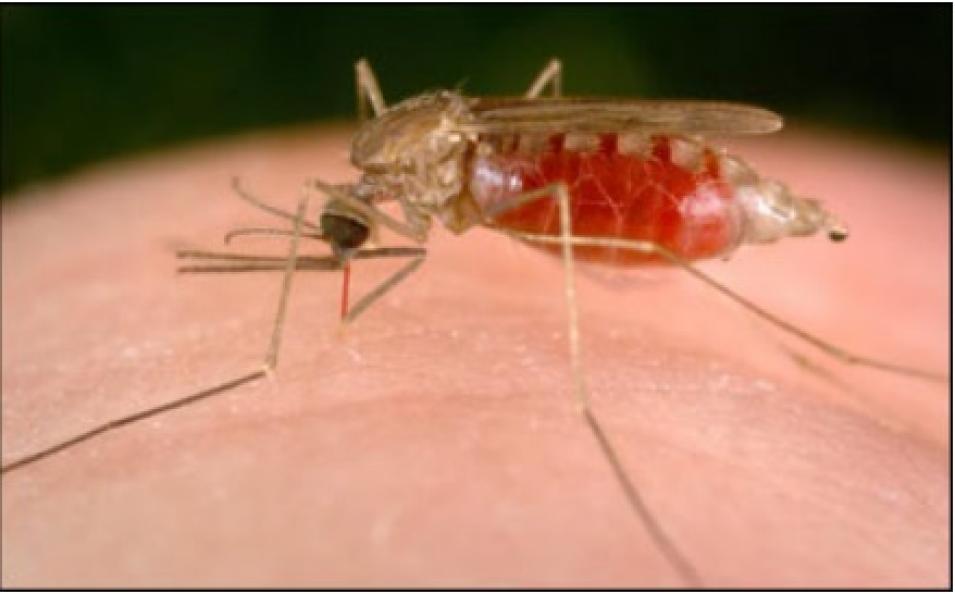
Anopheles mosquito
An Anopheles mosquito takes blood from a human host. This mosquito is a vector for malaria, which kills more than a million people each year in over 100 countries and territories. (Image courtesy of James Gathany and the Centers for Disease Control and Prevention)

In the 1980s, scientists found that using bed nets significantly decreased the chance of getting malaria, yet fewer than 5 percent of African children sleep under them, according to Snow. In addition, limited funding leads to the use of cheaper drugs to which the malaria parasite has developed resistance, which makes them ineffective. "Malaria victims are being treated for a life-threatening disease with drugs that don't work," he said.

Targeting bed nets and effective drugs to specific populations could cut the spread of malaria in half, Snow said, but researchers must have accurate population data to determine exactly where they should concentrate their efforts. For example, Snow said the United Kingdom gave a non-governmental organization (NGO) $20 million to market bed nets. The NGO marketed the nets in a city where people were less likely to contract malaria and, therefore, the project failed. "It's a complete mess on the international level," he said. "There's a lot of rhetoric and a lot of hand-holding and a lot of meetings, but that doesn't translate to solutions."

Andrew Tatem, a zoology researcher at the University of Oxford, said that before scientists can make headway in fighting malaria, they must first understand how the disease affects different populations. "There is so much we don't currently know about malaria," he said. "The basic numbers must be understood."

The WHO, along with the United Nations Development Program and the World Bank, plans to "Roll Back Malaria" by half by 2010. But Tatem said no one knows exactly what "half" is. If malaria researchers had accurate numbers for specific locations, they might be able to attack the problem in a proactive way. Data, Snow said, could provide solutions.

Deborah Balk, lead project scientist for NASA's Socioeconomic Data and Applications Center (SEDAC) at Columbia University, and her colleagues recently released a grid that shows population densities for specific regions not only in Africa, but in the rest of the world as well. SEDAC's Gridded Population of the World (GPW) data set, version 3, converts census information from more than 375,000 administrative subdivisions, such as countries and provinces, into a series of longitude/latitude grids that provide estimates of where those populations live. The data set allows researchers to easily analyze population data with other geographically referenced data, such as land-use patterns, geophysical hazards, and climate information.

Version 3 of the data set includes more input units (more individual sets of data for the administrative units), than the first two versions of GPW, allowing Balk to create smaller grids for many countries. "We did a massive update when the year 2000 census updates came out," Balk said. "In addition, we collected a different stream of census data--population estimates of human settlement and urban areas--and matched it with night-time-lights satellite data."


Image
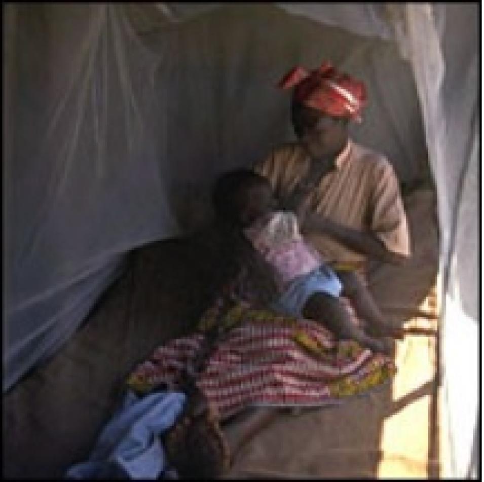
Zambia bed net
A mother and child in Zambia, Africa sleep under an insecticide-treated bed net. (Image copyright UNICEF/Giacomo Pirozzi)

The third version of GPW spawned two new projects: the Global Rural Urban Mapping Project (GRUMP) and the Gridded Population Density of the World, Future Estimates 2015. GRUMP adds a new dimension to the gridded population data by consistently defining how many people live in urban versus rural areas. "This has never been done before," said Balk. "It allows us to ask, 'What geophysical and environmental features define city location?' and 'Why are coastal areas disproportionately urban?'"

Balk, who works at the Center for International Earth Science Information Network (CIESIN) at Columbia University, where SEDAC is based, said that she and her colleagues have already begun using these new data to investigate where people live relative to ecosystems and urban areas. For example, they found that while coastal ecosystems in Africa are densely populated and disproportionately urban, close to 45 percent of Africans live in cultivated zones, with only about 40 percent of those residents being urban dwellers. With these data, scientists can look at where malaria-ridden mosquitoes live in relation to people, and learn about the effects of population growth on the environment.

Although field research shows that malaria is more prevalent in rural areas, the combined GPW, GRUMP, and satellite data allows scientists to better estimate malaria risk and burden. "You're less likely to be bitten by a malarious mosquito in an urban area," Tatem said. So, the new data gives scientists a better idea of where to send bed nets and medicine.

Tatem works with Simon Hay, also of the University of Oxford and principal scientist for the malaria project, to combine the population data of GRUMP with maps of areas considered to be at-risk from malaria. Using the data to determine disease distribution, they study the effects of climatic conditions on malaria. "We now have maps of malaria risk with accuracy to within one kilometer," Tatem said. "Once you have the numbers, you can come up with a plan and work out how you're going to attack the problem."

While the new population data promise to aid researchers in cutting malaria risk, compiling the data sets is not without obstacles. Although most nations have been open with their data, Balk said it's not always easy to get information. And for many countries, data may not be redistributable. Such was the case with the Indonesian census. Aide workers immediately called Balk after the tsunami hit in December 2004 to see if she could share her high-resolution input data for Aceh Province. Unfortunately, because of perceived security risks, Balk said the Indonesian government required her to sign a contract agreeing not to release the information to other parties. "We made the gridded data available to the aide agencies, and estimates of exposed population, as soon as possible, but we could not release the underlying data," Balk said. "That was a real shame."

In addition to financial and political hindrances, some governments simply don't have the information. War-torn countries, such as the former Yugoslav republics and Afghanistan, don't collect census data regularly or have had their regular census-taking interrupted. Other countries, such as Rwanda-Uganda, have seen their populations move to other countries seeking safety.

There is enough census data in Africa, however, to try to sort out the malaria problem. Doctors and scientists have solved the malaria problem before, according to Tatem. "Malaria used to be a problem in the central United States and in Northern Europe, but global efforts pushed it back to the tropics," he said.


Image
GPW GRUMP data
The Gridded Population of the World (GPW) data set has undergone a substantial improvement in the number of input units and in the target years of estimation. This table describes these improvements, and also refers to the new Global Rural-Urban Mapping Project (GRUMP) data collection, which shows how many people live in urban versus rural areas. (Information courtesy of Socioeconomic Data and Applications Center)

The WHO sprayed DDT from the 1940s until 1969, when environmental concerns forced them to stop. And, as Europeans improved their housing with window panes, screens and doors, they lessened malaria risks there. Growing cities and changing land use also removed many mosquito breeding grounds, but these precautions were often not taken in Africa. "Once the African countries gained independence, funding for controlling malaria dried up," Tatem said.

Snow said solving the malaria problem boils down to understanding where people live in relation to the malaria risk, and that's why the GPW, GRUMP, and population prediction data are so important. Analysis using GPW and UN projected population growth suggests 400 million births will occur within the malaria-infested areas of the world in the next five years, according to Tatem, but even that isn't a clear indicator of future malaria numbers. For example, the population boom will possibly cause those areas to become more urban, thus reducing mosquito habitat.

At the turn of the 20th century, about 77 percent of the world's population was at-risk of contracting malaria. By 1994, that number had fallen to 46 percent. But in 2002, it went back up to 48 percent because of population growth in at-risk areas. This underscores the need for accurate population data, and for a thorough understanding of how population distribution affects the spread of infectious diseases.

Despite his frustrations, Snow continues to conduct research in Kenya and work with African governments to control the problem. "African governments can't fight this alone--it takes money," he said. "And we need to get the numbers first."

"That is why I keep going. It's a lifetime of work."

References

Malaria is alive and well and killing more than 3000 African children every day.

World Health Organization. Accessed January 10, 2005.

For more information

NASA Socioeconomic Data and Applications Center (SEDAC)

Center for International Earth Science Network (CIESIN)

Gridded Population of the World (GPW) Data

World Health Organization "Roll Back Malaria"

About the data used
Data set Gridded Population of the World (GPW)
Parameter global urban rural mapping
DAAC NASA Socioeconomic Data and Applications Center (SEDAC)
Last Updated