Silent Signals

Synthetic aperture radar data and scientists in detecting the ground deformation associated with earthquakes and volcanic eruptions.
author-share

In the Andes Mountains of South America, people as far back as the Incas learned to accept devastating volcanoes and earthquakes as simply part of life's lot. Local lore speaks of the anger of ancient gods, which, it was believed, often resulted in violent eruptions and ground shaking.

A recent incarnation of Mama Pacha, the Earth Goddess of Incan mythology, killed 2,000 people in Chile after a magnitude 9.5 earthquake lurched through the region in 1960. But geologist Matthew Pritchard sees the swaying and swelling of the Earth as pure science, and he believes that science can potentially save hundreds of thousands of people.

"Our long-term research goal is to minimize the number of surprises we get from planet Earth," said Pritchard, assistant professor of earth and atmospheric sciences at Cornell University. He and his colleagues hope to reach a point where they can determine whether a volcano or earthquake poses an immediate threat -- even if they can't predict them.

Image
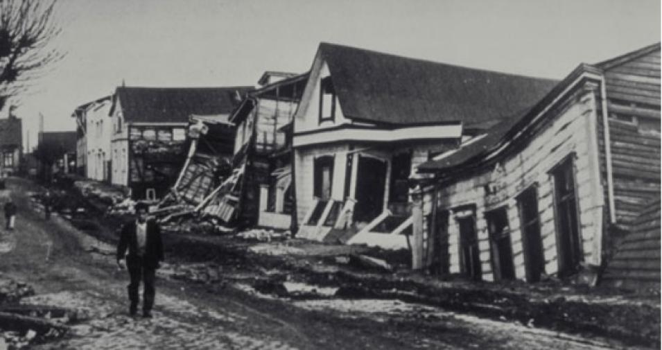
Valdivia Chile earthquake
Considerable damage to quality, wood-frame houses in Valdivia, Chile occurred during the 1960 earthquake that shook southern Chile. Valdivia suffered catastrophic damage because of its proximity to the epicenter of the massive quake. (Image courtesy of NOAA, Pierre St. Armand, Photographer)

For now, Pritchard said he's motivated by two key findings he uncovered while working on his Ph.D. dissertation at the California Institute of Technology (Caltech). First, about 40 fewer volcanoes in the Andes show activity than was previously believed. As a result, scientists on the ground can spend valuable time and resources evaluating just a few volcanoes in the Andes for dangerous activity, rather than dozens.

Second, some earthquakes make slow and steady progress over a period of months, rather than causing one abrupt shake -- what Pritchard refers to as "silent earthquakes." This means that some faults may never actually trigger violent temblors.

Other earthquakes

Pritchard observed in satellite imagery did not send out jarring seismic signals, but slipped silently down without discernible movement from the ground above. "Why do these occur?" he asked. "Why do we get some earthquakes that are devastating and others that are not?"

Pritchard said his fascination with geology began when he was about 10 years old. "I had a rock collection, and I started reading about earth science," he said. Though he grew up on a "flat and featureless" farm in Illinois, Pritchard said his parents took him to the Grand Canyon and Yellowstone National Parks, where he got a first-hand look at the landforms he had read about. "I started reading more about rocks and wondering why they were different," he said.

As Pritchard studied his rocks, he began to wonder about other worlds, which led him to study planetary science. "I became very interested in why the Earth behaves as it does and why we have certain activities here, like earthquakes and volcanoes, and not on some other planets," he said. But the movements of his own planet pulled him back down to Earth. "These events have a big impact on humans, and it's important to understand the way hazards affect society," he said.

Image
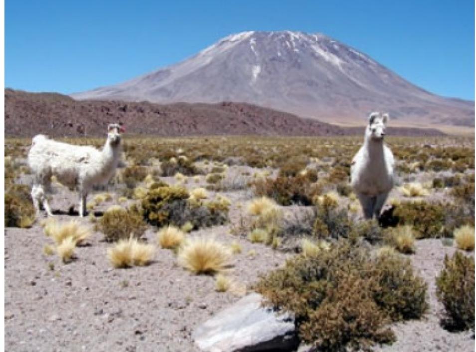
Lascar volcano
Lascar volcano in Chile is the most active volcano in the central Andes, with several eruptions occurring during the 1990s. Pritchard and Simons found no evidence of deformation at Lascar during their survey of 900 volcanoes in the region. (Image courtesy of Mark Simons)

Pritchard's graduate advisor at Caltech, Mark Simons, suggested that he look at some Synthetic Aperture Radar (SAR) data, some of which are archived at NASA's Alaska Satellite Facility (ASF) Distributed Active Archive Center (DAAC), that covered a small area in the Andes. Through a process known as interferometric SAR (InSAR), radar satellite instruments shoot beams of radar waves towards the Earth and record them after they bounce back off the Earth's surface. If the backscattered signal differs between two images of the same object, taken at two different times, then the object has moved or changed. Scientists can also tell what material the radar wave hits by how much of it is reflected back. For example, water reflects the wave back differently than rock does.

Think about standing on the edge of a ravine. If you toss a string with a rock tied to the bottom over the side of the ravine, you can mark the string at the top, pull it back up, and then measure the distance from the mark to the rock to see how deep the ravine is. And if you toss the rock from the same spot a week later and the measurement decreases by a foot, what does that mean? Either your measurements are inaccurate, or the ground moved.

In the Andes, InSAR technology works particularly well because much of the region is arid and sparsely populated. "We needed a study area where the ground properties weren't changing," Pritchard said. "There's no one plowing the fields, and there's little vegetation there. That helps ensure that we get accurate measurements."

Pritchard and Simons began their study by looking at volcanoes in a small area of the Andes, but they quickly realized how difficult it would be to survey the area from the ground, given its immense size. "Global Positioning System (GPS) surveys could do the job, but that's a very labor-intensive process," Pritchard said. "With 900 volcanoes, it could take years to do what we did in a couple of weeks using satellite data."

Even if they had the time and resources to survey the Andes from the ground, it would involve great risk. "Fieldwork there is dangerous, because of the volcanoes themselves and also because of the need to cross political borders," said Pritchard.

So, the researchers used satellite imagery to fill in the gaps from areas that could not be measured from the ground. They found that analysis of the InSAR data could reveal up to a 2-centimeter deformation (ground movement) at the volcanoes. They also found that far fewer volcanoes showed activity than they had expected.

"Out of about 900 volcanoes, only four showed signs of deformation or magma movement that we didn't already know about," Pritchard said. "I think it's safe to say that we were expecting more than four volcanoes -- maybe 50 had been considered potentially active. So we realized that the life cycles of these volcanoes are a little more complicated than we thought." Now, rather than monitoring all 900 volcanoes in the Andes, Pritchard and his colleagues know which ones they need to watch closely

Image
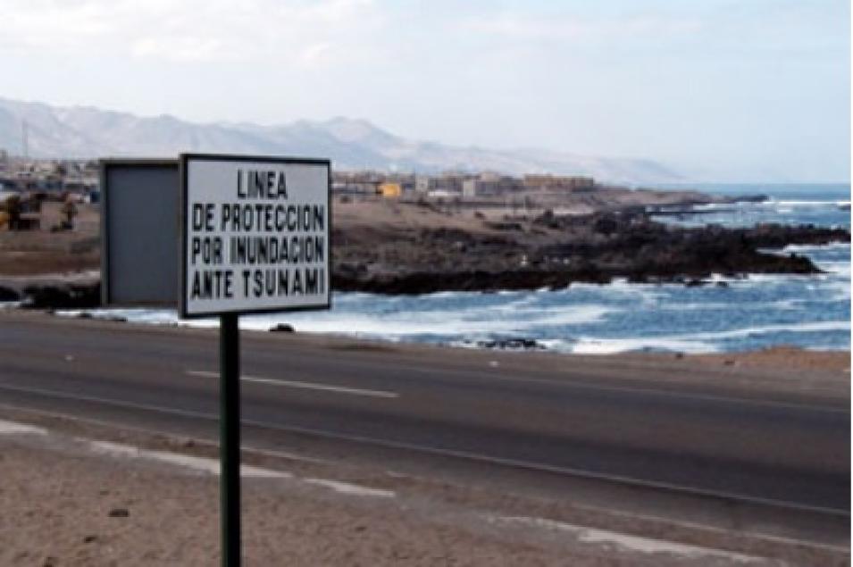
tsunami warning Antofagasta
This image shows a tsunami warning sign in the city of Antofagasta in northern Chile, which was shaken by a magnitude 8.0 earthquake on July 30, 1995. (Image courtesy of Mark Simons)

Still, Pritchard said, it's important to remember that volcanic eruptions and earthquakes can't be predicted. "Volcanoes have very different personalities," he said. "Sometimes they do things we expect, but sometimes they surprise us. Sometimes magma moves underneath the volcano, but it doesn't necessarily lead to an eruption."

Knowing precisely which volcanoes to monitor can help researchers concentrate their ground studies in the areas at most risk. An example of how effective monitoring can save lives came in June 1991 when seismic data revealed that earthquakes were occurring at Mount Pinatubo in the Philippines. The Philippine Air Force's Air Base command notified local towns that the volcano might erupt, and 60,000 people were evacuated. Officials estimate that 20,000 people would have died if the eruption alert had not been issued.

For the past year, Pritchard has applied InSAR data to earthquakes with the same striking results he observed with the volcanoes. "With a large earthquake -- a magnitude 7 or 8 -- it's no mystery that a fault slip occurred," he said. "But exactly which area slipped and where another slip might occur in the future aren't as apparent." And sometimes, the earth slips slowly with no quake at all, triggering Pritchard's newest questions: "Can a silent earthquake accelerate into a violent earthquake?"

In the Pacific Northwest, GPS recordings show that a silent earthquake occurs beneath Washington State and British Columbia about once every 14 months, but no one on the ground even notices it happening. Pritchard is looking for the same phenomena in the Andes where, unfortunately, there are few continuously operating GPS stations.

Since silent earthquakes may take days, weeks, or even months to occur, they don't send out seismic waves, Pritchard said. So, he watches them to try to learn how to assess potential hazards. "There appear to be some faults that never produce large earthquakes," he said. "And maybe there are also a few silent earthquakes that never evolve into a major event."

Pritchard and his colleagues sometimes joke about things seen in satellite images that don't actually appear on ground, like "the lost city of Atlantis." Some have suggested that the continent disappeared into Lake Titicaca in Bolivia, based on descriptions by Plato. But for Pritchard, the movements of the Earth hold plenty of fascination without lost cities.

"Some people claim to see evidence of Atlantis in satellite data," said Pritchard. "But if they saw the same area from the ground, they'd realize it's not Atlantis." But he does agree that observations from space often lead to discoveries that could take years to find from the ground alone, and he believes it's important to use both ground and remote sensing techniques.

"In satellite imagery, we get a bird's-eye view of where the deformation is happening," he said. "We spend most of our time looking at those images and using models to interpret the data, but we still like to get out in the field to see what's happening from the ground."

References

Pritchard, Matthew E. and Simons, M. 2004. An InSAR-based survey of volcanic deformation in the southern Andes. Geophysical Research Letters . 31, L15610, doi:10.1029/2004GL020545.

Pritchard, Matthew E. and Simons, M. 2004. Surveying volcanic arcs with satellite radar interferometry: the central Andes, Kamchatka, and beyond. GSA Today. 14 (8), 4-11.

For more information

NASA Alaska Satellite Facility Distributed Active Archive Center (ASF DAAC)

U.S. Geological Survey Earthquake Hazards Program

U.S. Geological Survey Volcano Hazards Program

About the remote sensing data used
Satellite SAR interferometry (InSAR) Global Positioning System (GPS) data
Parameter ground movement and deformation ground movement and deformation
DAAC NASA Alaska Satellite Facility Distributed Active Archive Center (ASF DAAC) ASF DAAC
Last Updated