In 1972, scientists eagerly awaited images from NASA Mariner 9 as it mapped the surface of Mars for the first time. The orbiter sent back thousands of images of craters, canyons, and fields of sand dunes. Succeeding NASA missions took more photos of the Red Planet over the next thirty-five years. But these missions yielded more images of unmoving landscapes. Although fascinating and a source of new research for many scientists, the images of these still landforms disappointed geomorphologists, who study land surfaces and the processes that shape them. “On Mars, we are always looking for signs of active surface processes like erosion, or evidence of wind and water—any sign of something happening on the planet today,” geologist Donald Hooper said.
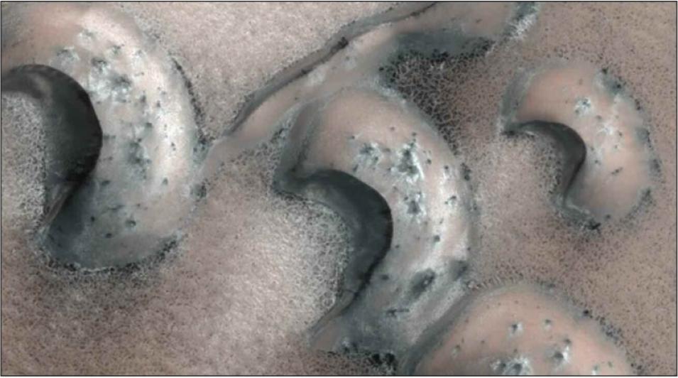
Then in 2008, researchers looked more closely at the images that the Mars Global Surveyor took of the planet’s north polar region, and found dunes that shrank or completely disappeared over three Martian years (six Earth years). Curiously, the surrounding dune field showed no other changes. “Since that discovery, scientists have wanted to know whether the surrounding dunes are also active,” Hooper said. With sparse data on Mars, scientists turned to sand dunes on Earth, to gain insight that would help them study and interpret dunes on Mars. They chose a location that is most similar to the north polar dune fields of Mars: the Great Kobuk Sand Dunes in Alaska.
A terrestrial analog
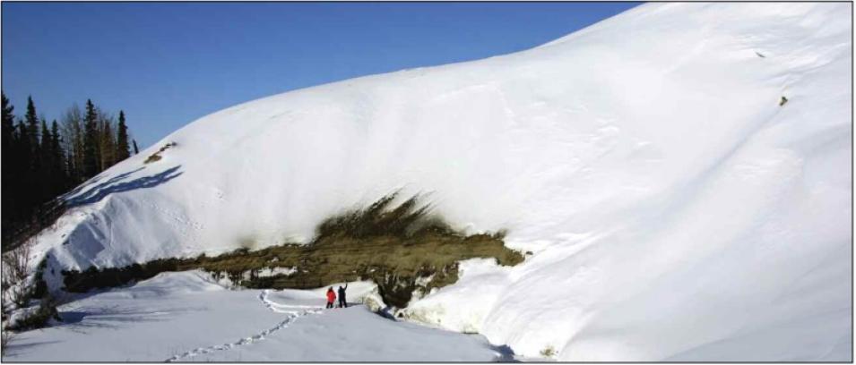
“This dune field is one of the few places on Earth where we can go and study an example of how the dunes probably are on Mars,” Hooper said. Scientists think that dune fields on Mars are locked in place somehow by frozen gases. “Because these dunes are indurated or cemented, it slows their migration rate,” Hooper said. Hydrogeologist Cynthia Dinwiddie, Hooper’s colleague at the Southwest Research Institute (SwRI), made the connection between Martian dunes and the Great Kobuk dunes. Dinwiddie said, “Dune fields in the polar regions of Mars are covered with carbon dioxide and water frost for three quarters of the Martian year. It got me thinking of Kobuk Valley in Alaska, where the dune system is covered with snow for three quarters of the year.”
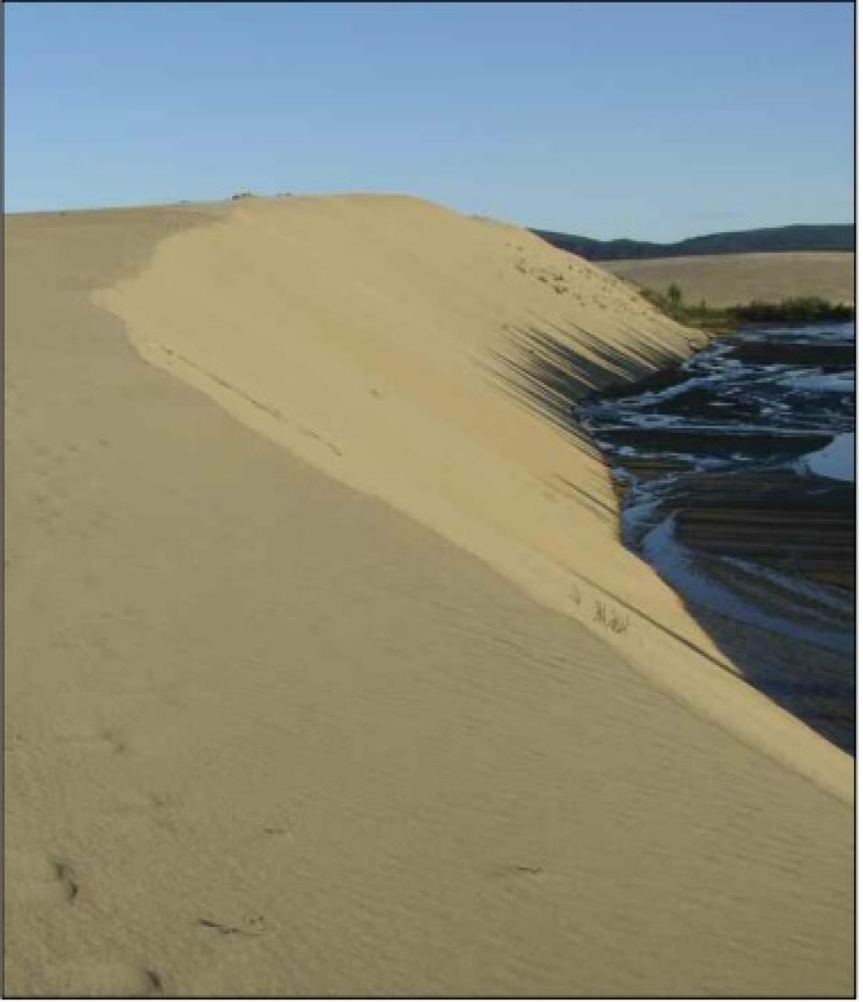
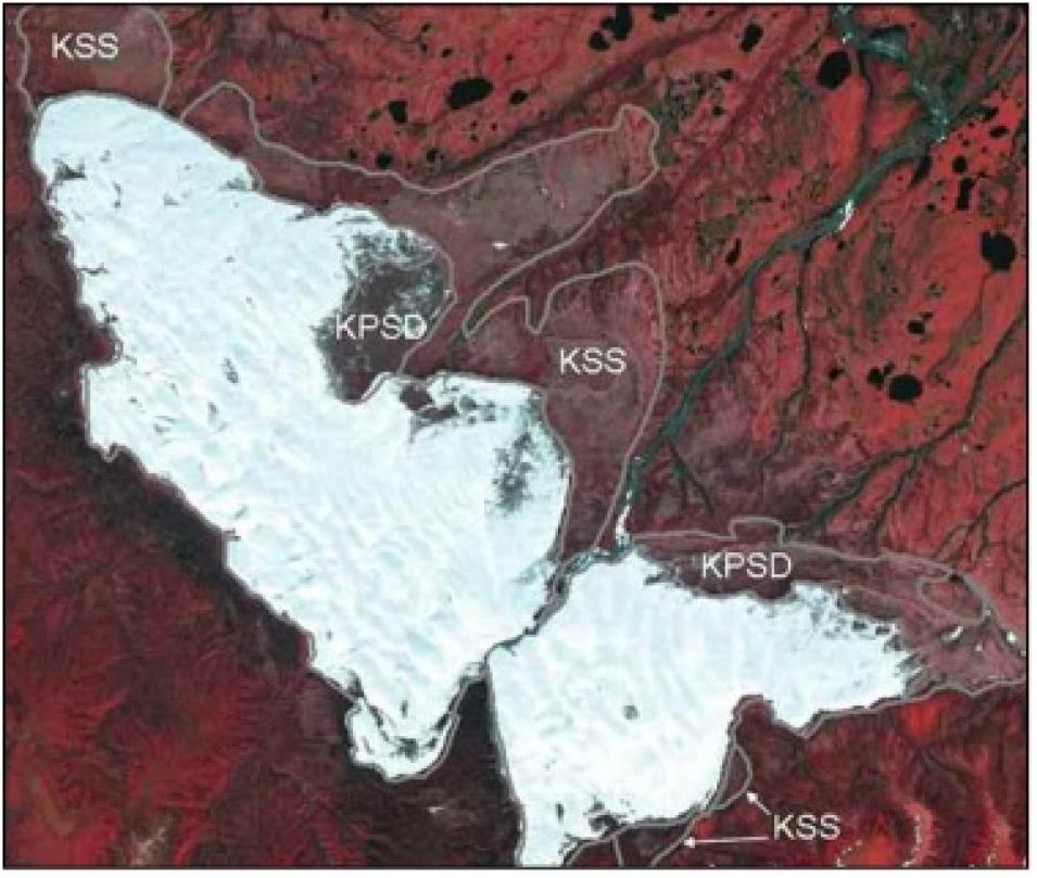
The Great Kobuk Sand Dunes is a butterfly-shaped dune system in northwestern Alaska, about sixty-five kilometers (forty miles) north of the Arctic Circle. Like most high-latitude, cold climate sand dunes, the Great Kobuk dunes move very slowly. Scientists believe that the dunes are slowed by the accumulation of snow and sand, and possibly by permafrost deep under the dune field. Although slow moving, most of the Great Kobuk dunes are classified as active, meaning the dunes still move, evolve, and are shaped by processes like wind and rain.
Reading the landscape
But what could an Alaskan dune field possibly reveal about dunes on another planet thirty-four million miles away? Hooper said, “Geomorphologists can look at the size and shape of dunes and the way they change or stay still, and be able to describe what kind of environment these dunes exist in.” A barchan dune, for example, is a crescent-shaped dune with arms or horns that point downwind. It is found in areas where wind flows from only one direction and where there is little or no vegetation. Because there is no vegetation to hold it down, a barchan dune will move across this desert, and it will not need a large supply of sand to invoke its migration. So, just looking at a barchan dune already gives a scientist wind direction, the presence or absence of vegetation, and sand supply—all important hints to the dunes’ environment.
“For Mars, the real interest in sand dunes is to find out just how alive the planet is,” Hooper said. “We know there’s wind on Mars, but we’re still trying to identify active surface processes. Being able to detect something like a dune moving, or a landslide on a steep escarpment would give us indicators that the planet is actively changing.”
To detect extremely slow sand dune movement on Mars, scientists need an efficient method to analyze thousands of large, high-resolution images. Dinwiddie said, “The resolution of the imagery for Mars is really good right now. Very recently, scientists have spotted movement of sand ripples on Mars. But researchers currently use brute force to identify movement—just looking at an image, then finding the next image of the same feature, and comparing the two.”
A Kobuk flip book
The team decided to look at all available satellite images of the Great Kobuk dunes. SwRI colleague Marius Necsoiu led the development of a more efficient method to measure subtle changes in sand dunes in Kobuk, with the hope of developing it further for Mars research. He said, “Because the Great Kobuk dunes were covered by snow and ice a good number of months each year, the snow-free images that our team could use were very few. And when you are trying to detect slow changes, you need data that represent a long period of time.”
To increase their image selection, the team looked at several sources of data. They started with optical satellite images taken in 2003 by the Advanced Spaceborne Thermal Emission and Reflection Radiometer (ASTER) sensor, flying on NASA's Terra satellite and obtained from NASA's Land Processes Distributed Active Archive Center (LP DAAC). “We then combined this with aerial photography taken by the U.S. Air Force and the U.S. Navy, in addition to images taken in 2008 by Spot Image Corporation,” Necsoiu said. Combining images taken by different sources and from different viewing angles posed its own challenges. The researchers needed to convert all the images to the same size and orientation to observe changes in the sand dunes. Like a child’s flip book that contains a series of pictures that are the same size but vary only gradually from one page to the next, the aerial images of the sand dunes had to be the same size and aligned the same way for the changes to appear accurately.
So Necsoiu and colleague Sebastien Leprince developed a method to co-register or align images at a high resolution, and to detect horizontal movement in the dunes. Dinwiddie said, “Marius came up with a more elegant way to find lateral changes in geomorphology. It has a real advantage over existing methods when you need to detect changes that are subtle, like changes within a year or over a season. It is also something that we hope to automate, so scientists can cover much wider areas of the planet.”
Liquid in the sand
The resulting map showed that the Great Kobuk dunes moved at a rate of 1.3 meters (4.3 feet) per year from 2003 to 2008. The researchers were able to plot out the directions these dunes were moving. Dinwiddie and her team also conducted field studies at the Great Kobuk dunes and stumbled on a surprising feature within the dune system. “Using a ground-penetrating radar, we found a groundwater aquifer very near the land surface all throughout the entire active dune system,” Dinwiddie said. “It caught us by surprise because we were there in March, after a long period of cold weather. We figured that any water within the dunes would be frozen, like permafrost, but instead we confirmed that the water was liquid by drilling several boreholes.”
The scientists think that snow cover and this liquid water within the sand are slowing the movement of the dune field. “Think about how sand castles are constructed with the right amount of sand and water. If you pour dry sand out of a bucket, it flows like a liquid,” Dinwiddie said. “Super-wet sand also behaves like a liquid. But moist sand enables you to build sand castles because it behaves like a solid. It will be resistant to wind action, and it’s not going to move very fast.” Could the slow movement of dunes on Mars also suggest the presence of water?
Hooper said, “Scientists have always been keen on following the water on Mars. We know that there is no surface water, but the thinking is that it may be below the surface. It may be locked into some of these dunes from rainfall from long ago, or from previous moisture patterns or river systems.” The team continues to be intrigued by what they are learning from Kobuk. “It’s really all about analogies,” Hooper said. “Kobuk could tell us what could be happening on Mars.”
References
Bourke, M.C., K.S. Edgett, and B.A. Cantor. 2008. Recent aeolian dune change on Mars. Geomorphology 94, doi: 10.1016/j.geomorph.2007.05.012.
Dinwiddie, C.L., McGinnis, R.N., D.E. Stillman, et al. 2010. Sand, wind, and ice: Mars analog aeolian studies at the Great Kobuk Sand Dunes, Alaska. In Proceedings from the Second International Planetary Dunes Workshop. http://www.lpi.usra.edu/meetings/dunes2010/pdf/2020.pdf.
Necsoiu, M., S. Leprince, D.M. Hooper, C.L. Dinwiddie, R.N. McGinnish, and G.R. Walter. 2009. Monitoring migration rates of an active subarctic dune field using optical imagery. Remote Sensing of Environment 113. doi:10.1016/j.rse.2009.07.004.
Silvestro, S., L.K. Fenton, and D.A. Vaz. 2010. Ripple migration and small modifications of active dark dunes in Nili Patera (Mars). In Proceedings of the Forty-first Lunar and Planetary Science Conference, Session 254. http://www.lpi.usra.edu/meetings/lpsc2010/pdf/1820.pdf.
For more information
NASA Land Processes Distributed Active Archive Center (LP DAAC)
Advanced Spaceborne Thermal Emission and Reflection Radiometer (ASTER)
Southwest Research Institute (SwRI)
About the remote sensing data used | ||
---|---|---|
Satellite | Terra | |
Sensor | Advanced Spaceborne Thermal Emission and Reflection Radiometer (ASTER) | |
Data set | ASTER L1A Reconstructed Unprocessed Instrument Data | |
Resolution | 15 meter (VNIR) | |
Parameters | Reflectance, digital elevation | |
DAAC | NASA Land Processes Distributed Active Archive Center (LP DAAC) |