NASA’s Worldview data visualization application has always been an easy way to interactively explore imagery created from data acquired by Earth observing satellites. A just-released Worldview update takes care of numerous bug fixes and introduces an exciting new feature: A Comparison button that makes it easier than ever to look at two images at the same time.
Previous Versions of Worldview Just Can't "Compare"
Along with comparing imagery from two different dates, the feature allows comparisons of two sets of imagery from the same date or even two sets of imagery from different dates. For more detailed information, check out the recent post on NASA's Global Imagery Browse Services (GIBS) blog.
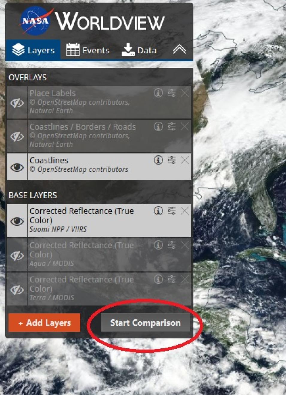
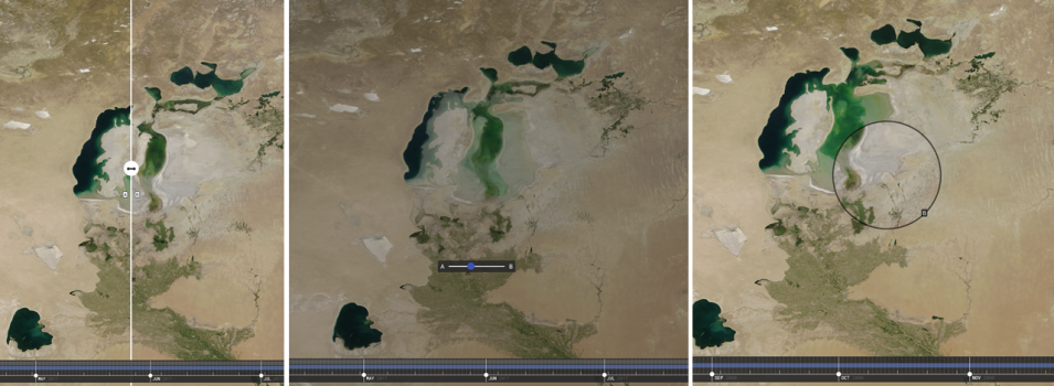
Enter the Worldview “Compare Mode” by clicking the “Start Comparison” button in the lower right corner of the Worldview control panel. This gives you three options for toggling between two images: swipe, opacity, or spy. “Swipe” is the default setting, and divides the Worldview screen into two halves representing the two images you want to compare: A (left side) and B (right side).
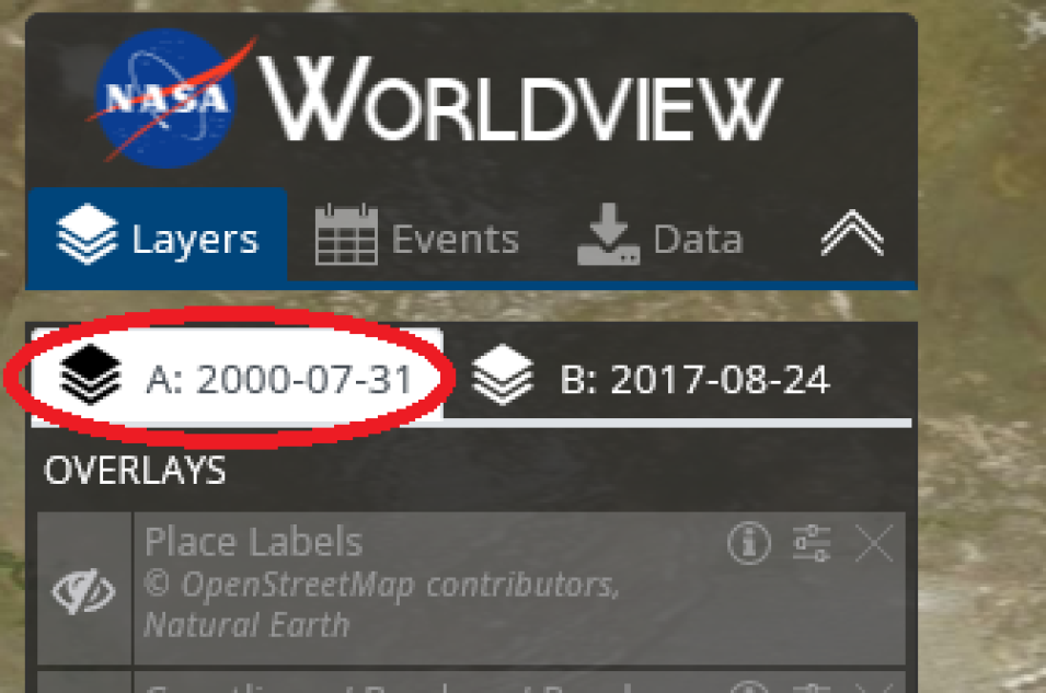
Let’s say you want to do a simple comparison to look at how much the Aral Sea has decreased in size between 2000 and 2017. The Aral Sea, which is located between Kazakhstan in the north and Uzbekistan in the south, was once one of the largest lakes in the world. Diversion of rivers feeding the lake during the 1960s caused the lake to dramatically shrink in size. Today, vast stretches of this formerly huge water body are now desert.
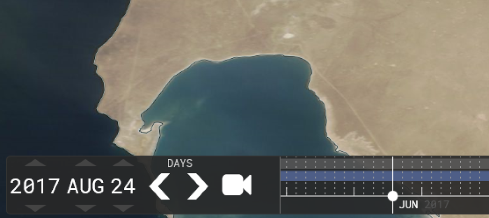
For our B-side image comparison, we’ll use an image of the lake acquired in 2017. In this example we’ll select a Terra MODIS true-color image from August 24, 2017. Click on the “B” tab to select it (the B tab turns white) and use the buttons on the date block (which is on the left side of the date slider at the bottom of the screen) to manually adjust the image date to “2017 August 24.”
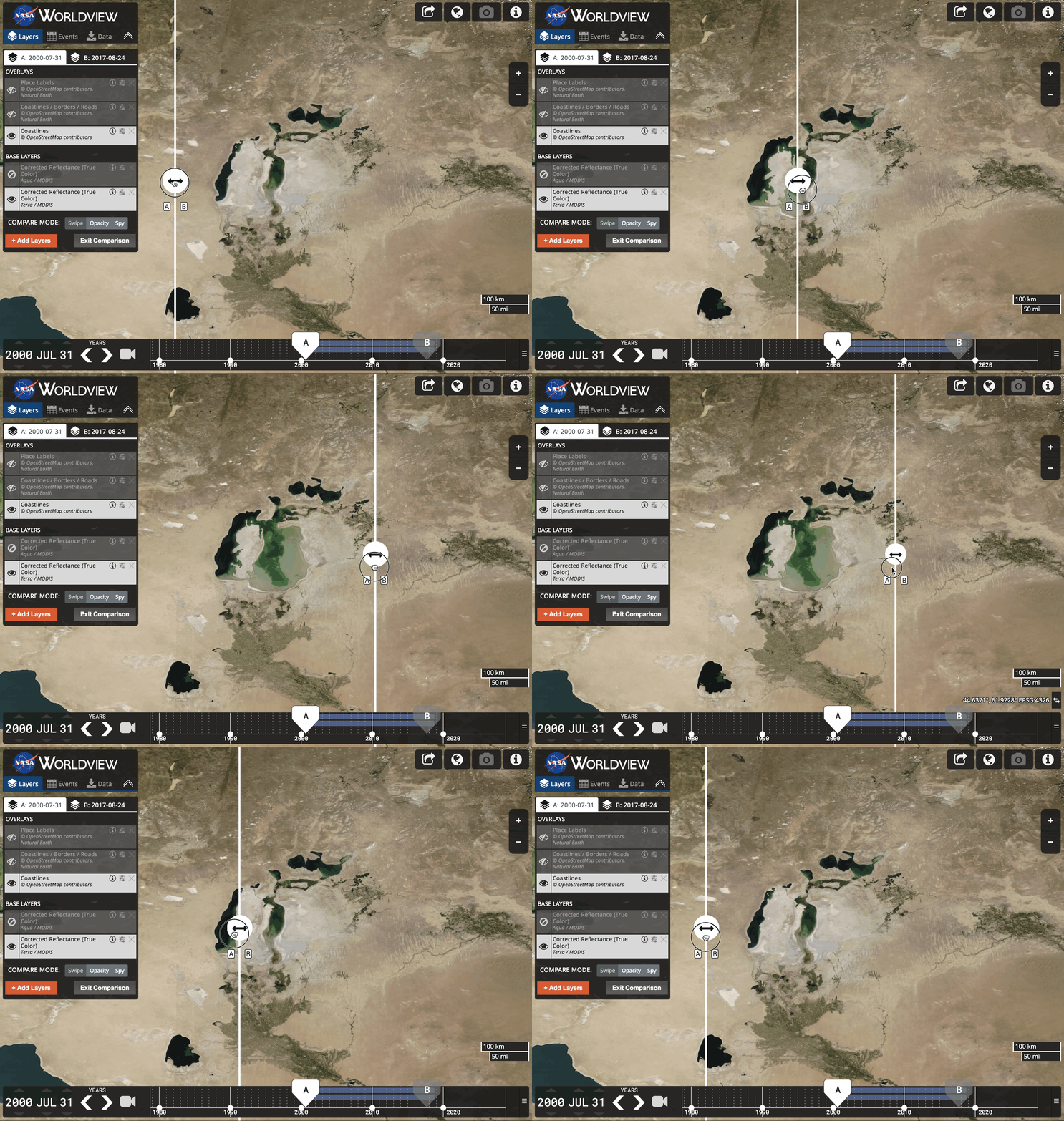
This animated GIF illustrates a swipe comparison of Aral Sea images from July 31, 2000 (left image) and August 24, 2017 (right image). Note that while it is possible to create animated GIFs of individual Worldview imagery, this ability is not yet available for use with the comparison feature. NASA Worldview graphic.
Another option is to use the “opacity” comparison button. This allows you to gradually fade from one image to another. The “spy” comparison option allows you to select either the “A” or “B” image to appear in a circular area that can be moved over the other image.
Imagery available in Worldview come from GIBS, which is part of NASA’s Earth Observing System Data and Information System (EOSDIS). GIBS provides quick access to more than 700 satellite imagery products covering every part of the world (including the poles). GIBS imagery can be interactively explored using Worldview or rendered in your own web client or GIS application using the GIBS API.
Examples of the swipe (left image), opacity (middle image), and spy (right image) comparison options using Terra MODIS true color images from July 31, 2000 (A image) and August 24, 2017 (B image). The opacity comparison (middle image) is shown in the middle of the image transition. Note the small “B” icon in the lower-right ring of the spy image (right image) indicating that the smaller circular “spy” image is the August 24, 2017 image. NASA Worldview images.
Check out the new Worldview comparison feature! While you’re in Worldview, be sure to explore some of the other features of this powerhouse application (like making animated GIFs of individual images or viewing MODIS global daily base map images dating back to 2000). See how easy it is using Worldview to explore your world, your way!
