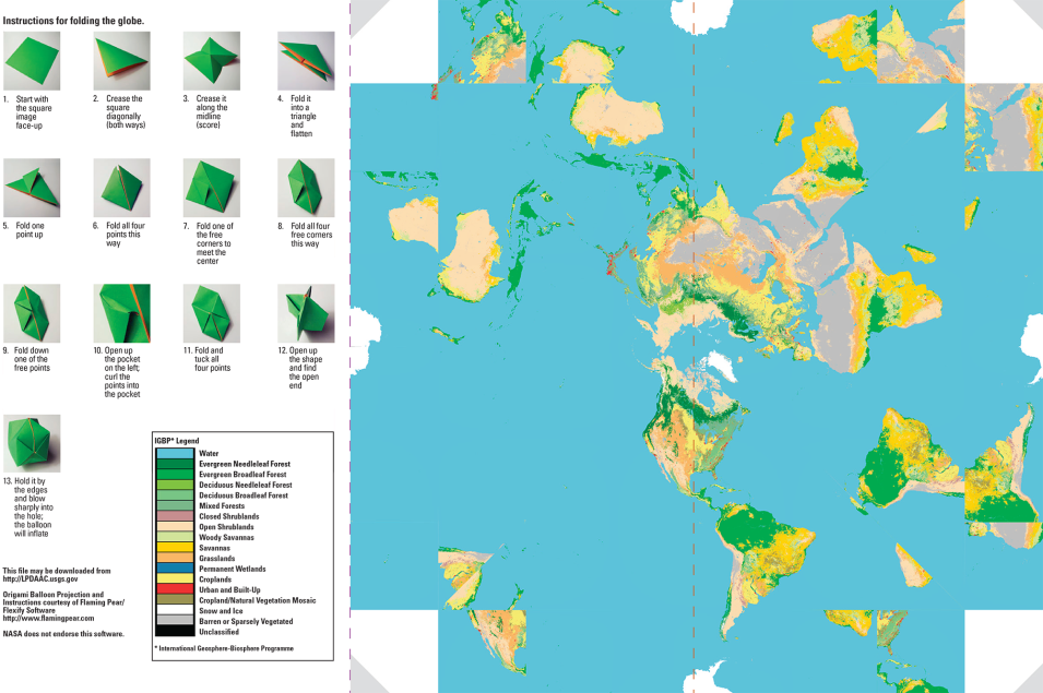
NASA's goal for Earth-Sun System science is to explore, discover, and understand the Earth and Sun as one system. NASA, working with its domestic and international partners, provides scientific data and analysis to advance our understanding of the Earth-Sun system and its response to natural and human-induced changes. Alteration of land cover from urbanization, deforestation, farming, and natural events (which include wildfires, vegetation succession, and flooding) can have a major impact on Earth's environment. Land cover data provide important information for resource management, policy making, geology, agrology, tourism, demography, sociology, forestry, and land development.
The data product used to create this origami globe is the Moderate Resolution Imaging Spectroradiometer (MODIS)/Terra Land Cover Type Yearly L3 Global 0.05 Deg CMG (MOD12C1). It illustrates the International Geosphere-Biosphere Programme (IGBP) land cover classification scheme for data collected throughout the year 2001.
