New NASA EMIT Data Tutorials: Working with Methane Data

New data tutorials are available for working with methane data from NASA's Earth Surface Mineral Dust Source Investigation (EMIT) mission.

Two new tutorials for using methane data from NASA's Earth Surface Mineral Dust Source Investigation (EMIT) are now available: Visualizing Methane Plumes Timeseries and Generating Methane Spectral Fingerprint. The tutorials show how to use Python-based Jupyter Notebooks to track methane plumes.

The tutorials are from the fourth EMIT data tutorial workshop hosted by NASA's Land Processes Distributed Active Archive Center (LP DAAC) and NASA's Jet Propulsion Laboratory (JPL) on March 14, 2024. The workshop was part of a series that began in 2023 to introduce data users to EMIT data products.
Image
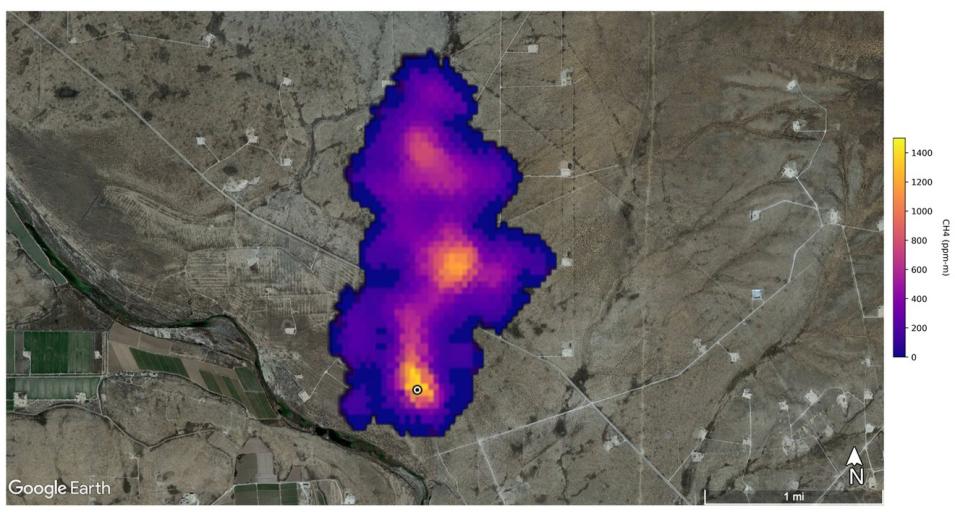
Purple and orange/yellow colors in this image created from EMIT data indicate the presence of  a methane (CH4) plume approximately 2 miles (3 kilometers) long detected southeast of Carlsbad, New Mexico, USA. Orange and red colors indicate higher concentrations of methane. Credit: NASA/JPL-Caltech.

Launched on July 14, 2022, and installed on the International Space Station, the primary mission of EMIT is to determine sources of dust in the atmosphere. EMIT data also are being used to detect the presence of carbon dioxide and methane super emitters.

Explore EMIT Data and Resources