N: 90 S: -90 E: 180 W: -180
Description
The MOD09GA Version 6 data product was decommissioned on July 31, 2023. Users are encouraged to use the MOD09GA Version 6.1 data product.
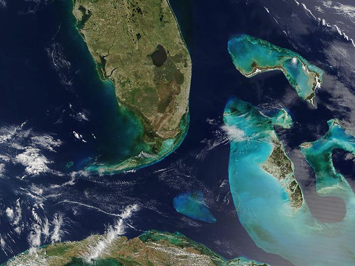
The MOD09GA Version 6 product provides an estimate of the surface spectral reflectance of Terra Moderate Resolution Imaging Spectroradiometer (MODIS) Bands 1 through 7, corrected for atmospheric conditions such as gasses, aerosols, and Rayleigh scattering. Provided along with the 500 meter (m) surface reflectance, observation, and quality bands are a set of ten 1 kilometer (km) observation bands and geolocation flags. The reflectance layers from the MOD09GA are used as the source data for many of the MODIS land products.
Known Issues
- Striping due to a dead detector is noticeable for bands 5, 6, and 7 in scenes acquired February 24 through October 31, 2000. Corrections were implemented to reduce the striping in data acquired after November 1, 2000. Users should always check the band quality for dead detectors even though reflectance values may be in the valid range.
- The Collection 6 MODIS Land Surface Reflectance product (MOD09) may incorrectly flag retrievals as ‘High Aerosol’ over brighter surfaces and at higher view angles. This will impact the downstream MODIS BRDF/Albedo (MCD43) and Vegetation Index (MOD13 and MYD13) data products which use the aerosol quantity flag to screen out high aerosol values.
- Corrections were implemented in Collection 6.1 reprocessing.
- For complete information about known issues please refer to the MODIS/VIIRS Land Quality Assessment website.
Version Description
Product Summary
Citation
Citation is critically important for dataset documentation and discovery. This dataset is openly shared, without restriction, in accordance with the EOSDIS Data Use and Citation Guidance.
Copy Citation
File Naming Convention
The file name begins with the Product Short Name (MOD09GA) followed by the Julian Date of Acquisition formatted as AYYYYDDD (A2002281), the Tile Identifier which is horizontal tile and vertical tile provided as hXXvYY (h33v11), the Version of the data collection (006), the Julian Date and Time of Production designated as YYYYDDDHHMMSS (2015151071841), and the Data Format (hdf).
Documents
USER'S GUIDE
ALGORITHM THEORETICAL BASIS DOCUMENT (ATBD)
PRODUCT QUALITY ASSESSMENT
Dataset Resources
Publications Citing This Dataset
Variables
Variables are a set of physical properties whose values determine the characteristics or behavior of something. For example, temperature and pressure are variables of the atmosphere. Parameters and variables can be used interchangeably. Variable level attributes provide individual information for each variable.
The Name in this table is the variable name. Fill value indicates missing or undefined data points in a variable. Valid range is the range of values the variable can store. Scale factor is used to increase or decrease the size of an object and can be used to correct for distortion. For questions on a specific variable, please use the Earthdata Forum.
| Name Sort descending | Description | Units | Data Type | Fill Value | Valid Range | Scale Factor |
|---|---|---|---|---|---|---|
| gflags_1 | Geolocation flags | Bit Field | uint8 | 255 | 0 to 248 | N/A |
| granule_pnt_1 | Granule pointer | N/A | uint8 | 255 | 0 to 254 | N/A |
| iobs_res_1 | Observation number | N/A | uint8 | 255 | 0 to 254 | N/A |
| num_observations_1km | Number of observations within a pixel | N/A | int8 | -1 | 0 to 127 | N/A |
| num_observations_500m | Number of observations per 500m pixel | N/A | int8 | -1 | 0 to 127 | N/A |
| obscov_500m_1 | Observation coverage | Percent | int8 | -1 | 0 to 100 | 0.01 |
| orbit_pnt_1 | Orbit pointer | N/A | int8 | -1 | 0 to 15 | N/A |
| QC_500m_1 | Surface Reflectance 500m Quality Assurance | Bit Field | uint32 | 787410671 | 0 to 4294966019 | N/A |
| q_scan_1 | 250m scan value information | N/A | uint8 | 255 | 0 to 254 | N/A |
| Range_1 | Distance to sensor | Meters | uint16 | 0 | 27000 to 65535 | 25 |
| SensorAzimuth_1 | Azimuth angle to sensor | Degree | int16 | -32767 | -18000 to 18000 | 0.01 |
| SensorZenith_1 | Zenith angle to sensor | Degree | int16 | -32767 | 0 to 18000 | 0.01 |
| SolarAzimuth_1 | Azimuth angle to sun | Degree | int16 | -32767 | -18000 to 18000 | 0.01 |
| SolarZenith_1 | Zenith angle to sun | Degree | int16 | -32767 | 0 to 18000 | 0.01 |
| state_1km_1 | 1km Reflectance Data State QA | Bit Field | uint16 | 65535 | 0 to 57335 | N/A |
| sur_refl_b01_1 | Surface Reflectance for Band 1 | N/A | int16 | -28672 | -100 to 16000 | 0.0001 |
| sur_refl_b02_1 | Surface Reflectance for Band 2 | N/A | int16 | -28672 | -100 to 16000 | 0.0001 |
| sur_refl_b03_1 | Surface Reflectance for Band 3 | N/A | int16 | -28672 | -100 to 16000 | 0.0001 |
| sur_refl_b04_1 | Surface Reflectance for Band 4 | N/A | int16 | -28672 | -100 to 16000 | 0.0001 |
| sur_refl_b05_1 | Surface Reflectance for Band 5 | N/A | int16 | -28672 | -100 to 16000 | 0.0001 |
| sur_refl_b06_1 | Surface Reflectance for Band 6 | N/A | int16 | -28672 | -100 to 16000 | 0.0001 |
| sur_refl_b07_1 | Surface Reflectance for Band 7 | N/A | int16 | -28672 | -100 to 16000 | 0.0001 |
