We are in the process of migrating all NASA Earth science data sites into Earthdata from now until end of 2026. Not all NASA Earth science data and resources will appear here until then. Thank you for your patience as we make this transition.
Read about the Web Unification Project
ABI Resources
Earthdata resources for users working with NASA’s Advanced Baseline Imager (ABI) include tutorials and other learning resources, news announcements such as instrument updates and data releases, user guides and related documents, and frequently asked questions.
ABI Learning Resources

This webinar introduces the Geostationary Earth Orbit (GEO)-Low-Earth Orbit (LEO) Dark Target Aerosol data product suite and shows how to find, access, and download the data.
Webinar
May 16, 2024

NASA GLOBE Clouds is an international citizen science program that collects cloud observations from participants around the world and compares them with satellite data. Learn more about the benefits and limitations of this citizen science data for scientific inquiry.
Webinar
April 15, 2022
View examples of Worldview embedded into a webpage, StoryMap, or other web-based product.
Tutorial
Jan. 4, 2022

Join us to learn how to use NASA’s Worldview, an imagery mapping and visualization tool that provides access to over 900 data imagery layers, many of which are available within hours, even minutes, to explore Earth’s interconnected processes and events.
Webinar
May 26, 2021

This ARSET training covers the use of remote sensing in determining and explaining urban heat islands, and ways to mitigate the effects.
Training
Nov. 10-24, 2020

This ARSET training introduces satellites with a high temporal resolution for air quality applications.
Training
Sept. 4-25, 2018
SHOWING 6 OF 6

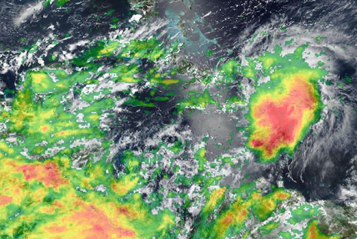
Image captured April 8, 2024, at 1:40 p.m., EDT, by the Advanced Baseline Imager (ABI) instrument aboard the GOES-East satellite.
Worldview Image of the Week
April 11, 2024

The Geostationary Earth Orbit (GEO) – Low-Earth Orbit (LEO) Dark Target Aerosol product suite enables users to track rapid changes and movements in smoke and dust plumes that can severely impact air quality.
News
March 19, 2024

IMPACT members led a workshop on best practices for training machine learning models on high performance computing workstations and using cloud technologies to infer from the trained models.
Blog
Dec. 7, 2023
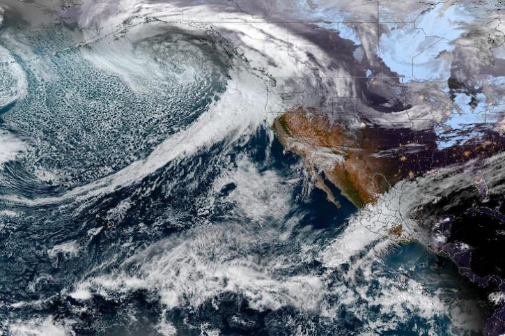
Image captured on Dec 4, 2023, by the ABI instrument aboard the GOES-West satellite.
Worldview Image of the Week
Dec. 7, 2023
SHOWING 4 OF 35
Frequently Asked Questions
Earthdata Forum
Our online forum provides a space for users to browse thousands of FAQs about research needs, data, and data applications. You can also submit new questions for our experts to answer.
Submit Questions to Earthdata Forumand View Expert Responses