We are in the process of migrating all NASA Earth science data sites into Earthdata from now until end of 2026. Not all NASA Earth science data and resources will appear here until then. Thank you for your patience as we make this transition.
Read about the Web Unification Project
GMI Resources
Read the latest Global Precipitation Measurement (GPM) Microwave Imager (GMI) news and access learning resources designed to help you optimize your Earth science research.
GMI Learning Resources

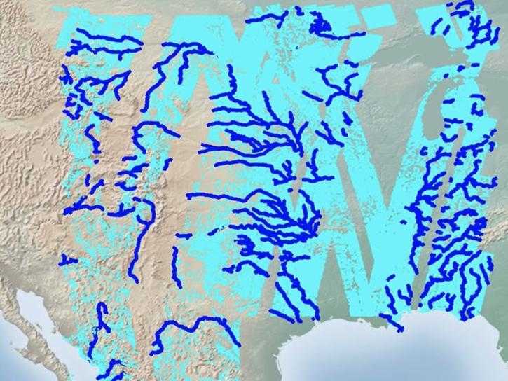
Users of NASA’s precipitation and land data assimilation products converted liquid precipitation rate to snowfall rate and snow depth using snow-to-liquid ratios.
Data in Action
Jan. 30, 2026

The Emergency Environmental Health Dashboard helped local communities assess water quality risks and infrastructure damage following Hurricane Helene and Tropical Storm Chantal.
Data in Action
Nov. 18, 2025
Follow this step-by-step tutorial to upload data into popular and versatile Geographic Information Systems (GIS) programs.
Tutorial
Nov. 17, 2025
This ARSET training teaches participants how satellite-based Earth observations can inform landslide science and disaster planning.
Training
March 11-18, 2025
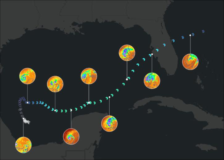
Join us on January 29 at 2PM ET (-05:00 UTC) to learn how to access and use MERRA-2, GPM, TROPICS, and LDAS data provided by NASA's Goddard Earth Sciences Data and Information Services Center (GES DISC) to investigate Hurricane Milton's milestones.
Webinar
Jan. 10, 2025
Join NASA scientists and other decision-makers on Thursday, April 11, to explore the many ways NASA Earth science data are helping us to better understand and protect Earth—and how you can make a positive difference in improving life on our planet.
Webinar
March 27, 2024

This webinar delves into the use of public Zarr store and cloud computing to investigate extreme precipitation events.
Webinar
Oct. 13, 2023

This advanced-level training focuses on using remote sensing observations for monitoring post-fire impacts on watershed health.
Training
July 6-13, 2023
SHOWING 8 OF 29

Who uses NASA Earth science data? Dr. Rachel Albrecht, to pinpoint global lightning hotspots.
Data User Story
April 20, 2021

Who uses NASA Earth science data? Dr. Pierre Kirstetter, for improving our understanding of precipitation and flooding.
Data User Story
April 20, 2021
Learning how terrain shapes storms is no walk in the park.
Feature Article
April 19, 2021

Researchers aim a barrage of sensors at nature's most enduring heiroglyphs.
Feature Article
April 19, 2021
SHOWING 4 OF 25
Frequently Asked Questions
Earthdata Forum
Our online forum provides a space for users to browse thousands of FAQs about research needs, data, and data applications. You can also submit new questions for our experts to answer.
Submit Questions to Earthdata Forumand View Expert Responses