We are in the process of migrating all NASA Earth science data sites into Earthdata from now until end of 2026. Not all NASA Earth science data and resources will appear here until then. Thank you for your patience as we make this transition.
Read about the Web Unification Project
Suomi NPP Resources
Suomi NPP News
View All News
Filters

Base image captured on Mar 11, 2022, by the VIIRS instrument, aboard the joint NASA/NOAA Suomi NPP satellite overlaid with Precipitation Rate from IMERG.
Worldview Image of the Week
May 18, 2022

Image captured on Feb 22, 2022, by the VIIRS instrument aboard the joint NASA/NOAA Suomi NPP satellite.
Worldview Image of the Week
May 18, 2022

Image captured on Feb 5, 2022 by the VIIRS instrument aboard the joint NASA/NOAA Suomi NPP satellite.
Worldview Image of the Week
May 18, 2022

Image captured on Apr 10, 2022 by the VIIRS instrument aboard the joint NASA/NOAA Suomi NPP satellite.
Worldview Image of the Week
May 18, 2022
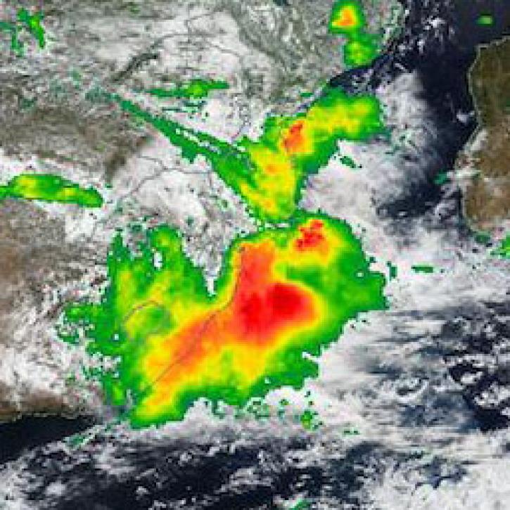
IMERG Precipitation Rate from Apr 11, 2022.
Worldview Image of the Week
May 18, 2022

This Earth Day we invite you to explore global, full-resolution NASA Earth science imagery to see volcanoes erupting, wildfires spreading, tropical cyclones forming, and city lights illuminating. With NASA Worldview, you can also take a snapshot, create an animated GIF, or compare imagery from two dates to view changes over time.
Feature Article
May 17, 2022
Image captured on Jan 22, 2022 by the VIIRS instrument aboard the joint NASA/NOAA Suomi NPP satellite.
Worldview Image of the Week
May 17, 2022

Image captured on May 9, 2022 by the VIIRS instrument aboard the joint NASA/NOAA Suomi NPP satellite.
Worldview Image of the Week
May 17, 2022
SHOWING 8 OF 332
Frequently Asked Questions
Earthdata Forum
Our online forum provides a space for users to browse thousands of FAQs about research needs, data, and data applications. You can also submit new questions for our experts to answer.
Submit Questions to Earthdata Forumand View Expert Responses