We are in the process of migrating all NASA Earth science data sites into Earthdata from now until end of 2026. Not all NASA Earth science data and resources will appear here until then. Thank you for your patience as we make this transition.
Read about the Web Unification Project
NSITE News
Articles, resources, and announcements from NASA's Satellite Needs Working Group (SNWG) Implementation TEam (NSITE).
Filters

Several pollutants measured by TEMPO are available as ArcGIS image services, including nitrogen dioxide vertical column troposphere, formaldehyde vertical column, ozone total column, and cloud fraction.
News
April 1, 2026
Join the NASA Satellite Needs Working Group Implementation Team (NSITE) for a virtual workshop showcasing the Harmonized Landsat and Sentinel-2 (HLS) Solution.
Event
March 26, 2026

New SWOT L4 river water flow and quality estimates support water resources management, extremes forecasting, and science research.
News
Jan. 16, 2026

Image captured on December 18, 2025, by the C-SAR instrument aboard ESA's Sentinel-1A platform.
Worldview Image of the Week
Jan. 2, 2026

Harmonized Landsat and Sentinel-2 (HLS) image captured on December 1, 2025, by the OLI instrument aboard the Landsat 8 platform.
Worldview Image of the Week
Dec. 12, 2025

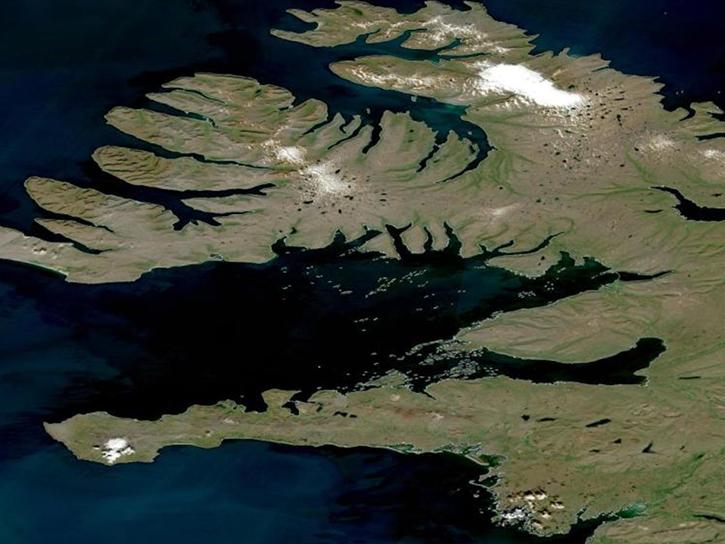
Harmonized Landsat and Sentinel-2 (HLS) image captured on November 9, 2025, by the MSI instrument aboard the Sentinel-2B platform.
Worldview Image of the Week
Nov. 20, 2025
The addition of HLS data to Azure provides a foundation for next-generation Earth observation capabilities.
Blog
Sept. 30, 2025

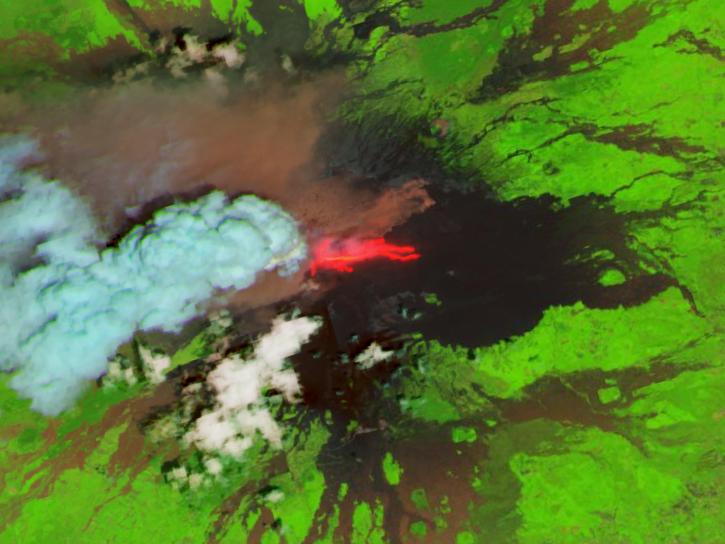
Harmonized Landsat Sentinel-2 (HLS) image captured on August 30, 2025, by the OLI instrument aboard the Landsat 8 platform.
Worldview Image of the Week
Sept. 4, 2025
SHOWING 8 OF 98