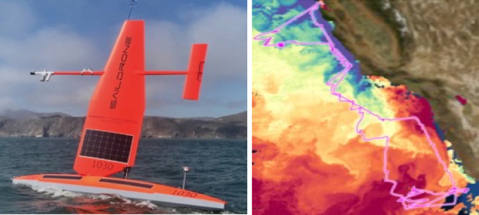
A unique unmanned surface vehicle (USV) called Saildrone conducted a two-month cruise during the spring of 2018 along the California coast and Baja Peninsula collecting data about upper ocean physics and ecology. Data from the 60-day Saildrone Baja Field Campaign are now available through NASA’s Physical Oceanography Distributed Active Archive Center (PO.DAAC).
Saildrone Baja Field Campaign Data Available at PO.DAAC
Saildrone generates power through solar panels mounted on its 23-foot-long float and 20-foot-tall “sail.” The pink line on the map at right is the Saildrone track during the Baja campaign; colors indicate sea surface temperature (SST): yellow, orange, and red indicate warmer temperatures (such as along the Baja Peninsula in the south); blue and green indicate cooler temperatures (such as along the California coast in the north). Image: PO.DAAC.
Saildrone is a remotely-controlled platform that can be configured with a variety of instruments to collect data over long distances on deployments lasting up to 12 months and relay live data wirelessly to research teams. During the Baja Field Campaign, Saildrone collected data about sharp ocean water temperature boundaries along the U.S. West Coast and Mexico’s Baja Peninsula, where very cold water mixes with warm water. In addition, Saildrone explored air-sea interactions along its deployment track, with an emphasis near San Francisco, CA, and at Guadalupe Island off the west coast of the Baja Peninsula. Saildrone data also helped validate data from ocean buoys and satellite-based sensors, including sea surface temperature, sea surface salinity, and chlorophyll-a concentrations.
PO.DAAC is the NASA Earth Observing System Data and Information System (EOSDIS) Distributed Active Archive Center (DAAC) responsible for data and related information pertaining to the physical processes and conditions of the global oceans, including measurements of ocean winds, temperature, topography, salinity, circulation and currents, and sea ice. PO.DAAC is located at NASA’s Jet Propulsion Laboratory in Pasadena, California.
Explore Saildrone Baja Field Campaign data: doi: 10.5067/SDRON-SURF0
