More AGU Previews

Another set of previews of the presentations that IMPACT team members will be delivering at #AGU20.
author-share

The American Geophysical Union's #AGU20 Fall Meeting is just around the corner. We have another set of previews of the presentations that IMPACT team members will be delivering at #AGU20.

Pipeline for Applications-Based Data Discovery
IN047 — Recent Advancements in Earth Science Data Discovery and Metadata Stewardship Practices

From disaster response and mitigation to monitoring water quality or protecting wildlife habitat, satellite Earth observation data can be applied in countless ways to meet pressing needs and benefit society. The crucial first step toward successful data application is data discovery. Potential users often know exactly what data they need — what Earth feature or phenomenon they need to observe, how frequently and at what resolution or level of accuracy — but may still struggle to discover the existing observations that best meet their needs.

Image
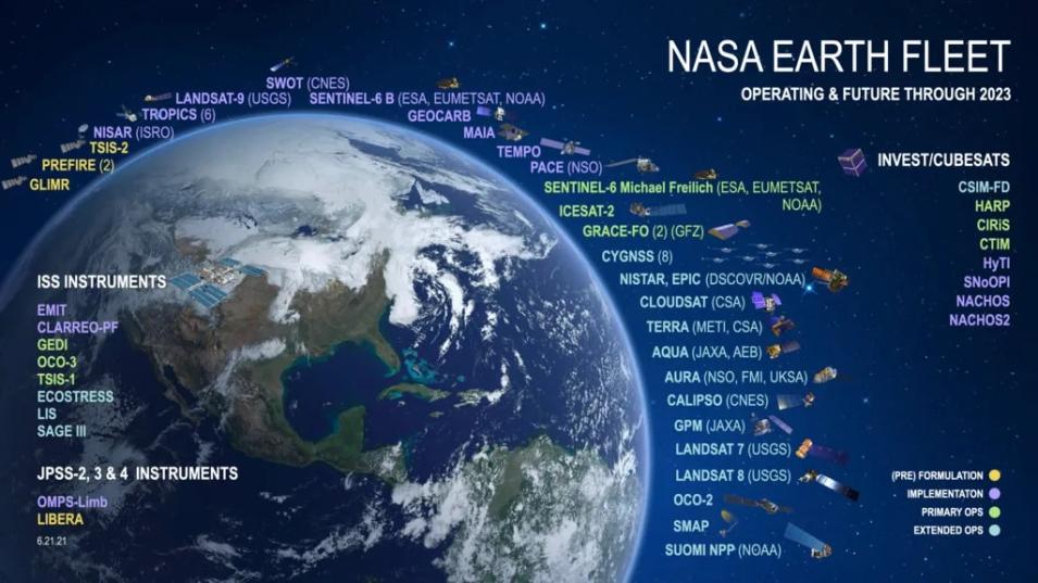
NASA and partner Earth observing satellites, including future missions. Credit: NASA

Katrina Virts will present a pipeline developed to connect applications-based users to specific data collections within NASA’s Earth observation program of record that are highly relevant to their data needs. This pipeline combines available information on satellite and instrument measurement characteristics with an innovative approach that identifies specific Earth science datasets that are most relevant to the feature or phenomenon of interest. We demonstrate how this pipeline enables users to query and discover the data collections within NASA’s Earth observation program of record that address their measurement needs.

Automated Contrail Detection on Terra MODIS Imagery
IN011 — End-to-End Machine Learning for Earth Science: Tools, Frameworks, and Practical Applications II

Contrails are vapor condensation trails created by the engine exhausts of aircrafts which can persist in the troposphere from minutes to several hours. Recent estimates suggest that approximately 50% of global warming caused by aviation emissions is a result of these artificial clouds and if left unchecked, the aviation industry may contribute up to 15% of all anthropogenic warming in the next three decades. This shows the importance of detecting contrails in satellite imagery for large-scale climate-related analyses. Manually identifying contrails is extremely time consuming and impractical, making automated contrail detection of significant importance.

Image
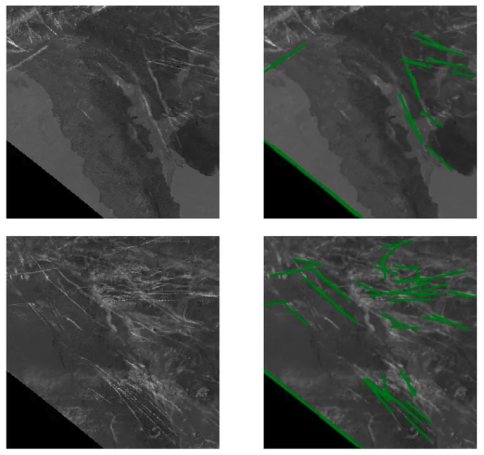
Contrail detections over Los Angeles


Ankur Shah presents an algorithm for automatic detection of contrails in the Terra Moderate Resolution Imaging Spectroradiometer (MODIS) Level 1B data. The algorithm, a form of unsupervised detection, implements a combination of thresholding, phase congruency, and Hough transforms to detect contrails in Brightness Temperature Difference (BTD) images created by subtracting Band 30 (11 um) from Band 31 (12 um) of the Terra satellite. Long, solid, and thin contrails are detected most easily with this algorithm. Due to the uneven nature of contrails however, some may be curved, diffused, or broken. Such contrails are not detected. This work presents a modular algorithm which may enable rapid automatic detection of most contrails on satellite imagery.

Enabling Discovery and Access of Commercial Small Satellite Data
IN004 — Developing Innovative Tools and Services to Enable Data Use Across Broad User Communities II

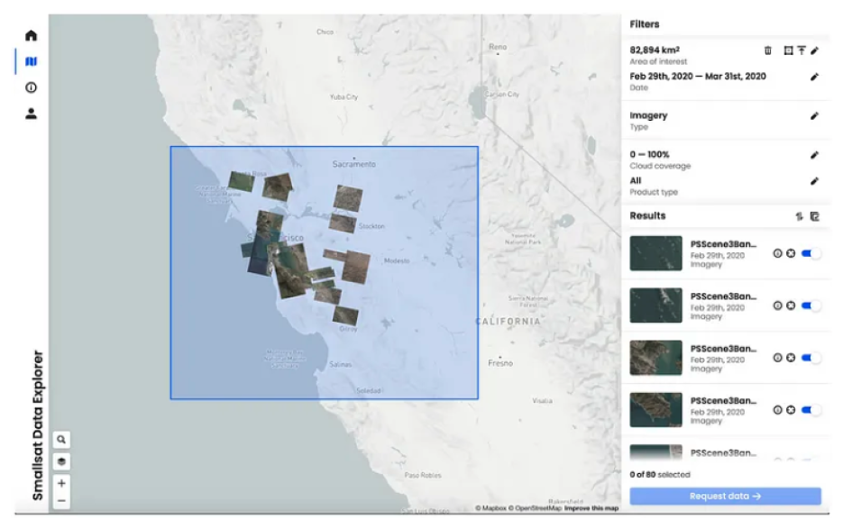
Initiated in 2017, NASA's Commercial Smallsat Data Acquisition (CSDA) Program identifies, evaluates, and acquires data from commercial satellite companies that complement NASA’s Earth science missions and research goals. In support of these activities, the CSDA Program establishes scalable, efficient, continuous, and repeatable processes to manage all data purchased from commercial vendors. This includes providing data curation, archive, discovery, and distribution services of acquired commercial data products for the NASA research community. However, significant data stewardship challenges arise in acquiring and managing disparate data and sources. The program seeks to support the search, discovery, and distribution expectations of the existing community while developing innovative data management capabilities with user interfaces to actively identify and engage new science users and communities.
Image
The initial release of the Smallsat Data Explorer is available.


Aaron Kaulfus will highlight the ongoing efforts of the CSDA Program to support NASA’s current and future science goals, discuss the data stewardship efforts and challenges faced by the program, and underscore the technological solutions and tools used to overcome these issues.

More information about IMPACT can be found at NASA Earthdata and the IMPACT project website.

Last Updated