Introduction
Many landscapes define the Earth’s surface, from bleak sandy deserts to rolling green hills. Scientists use both bidirectional reflectance distribution function (BRDF), and albedo to better understand the topography and vegetation cover of these surfaces. BRDF and albedo provide information about solar energy output. Identifying how outgoing solar energy scatters can help scientists to better understand the dynamics of a ground surface, and can help the human population better prepare for events such as wind erosion. Wind erosion affects air quality, leads to soil loss, and stunts anthropogenic and natural vegetation growth, which can be vital for human populations.
BRDF values are estimates of the directions that solar energy takes (scattering) as it reflects off Earth’s surface. These values are used to estimate albedo, which is the proportion of solar energy that is reflected from the Earth’s surface versus the energy that is absorbed. Sun and others (2017) state that remote sensing is the best way to observe these values over time, and at a global scale.
Instruments and Techniques Used
This study uses BRDF and albedo data products derived from measurements collected by the Moderate Resolution Imaging Spectroradiometer (MODIS) Version 6, located onboard NASA’s Terra and Aqua platforms, to observe how topography and vegetation cover can influence wind erosion in Australia.
Major Findings
Chappell and others (2017) explain that flat surface areas produce a mirror BRDF reflection, meaning light is scattered in one direction. Rougher surfaces have crevasses that scatter light in many directions as it reflects back into the atmosphere. Conversely, the crevasses in rough surfaces halt the forces of wind.
In Australia, flat surfaces such as deserts, and areas that have been “clear-cut” from human activity, cannot absorb wind as well as rougher surfaces, thus leaving these areas vulnerable to wind erosion and its impacts on the human population. To prevent wind erosion events from occurring in the future, ground cover can be maintained to promote a “rougher” ground surface. Li and others (2017) report that MODIS BRDF/albedo data provide frequent observations that can be valuable when observing short- and long-term wind erosion, finding that environmental variables such as temperature and precipitation affect vegetation cover.
MODIS BRDF and albedo data can also be used alongside spectral indices such as Normalized Difference Vegetation Index (NDVI) to estimate the greenness of vegetation cover. Light surfaces, such as deserts or snow typically reflect more solar energy. Instead of measuring the “greenness” of vegetation, such as NDVI, MODIS BRDF and albedo measure the reflection of solar energy and provide scientists with an understanding of vegetation structure, which may be more relatable to non-green areas, such as deserts in Australia.
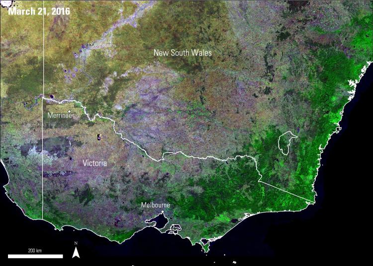
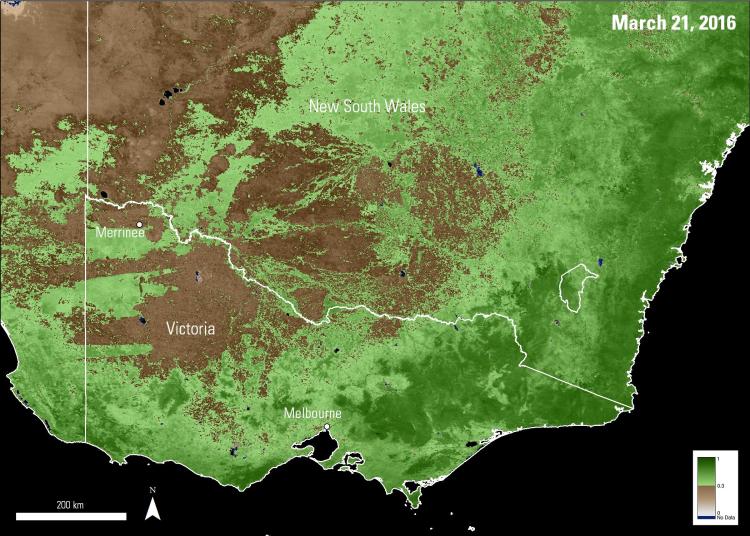
Images below show a portion of southeastern Australia, comparing the daily composite Terra and Aqua Combined MODIS 500 meter resolution BRDF Measurements data (MCD43A1) (left) to the 16-day composite Terra MODIS 500 meter resolution NDVI data (MOD13A1) (right). These images allow users to better understand the topography and vegetation cover of the area, in efforts to predict and to prevent wind erosion events in the future.

