Delivery of Suomi National Polar-orbiting Partnership (Suomi NPP) satellite data products will cease on November 1, 2026. Data users should transition now to alternative products from NOAA-21 and NOAA-20.
Suomi NPP data announcement
- Launch ArcPro and open Catalog window.
- Create New Map
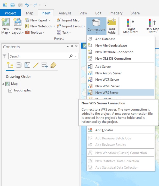
- Add New WFS Server Connection
Image
Step 2 - Establish Connection
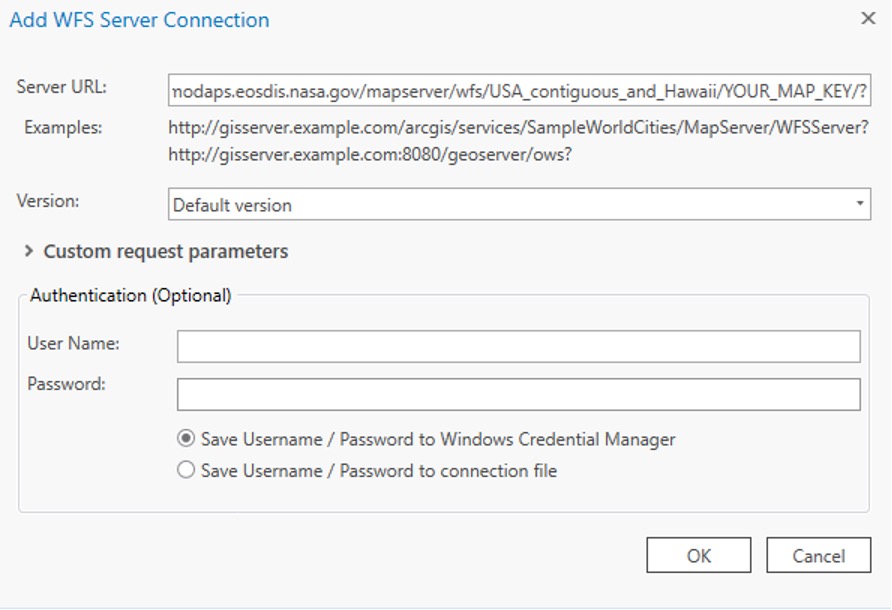
- For server URL set WFS Connection/URL enter connection string for the desired WFS. For example, for the last 7 day WFS services for the continental US and Hawaii use
https://firms.modaps.eosdis.nasa.gov/mapserver/wfs/USA_contiguous_and_Hawaii/<YOUR_MAP_KEY>/?where<YOUR_MAP_KEY>is the unique code containing both letters and numbers
(make sure/?is included at the end of your WFS URL). - Click OK
Image
Step 3 - View FIRMS Layers
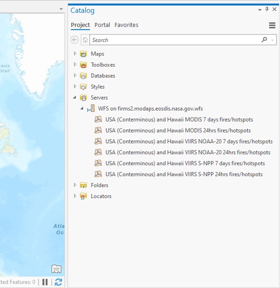
- If connection was successful, there will be a list of FIRMS WFS service feature layers.
- Open the tree structure under Servers → firms.modaps.eosdis.nasa.gov.wfs to see the WFS the feature type layers.
- Find the layer of interest and drag into your Map Project (ex. NOAA-20 7 days fires).
Image
Step 4 - Draw FIRMS Layer
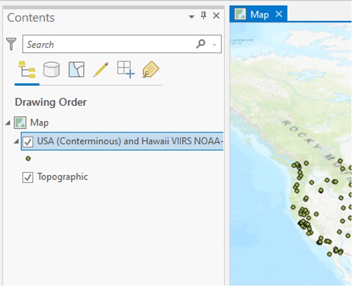
- Drag the layer of interest into the desired ArcPro map window.
- The layer will be added to your window and draw.
- Position the layer accordingly in the draw order so it is visible with other layers.
Image
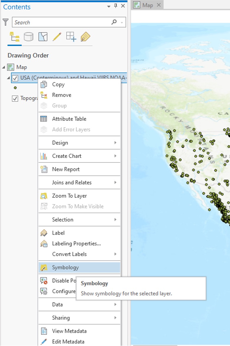
Step 5 - Open Layer Symbology Window
- Right click on the FIRMS layer.
- Click on Symbology.
Image
Step 6 - Set Layer Symbology Parameters
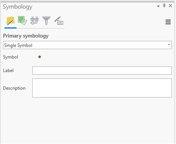
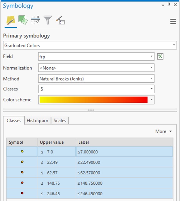
- Configure the symbology as desired. Active fire detections can all be symbolized using a single symbol or they can be classified and symbolized uniquely or as graduated symbols based on feature layer attribute values.
- Click OK button to assign the desired symbology scheme.
Image
Image
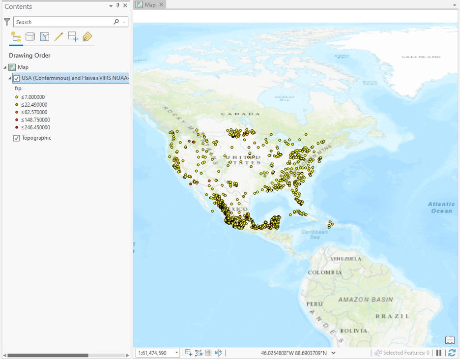
Step 7 - View Results
- The map will display using your custom symbology.
Image
* Note About Connection Parameters
ArcGIS Pro (v2.6.4)
- Using default settings, no customization or adjustments needed (WFS v2.0.0 by default)
- Works with WFS v1.1.0 and WFS v2.0.0
- NOT working with WFS v1.0.0
ArcGIS Pro (v2.7.4)
- Using default settings, no customization or adjustments needed (WFS v2.0.0 by default)
- Works with WFS v1.1.0 and WFS v2.0.0
- NOT working with WFS v1.0.0
Having Problems...
Smart Card users:
- When connecting to a WMS or WFS service, the Windows Credential Manager may be toggled on by default.
- Toggle it off.
Image
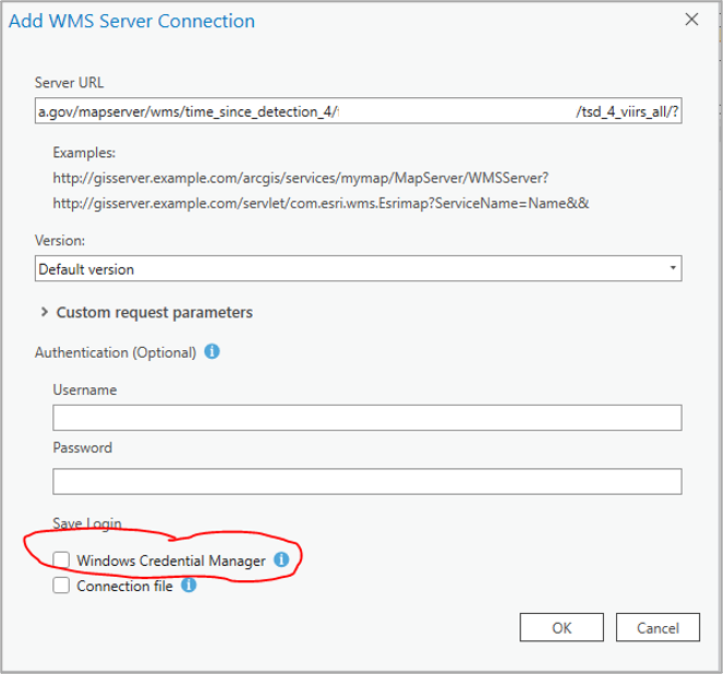
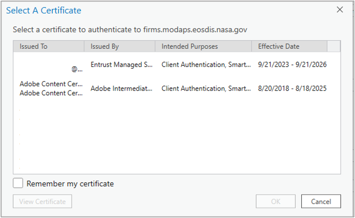
- When prompted to select a PIV certificate in the subsequent step, do not select one and select 'Cancel'.
Image
Details
Last Updated
Published
Sept. 28, 2021