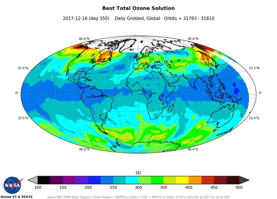
Four near real-time (NRT) data products from the Ozone Mapping and Profiler Suite (OMPS) are available through NASA’s Land, Atmosphere Near real-time Capability for EOS (LANCE):
- Nadir Profiler Vertical Ozone Profile Swath (NPBUVO3-L2-NRT)
- Nadir Mapper Total Column Sulfur Dioxide (NMSO2-PCA-L2-NRT)
- Nadir Mapper total Column Ozone (NMTO3NRT)
- Nadir Mapper Aerosol Index (NMMIEAI-L2-NRT)
OMPS is one of five instruments aboard the joint NASA/NOAA Suomi National Polar-orbiting Partnership (Suomi NPP) satellite, which launched in October 2011. Suomi NPP observes Earth’s surface twice every 24-hours (once in daylight and once at night) from a polar orbit 824 km (512 miles) above the planet. OMPS provides data to help scientists monitor the status of Earth's ozone layer and verify whether this vital atmospheric layer is recovering as expected.
Three hyperspectral sensors make up OMPS. The downward-looking Nadir Mapper (NM) and Nadir Profiler (NP) sensors acquire daily measurements of the global distribution of the total atmospheric ozone column as well as ozone profile information. Data from these two sensors provide all of the OMPS NRT data currently available through LANCE.
The third OMPS sensor is the Limb Profiler. Unlike the downward-looking nadir instruments, the Limb Profiler looks through the atmosphere at an angle to measure both the vertical distribution of both ozone and aerosols from roughly 15 to 60 km (about 9 to 37 miles) above Earth's surface with a much higher vertical resolution than the OMPS NP sensor. The current algorithmic retrievals from the Limb Profiler do not yet meet the stringent LANCE latency requirements, which is why Limb Profiler data are not available through LANCE. Plans are to provide these products in the future as computational times come down.
Along with determining atmospheric ozone, the OMPS NM and NP NRT products also provide valuable information on atmospheric sulfur dioxide (SO2) and ultraviolet (UV) absorbing aerosols (such as smoke, dust, and volcanic ash). OMPS NRT data products are used to:
- Monitor the health of the ozone layer;
- Monitor, track, and provide alerts about SO2 ash clouds from volcanic eruptions, which pose hazards to people on the ground and to flying aircraft;
- Monitor atmospheric SO2 levels for air quality purposes;
- Monitor and track the development, evolution, and transport of smoke plumes from biomass burning and dust clouds from dust storms; and
- Evaluate UV radiation intensity to monitor exposure to the Sun.
LANCE makes data from almost a dozen instruments available generally within three hours of a satellite observation. While not intended for use in scientific research, NRT data are a vital component of applications such as numerical weather and climate prediction; forecasting and monitoring natural hazards, ecological/invasive species, agriculture, and air quality; providing help with disaster relief; and homeland security.
LANCE is part of NASA’s Earth Observing System Data and Information System (EOSDIS). EOSDIS provides end-to-end capabilities for managing NASA’s Earth science data, which are acquired from satellites, aircraft, field measurements, and numerous other EOSDIS programs. The primary services provided by EOSDIS are data archive, management, and distribution; information management; product generation; and user support services.
Links to OMPS data:
- OMPS NRT products in LANCE
- OMPS data in Earthdata Search
- OMPS Standard Data Products at NASA's Goddard Earth Sciences Data and Information Services Center (GES DISC)
Updated March 2, 2021
