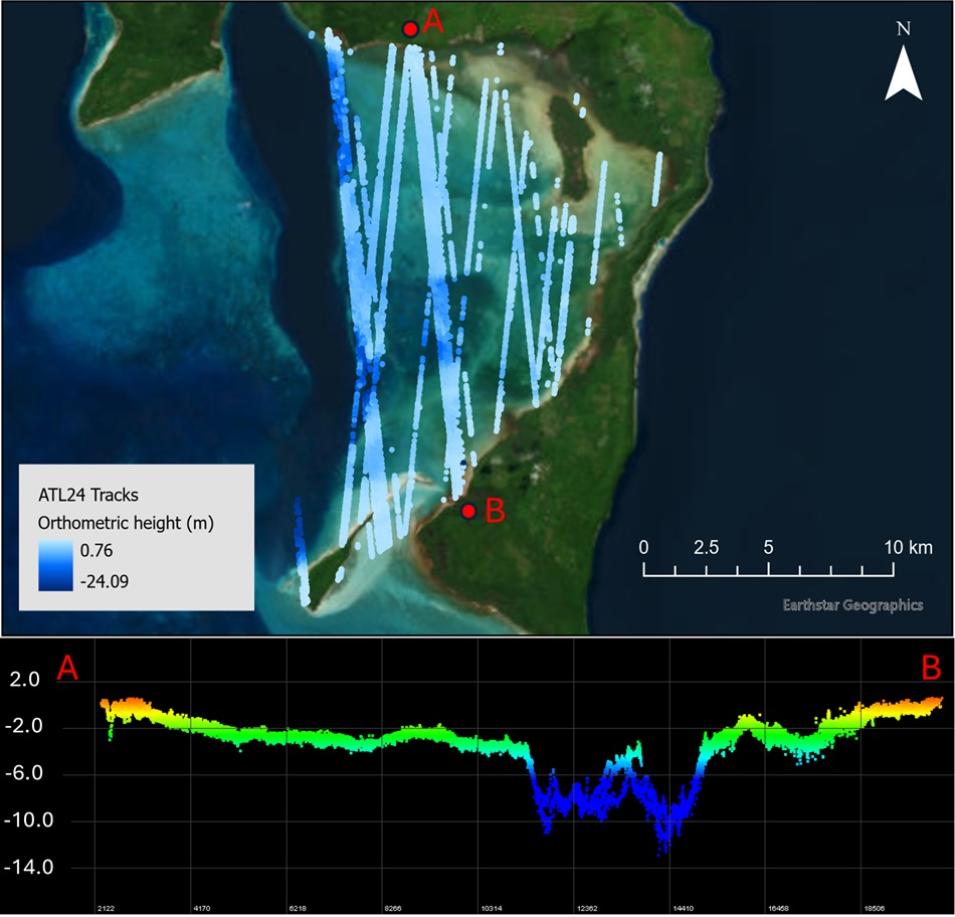
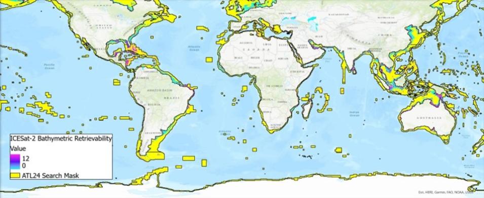
NASA’s National Snow and Ice Data Center Distributed Active Archive Center (NSIDC DAAC) released the ATLAS/ICESat-2 Level 3A Along Track Coastal and Nearshore Bathymetry (ATL24), Version 1 dataset, which provides global along-track coastal and near-shore bathymetry data consisting of refraction-corrected seafloor and sea surface heights as well as associated uncertainty estimates.
New Global ICESat-2 Bathymetric Data Fills Near-Shore Data Voids
Parrish is co-lead of the ATL24 development team with Lori Magruder, Associate Professor of Aerospace Engineering and Engineering Mechanics, and Director of the UT Center for Space Research.
Bathymetric lidar uses spaceborne laser scanning to measure underwater terrain. The laser wavelength can penetrate the water column, providing both the water surface height and the sea floor depth. The “ATL” in ATL24 refers to the Advanced Topographic Laser Altimeter System (ATLAS), the lone instrument aboard the Ice, Cloud, and Land Elevation Satellite-2 (ICESat-2) satellite.
ATLAS’s green wavelength, photon-counting lidar signal can reach depths of up to 40 meters in regions with adequate water clarity to provide shallow, near-shore bathymetric data for a range of applications, including coastal and marine science management, nearshore habitat research, marine navigation, and engineering applications. Although ICESat-2 was designed primarily for cryospheric science, it didn’t take long for researchers to recognize its value as a spaceborne bathymetric lidar.
“After ICESat-2 launched, a lot of researchers developed their own algorithms, tools, and workflows for extracting bathymetry data, but unfortunately, a lot of the source code, the tools, and the final datasets were not made publicly available,” said Parrish. “To address that, our research team began work in 2022 as part of the ICESat-2 extended mission timeline on a new dedicated along track ICESat-2 bathymetric data product—ATL24.”
The chief advantage of obtaining bathymetry data from space is the spatial and temporal coverage: ICESat-2 provides coastal bathymetry coverage from 88° North to 88° South Latitude beginning in 2018, with places that are very difficult to access, such as islands in the South Pacific.
In addition, ICESat-2’s near-polar orbit and 91-day revisit time provides researchers with the opportunity to revisit areas where water clarity is seasonal, so if water is too opaque for its depth to be measured during one overpass, it might be more suitable on the next. Further, in places like the Florida Keys where the water is often clear, ICESat-2’s orbit allows researchers to create a time series of observations and explore bathymetric change across significant weather events or as a result of anthropogenic influences.
About the Dataset
The ATL24 data product is derived from the ATLAS/ICESat-2 Level 2A Global Geolocated Photon Dataset (ATL03) and processed with a bathymetric search mask designed to reduce computation time by removing data on land or in areas that are too deep or turbid for ICESat-2 measurements. Then these data are subjected to an ensemble model approach for signal classification to ensure operability across a full extent of seafloor types, morphologies, depth ranges, water types, and cover types that exist throughout coastal and nearshore areas. Finally, the data undergo a series of checks, corrections, and calculations (such as blunder detection, refraction correction, and uncertainty calculations) before the product is complete.
The ATLAS instrument transmits laser pulses at 10 kilohertz (kHz). At the nominal ICESat-2 orbit of 496 kilometers, this yields approximately one transmitted laser pulse every 0.7 meters along the satellite’s ground tracks. To measure the time it takes a photon to travel from ATLAS to Earth and back to the instrument, the ICESat-2 observatory uses ancillary systems (such as the Global Positioning System, star tracker cameras, and a ground processing system) to determine the reflected photon's geodetic height, latitude, and longitude.
However, the number of photons from each pulse that return to the telescope depends on surface reflectivity and cloud cover, which can obscure ATLAS's view of Earth. Therefore, because the number of bathymetric photon returns depends on the water depth, turbidity, and seafloor reflectance, the spatial resolution of these parameters may vary with geographical location and environmental conditions.
Data Access
The ATL24 dataset is available from NSIDC DAAC and NASA’s Earthdata Search. The current temporal coverage of ATL24 is October 14, 2018, through November 11, 2024. New data will be added periodically as more ATL03 data are processed. The data are provided in HDF5-format.
Resources
Users can also explore the ATL24 dataset in SlideRule Earth, which allows users to define a geographic area of interest and key processing parameters via an interactive web interface, enabling rapid data visualization and scientific interpretation. SlideRule is a collaboration between the University of Washington and NASA Goddard Space Flight Center to create an open-source framework for user customized processing of science data in the cloud.
Learn more by watching the recent Earthdata webinar Laser Altimetry Applications for a Changing World: Working with ICESat-2 Bathymetry Data.

