Delivery of new Suomi National Polar-orbiting Partnership (Suomi NPP) satellite observations will cease on November 2, 2026. Data users should transition now to alternative products from NOAA-21 and NOAA-20.
Suomi NPP data announcement
Filters

Heavy rains fell over Tokyo in September 2026 due to successive typhoons and a prolonged high-pressure front.
Worldview Image of the Week
Oct. 2, 2026
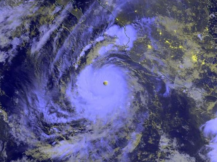
The category 5 hurricane underwent extremely rapid intensification. It is predicted to make landfall in the waning days of September.
Worldview Image of the Week
Sept. 25, 2026

Construction of the new city began in 2022, and the last of five phases is projected for completion by 2045.
Worldview Image of the Week
Sept. 18, 2026

A satellite captured multiple ways of viewing the ash and sulfur dioxide emissions in early September 2026.
Worldview Image of the Week
Sept. 11, 2026

Hurricanes Lowell, Karina, and Marie formed in late August and early September 2026.
Worldview Image of the Week
Sept. 4, 2026

Wildfires are burning across Indonesia - affecting the islands of Sumatra, Kalimantan, Sulawesi, Java, and Papua and causing poor air quality across the country.
Worldview Image of the Week
Aug. 31, 2026
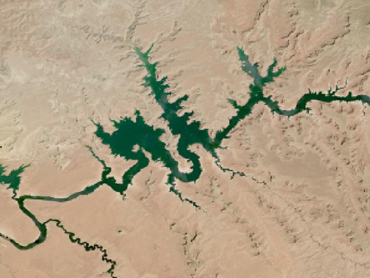
The two largest reservoirs in the United States provide water to 40 million people and irrigation for 5 million acres of farmland.
Worldview Image of the Week
Aug. 24, 2026

Earlier than usual melting of the snow in the summer of 2026 on Canada's Baffin Island exposed this remnant of the Laurentide Ice Sheet.
Worldview Image of the Week
Aug. 14, 2026
SHOWING 8 OF 581