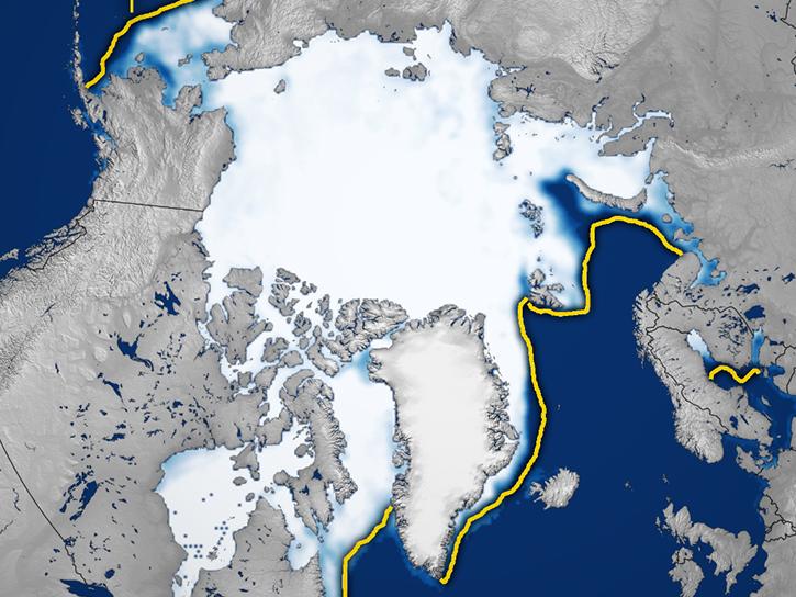
The 700,000 square kilometers of glaciers and nearly 16 million square kilometers of ice sheets on Earth make up about 10 percent of the planet's total land area. Glaciers are found on every continent except Australia, while the only remaining ice sheets are located in Greenland and Antarctica.
Glaciers typically develop when old accumulations of snow transform to ice. The ice builds up layer after layer, year after year, and slowly flows downhill over land. As glaciers age, the size of their crystals increase, some growing to be centimeters across.
Scientists and decision-makers study glaciers and ice sheets for multiple reasons. They are important sources of water and aquatic nutrients. They influence and are greatly affected by weather. They shape land. They can pose hazards to communities.
Land ice continually adds mass through precipitation and loses mass via meltwater runoff and the calving of icebergs into the ocean. If the losses are greater than gains, land ice loses mass, causing sea level to rise.
How Are Glaciers/Ice Sheets Measured?
Researchers can use NASA's glacier and ice sheet data to accurately track the size, evolution, and impact of these great masses of ice. Scientists have generally used three approaches to measuring ice sheet mass balance:
comparing outflow and melt to snowfall accumulation (the mass budget method)
observing changes in glacier elevation (volume change or geodetic method)
detecting changes in the Earth’s gravity field over the ice sheet (gravimetric method)
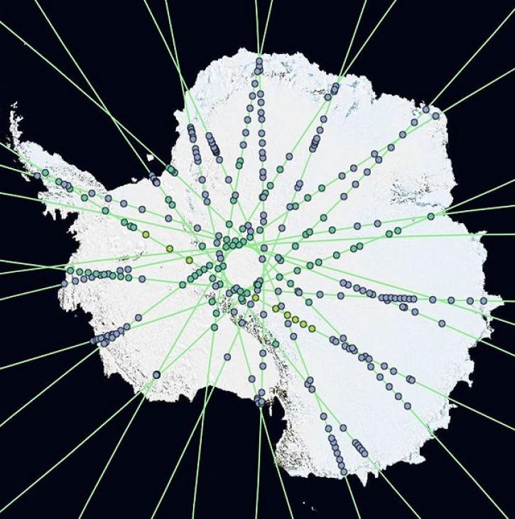
Since 2002, the Gravity Recovery and Climate Experiment series of satellites (GRACE and GRACE-FO) have made complete maps of Earth’s gravitational field every 30 days. Gravity is determined by mass. While most of the planet’s mass—its surface crust (tectonic plates), mantle, and core—does not move much in 30 days, its water and ice do, causing Earth’s gravity to shift slightly. By tracking these slight changes, GRACE and GRACE-FO can identify how much ice sheets, icefields, ice caps, and mountain glaciers are changing.