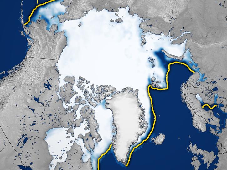
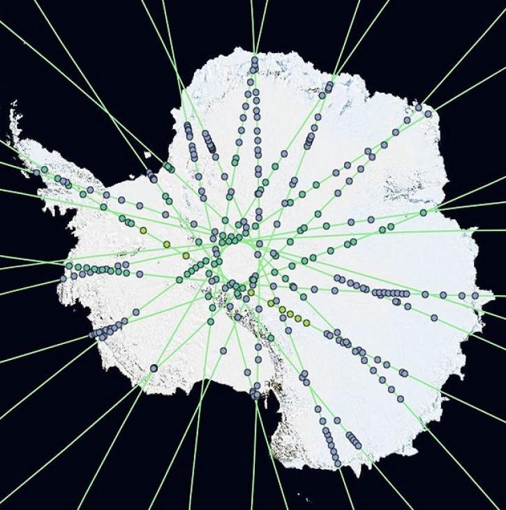
The 700,000 square kilometers of glaciers and ice sheets in the world make up 10% of Earth's total land area and are located on every continent except Australia. Glaciers typically develop when old accumulations of snow in mountains transform to ice. The ice builds up layer after layer, year after year, and flow into valleys. As glaciers age, the size of their crystals increase, some growing to be bigger than a baseball. There are also flat, glacial ice sheets more than 50,000 square kilometers in size that previously covered approximately 30% of the ocean and 30% of all land. Today, only two such dome-shaped "ice caps" remain in Greenland and Antarctica.
Glaciers and ice sheets are of interest to scientists as dynamic parts of the environment, influencing weather and climate, providing fresh water, and shaping topography over centuries. They also affect rates of sea level change, influence marine ecosystems, and can pose hazards to human communities. To accurately measure their size and track the impacts of these ice giants, scientists rely on missions like NASA's Gravity Recovery and Climate Experiment (GRACE).
Since 2002, the twin GRACE satellites have made a complete map of Earth’s gravitational field every 30 days. Gravity is determined by mass. While most of the planet’s mass — its land and core — doesn’t move much in 30 days, its water and ice do, causing Earth’s gravity to shift. By tracking these changes, GRACE and GRACE-FO can identify how much ice sheets and glaciers are shrinking.
GRACE data are used to monitor mass changes in the world's land ice, like ice sheets, ice caps, and glaciers. Land ice is formed from frozen precipitation, but these structures lose mass when they melt, releasing water or calving solid ice into the ocean. Processes like this have been estimated to account for about two-thirds of global sea level rise, so by observing the balance of these processes with remote sensing, scientists can make better predictions of the exact rates and mechanisms of sea level change.