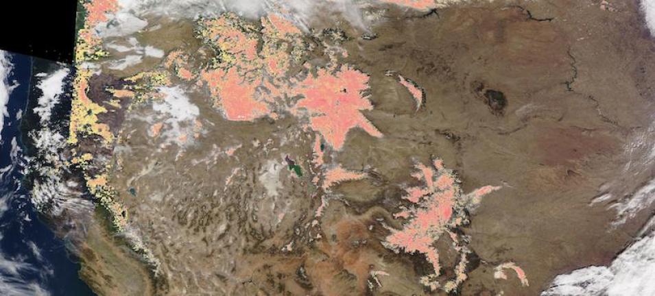
Image of snow in the American Rockies, acquired on 29 November 2020. The underlying photo-like, true color corrected reflectance image was captured by the Moderate Resolution Imaging Spectroradiometer (MODIS), aboard NASA's Terra satellite. The image is overlaid with the Snow Cover (Normalized Difference Snow Index [NDSI]) layer.
This layer shows the presence of snow cover over land and water bodies as an index related to the presence of snow. Pink indicates moderate amounts of snow cover. Investigate the different layers loaded in Worldview - Snow Cover, Corrected Reflectance (Bands 3-6-7) and Corrected Reflectance (True Color) to see how the snow is highlighted in each layer and click on the "i" button in the Layer List to read a description of the layer.
Visit Worldview to visualize near real-time imagery from NASA's EOSDIS, and check out more Worldview weekly images in our archive.
Snow Cover (MOD10_L2) dataset doi: 10.5067/MODIS/MOD10_L2.006
