We are in the process of migrating all NASA Earth science data sites into Earthdata from now until end of 2026. Not all NASA Earth science data and resources will appear here until then. Thank you for your patience as we make this transition.
Read about the Web Unification Project
GMI Resources
Read the latest Global Precipitation Measurement (GPM) Microwave Imager (GMI) news and access learning resources designed to help you optimize your Earth science research.
GMI Learning Resources

This training will cover how soil moisture is modeled within LIS in to improve drought monitoring.
Training
May 17-31, 2023

During this webinar we will provide an overview of TRMM and GPM precipitation data products and discuss the various ways to discover and access these data. We will also demonstrate the visualization and analysis tools and services provided by NASA's Goddard Earth Science Data and Information Services Center (GES DISC).
Webinar
April 18, 2022
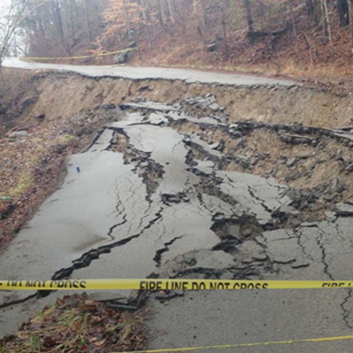
Machine Learning and Remote Sensing Show Where and When Landslides are Most Likely
StoryMap
Feb. 1, 2022

This ARSET training introduces data, methods, and tools useful for monitoring natural hazards on small island nations.
Training
Aug. 18-26, 2021
Esta capacitación de ARSET introduce datos, métodos y herramientas útiles para monitorear peligros naturales en pequeñas naciones insulares.
Training
Aug. 18-26, 2021

Esta capacitación de ARSET cubre el uso de observaciones terrestres para el monitoreo operativo de incendios.
Training
May 11-27, 2021
This ARSET training provides lectures and case studies focused on the use of Earth observations for operational fire monitoring.
Training
May 11-27, 2021

This ARSET training teaches how to use earth observations to estimate water budgets for a given river basin.
Training
July 21 - Aug. 4, 2020
SHOWING 8 OF 29

Ground validation campaigns connect the dots between what is being remotely-sensed by a satellite instrument and ongoing Earth processes.
Feature Article
Nov. 4, 2020

NASA’s global precipitation data and data processing systems have come a long way from the launch of TRMM in 1997 to the ongoing GPM mission.
Feature Article
Nov. 4, 2020
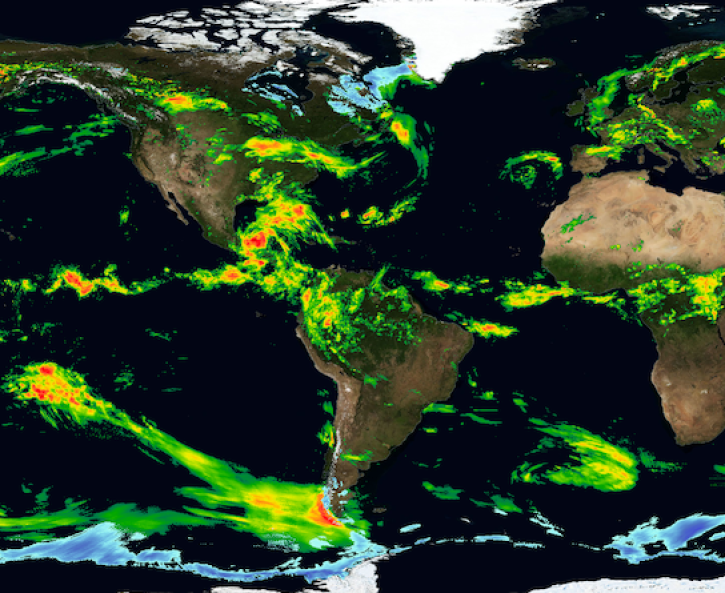
A new data product merges data from the Tropical Rainfall Measuring Mission (TRMM) and the Global Precipitation Measurement (GPM) mission, giving meteorologists and researchers access to a 20-year precipitation record.
Feature Article
Nov. 4, 2020
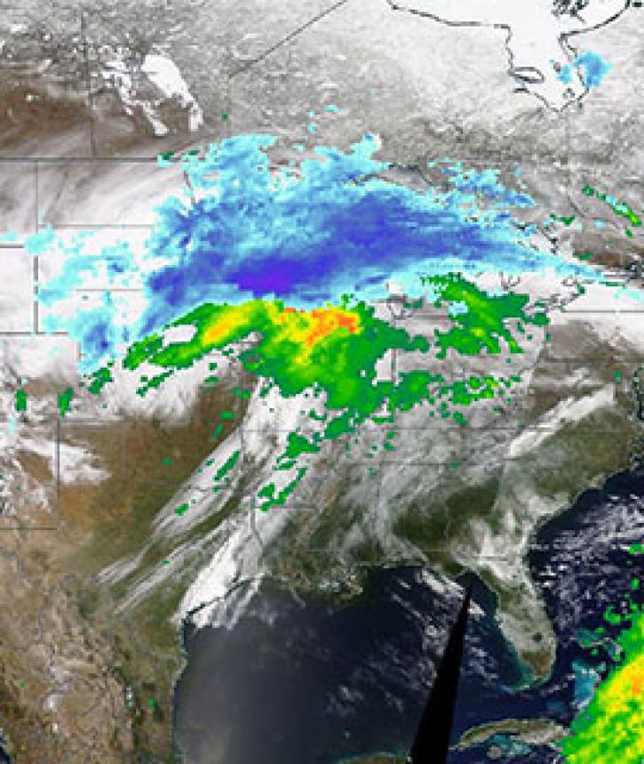
Image captured on 11 April 2019, by the MODIS instrument, aboard the Terra satellite and overlaid with IMERG Rain and Snow rates.
Worldview Image of the Week
Nov. 4, 2020
SHOWING 4 OF 25
Frequently Asked Questions
Earthdata Forum
Our online forum provides a space for users to browse thousands of FAQs about research needs, data, and data applications. You can also submit new questions for our experts to answer.
Submit Questions to Earthdata Forumand View Expert Responses