We are in the process of migrating all NASA Earth science data sites into Earthdata from now until end of 2026. Not all NASA Earth science data and resources will appear here until then. Thank you for your patience as we make this transition.
Read about the Web Unification Project
GMI Resources
Read the latest Global Precipitation Measurement (GPM) Microwave Imager (GMI) news and access learning resources designed to help you optimize your Earth science research.
GMI Learning Resources

This ARSET training addresses how to use remote sensing data for agriculture monitoring, specifically drought and crop monitoring.
Training
April 14 - May 5, 2020

This ARSET training focuses on the analysis and interpretation of long-term IMERG data for extreme dry and wet period monitoring and management.
Training
Jan. 28 - Feb. 4, 2020

This ARSET training focuses on Earth observation data useful for disaster risk assessment.
Training
Aug. 6-15, 2019

Esta capacitación de ARSET cubre cómo usar datos de la NASA para caracterizar eventos de desastres y apoyar esfuerzos de ayuda.
Training
April 16-30, 2019
This ARSET training shows how NASA remote sensing data can be used to characterize and monitor disaster-related events and support relief efforts.
Training
April 16-30, 2019

This ARSET training introduces using satellite data and Earth system modeling data sources to estimate surface water budgets.
Training
March 13 - April 3, 2019
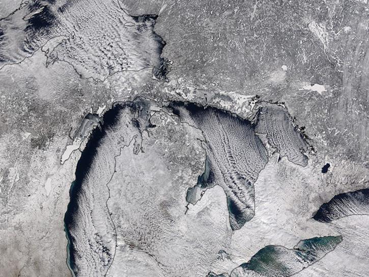
Studying the mechanics of lake effect snow helps researchers better understand water/land contrasts across snowfall bands.
Data in Action
Oct. 19, 2018
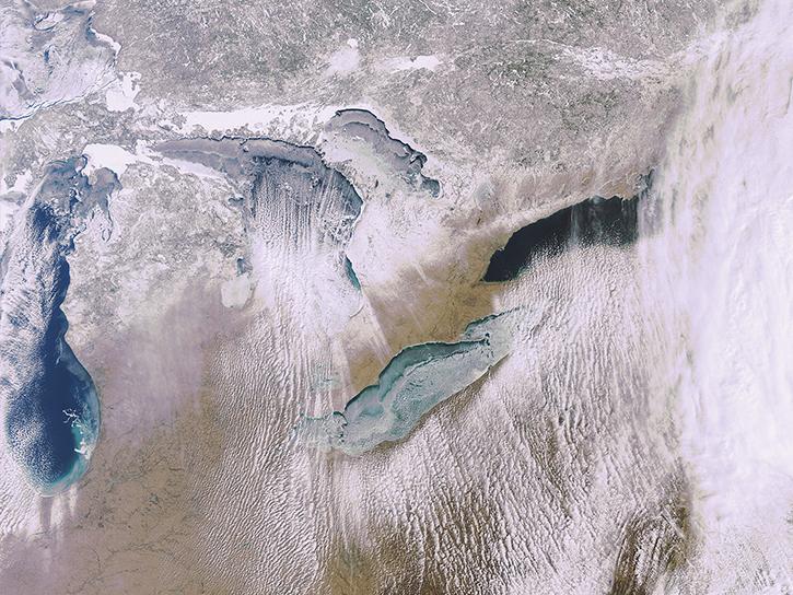
What is the 3D structure of falling snow and how does its variability affect remotely sensed retrievals?
Data in Action
Oct. 19, 2018
SHOWING 8 OF 29

Ground validation campaigns connect the dots between what is being remotely-sensed by a satellite instrument and ongoing Earth processes.
Feature Article
Nov. 4, 2020

NASA’s global precipitation data and data processing systems have come a long way from the launch of TRMM in 1997 to the ongoing GPM mission.
Feature Article
Nov. 4, 2020
A new data product merges data from the Tropical Rainfall Measuring Mission (TRMM) and the Global Precipitation Measurement (GPM) mission, giving meteorologists and researchers access to a 20-year precipitation record.
Feature Article
Nov. 4, 2020
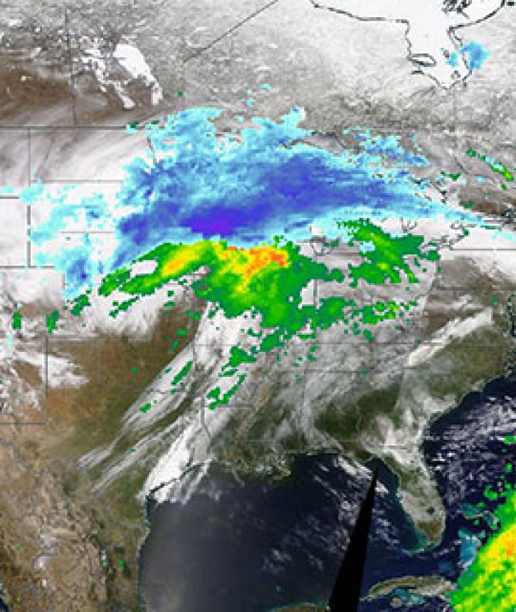
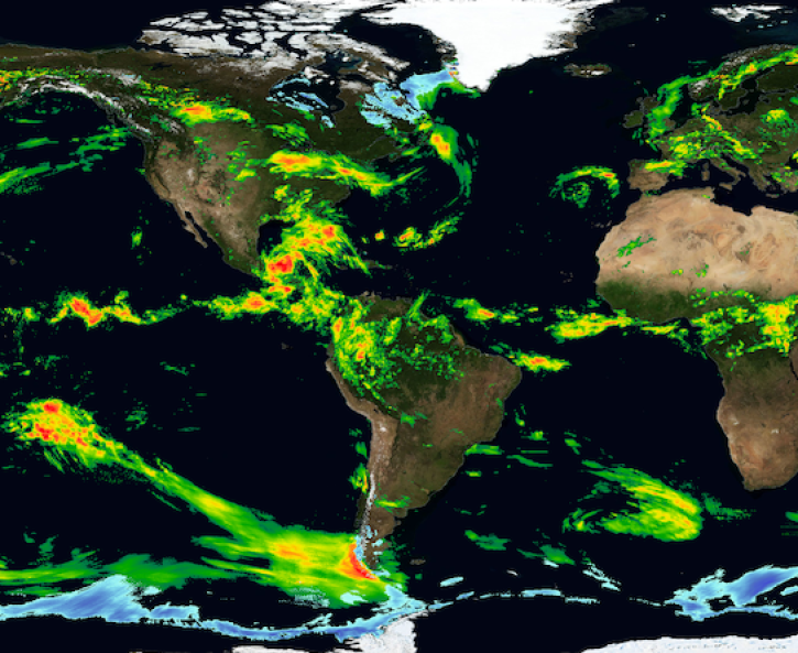
Image captured on 11 April 2019, by the MODIS instrument, aboard the Terra satellite and overlaid with IMERG Rain and Snow rates.
Worldview Image of the Week
Nov. 4, 2020
SHOWING 4 OF 25
Frequently Asked Questions
Earthdata Forum
Our online forum provides a space for users to browse thousands of FAQs about research needs, data, and data applications. You can also submit new questions for our experts to answer.
Submit Questions to Earthdata Forumand View Expert Responses